BULLETIN 243
WESTERN CANADA: BOOKS, MAPS, MANUSCRIPTS, PRINTS, POSTERS, & PAINTINGS
GENERAL 1-211
ALBERTA 212-251
BRITISH COLUMBIA 252-414
MANITOBA 415-506
SASKATCHEWAN 507-543
GENERAL
1. ADAM, G[raeme] Mercer [1839-1912]. The Canadian North-West: Its History And Its Troubles… [At Head of Title: From Savagery To Civilization ] . 8vo. pp. vi, [7]-408. 12 portraits (incl. frontis.). decorative head & tailpieces & initials. original gilt-stamped cloth (covers bit soiled, spine faded & frayed at ends, library bookplate & number on lower spine, stain to inner margin of frontis. & title). Toronto: Rose Publishing Company & Whitby: J.S.Robertson & Bros., 1885. $150
First Edition.
Peel 1325.
2. AFLALO, F.G. Sunset Playgrounds Fishing Days And Others In California And Canada. 8vo. pp. xii, 251. 36 plates (incl. frontis.). original cloth (spine ends slightly frayed, clippings mounted on front blank & flyleaf). London: Witherby & Co & New York: Charles Scribner's Sons, 1909. $75
First Edition. Pp. 185-251 relate to Canada from British Columbia and the Rockies to Quebec.
3. BACON, G.W. Pitner's New Map Of Western Canada Compiled from the latest Official & Private Surveys By G.W. Bacon F.R.G.S…. Published By Pitner & Company Limited, Vancouver, B. C. [c1911]. [Inset Map: ‘Geological Map Of Western Canada']. coloured map in sections, as issued, measuring 36 ¾” x 47 ¼” (tears to folds repaired – backed on archival tissue). original gilt-stamped cloth covers. $1,400
Shows Western Canada in great detail, including, railway and steamship routes, Hudson's Bay Company Posts and an alphabetical index of the towns and villages of Western Canada.
4. BALLANTYNE, Robert M[ichael]. Hudson's Bay or Every-Day Life in the Wilds of North America. 12mo. pp. xxii, [2], 328. frontis; text illus. cloth. dw. Rutland & Tokyo: Charles E. Tuttle Co., [1972]. $50
Peel 241n.
5. BARBEAU, Marius. Indian Days in The Canadian Rockies. 8vo. pp. 3 p.l., 207, [1]. 16 colour portraits (incl. 1 mounted on front dw.) by W.Langdon Kihn. map on endpapers. quarter cloth (1 corner showing, some light foxing). dw. (edges of dw. chipped, tears along spine folds). Toronto: Macmillan Company of Canada Limited, 1923. $150
First Edition.
6. BARBEAU, Marius. Indian Days On The Western Prairies. [Bulletin No. 163 Anthropological Series No. 46]. 4to. pp. vi, 234. colour frontis. & numerous text illus. by W.Landon Kihn & Arthur Price. colour map on endpapers. pictorial wrs. (spine ends chipped). Ottawa: Department of Northern Affairs and National Resources, National Museum of Canada, 1960. $70
First Edition.
7. BARNEBY, W[illiam] H[enry] [1843-1914]. Life And Labour In The Far, Far West: Being Notes of a Tour In The Western States, British Columbia, Manitoba, And The North-West Territory… Second Edition. 8vo. pp. xvi, 432 + [8]ads. complete with half-title. large folding coloured lithographed map. Untrimmed in original gilt-stamped cloth (spine dull). London, Paris & New York: Cassell & Company, 1884. $450
The transcript from a journal kept during a tour made in North America in the spring and summer of 1883, during which the author travelled through Utah to San Francisco, the Yosemite Valley, Los Angeles, up the coast to Victoria, Nanaimo, New Westminster, through the Cascade and Rocky Mountains and across the Canadian and American prairies. More than half of the narrative relates to the Canadian prairies (Regina, Moose Jaw, Medicine Hat, Qu'Appelle, Pembina, &c.). Appended is The Kootenay Lake District by Mr. W.A.Baillie-Grohman.
Lande S145 (with facsimile plate, present only in some copies). Lowther 641. Peel 1115n. Smith 560. cfGraff 187.
8. BARNEBY, W[illiam] Henry [1843-1914]. The New Far West And The Old Far East, Being Notes Of A Tour In North America, Japan, China, Ceylon, Etc…. 8vo. pp. x, [2], 316, [4]ads. with half-title. 3 folding colour maps & 8 plates. original black & gilt-stamped pictorial cloth (extremities frayed). London: Edward Stanford, 1889.$250
First Edition. The first half of the work relates the author's impressions of his third visit to Canada, on which he toured the West via the new Manitoba and North Western Railway and the Canadian Pacific Railway: Winnipeg, Portage-La-Prairie, Calgary, to Banff and Donald over the Rocky Mountains, on to Revelstoke over the Selkirk Range, then over the Gold and Cascade Ranges to Vancouver and Victoria. Chapters VII to IX describe farming conditions and prospects for the emigrant in Manitoba. Barneby returned home via San Francisco, Japan, China, Ceylon, and Egypt.
Lowther 805 (citing incorrect title). Peel 1762.
9. BEAHEN, William & Stain HORRALL. Red Coats On The Prairies The North-West Mounted Police 1886-1900. 4to. pp. xvi, 352. frontis. & 14 double-sided plates. index. bds. dw. Regina: Centax Books, PrintWest Publishing Services, [and Friends of the Mounted Police Museum, 1998]. $70
First Edition.
10. BEGG, Alexander [1839-1897]. History Of The North-West. 3 Volumes. 8vo. pp. xii, [13]-515, xlvii; 5 p.l., vii-xi, [1]blank, [13]-420, xcvi; 1 p.l., [v-vii], [1]blank, [13]-492, xxvii. 34 plates (portraits). A very nice set in original gilt-stamped cloth (very slight fraying to head of Vol. I spine). Toronto: Hunter, Rose And Co., 1894-95.$600
First Edition. Standard work on the Canadian North-west, its social, political and economic history, from the early days of the fur trade to the period of the Riel Rebellion, with discussion of the Hudson's Bay and Northwest Companies, exploration, the Selkirk settlement on the Red River, immigration, Indian treaties, the Canadian Pacific Railway, the RCMP, &c. At the time of the Riel Rebellion, the author, a Manitoba journalist, adopted a tolerant attitude, writing letters to the Toronto ‘Globe' under the pseudonym ‘Justicia', attempting to explain the grievances which led to the insurrection.
Peel 2184.
11. BERTON, Pierre. The Promised Land Settling the West 1896-1914. 8vo. pp. viii, 388. numerous maps (1 full-page) & text illus. illus. on endpapers. biblio. index. cloth. dw. [Toronto]: McClelland & Stewart, [1984]. $40
First Edition.
12. BEZANSON, A[ncel] M[aynard]. Sodbusters Invade the Peace. 8vo. pp. vi, 209. map on end-leaves. cloth. dw. (light wear to edges of dw.). Toronto: The Ryerson Press, [1954]. $50
First Edition.
Edwards & Lort 230.
13. BIBLE. NEW TESTAMENT. CREE. (HORDEN, John [1828-1893] (Translator) ). [Three lines syllabic characters] The New Testament, Translated Into The Cree Language... 8vo. pp. 2 p.l., 425. text printed entirely in Cree syllabic characters, Moose dialect. original blind-stamped sprinkled calf (joints cracked, spine ends & corners worn). London: Printed For The British And Foreign Bible Society, 1876. $1,250
Horden came to Canada in 1851, and was stationed by the Church Missionary Society at Moose Factory on Hudson's Bay. There he spent the rest of his life, baptizing thousands of Indians, and translating over twenty texts into the Cree, Salteaux and Ojibwa languages. Several of his Cree translations he printed with his own hands on a press sent out from England. Pilling notes that some copies of the present work end on page 245, the verso of which is blank, and include only to the end of Acts, while in complete copies, as this one, Romans begins on page 246.
Darlow & Moule 3123. Banks p. 38. Evans 80. Peel. 782. Pilling, Algonquian , pp. 236-37.
14. BLACK, Samuel [1780-1841]. A Journal of A Voyage From Rocky Mountain Portage in Peace River To The Sources of Finlays Branch And The North West Ward In Summer 1824…Edited By E.E.Rich… 8vo. pp. c, 260, [xiv]. folding map. Unopened in original gilt-crested blue cloth, t.e.g., others untrimmed (spine faded). London: The Hudson's Bay Record Society [Publication No. XVIII], 1955. $150
Numbered Limited Edition.
Strathern 46. TPL 4879.
15. BRIDGMAN, Wellington. Breaking Prairie Sod The Story Of A Pioneer Preacher In The Eighties With A Discussion On The Burning Question Of To-day "Shall the Alien Go?". 12mo. pp. xv, 265. 6 portrait plates. cloth (some spotting to covers). Toronto: The Musson Book Company Limited, [1920]. $60
First Edition.
Peel 1348.
16. BRYDGES, Charles John. The Letters Of…1879-1882 […1883-1889] Hudson's Bay Company Land Commissioner Edited By Hartwell Bowsfield… 2 Volumes. 8vo. pp. lxxxiv, 328, xviii; lxxxii, 380, xvii. tipped-in erratum in second volume. frontis. portrait, 1 plan & 1 folding map; frontis. plan. indexes. gilt-crested cloth. dw.Winnipeg: Hudson's Bay Record Society [Publication Nos. XXXI_XXXIII], 1977-81. $100
Limited Edition.
17. BRINLEY, [Kathrine] Gordon[(Sanger)]. Away To The Canadian Rockies and British Columbia. 8vo. pp. x, [1 leaf], 301, [5]. 24 colour & tinted plates. several text illus. maps on endpapers. cloth (light foxing to frontis. & first leaves). Toronto: McClelland & Stewart Limited, [1938]. $60
First Edition.
Edwards & Lort 323.
18. BURPEE, Lawrence J [ohnstone] [1873-1946] . Sandford Fleming Empire Builder. 8vo. pp. 288. folding facsimile & 16 plates. biblio. index. cloth (sticker remnant on upper cover, some light foxing). Oxford…: Humphrey Milford, Oxford University Press, 1915. $125
First Edition.
Lowther 1622. Peel 4107.
19. BURPEE, Lawrence J [ohnstone] [1873-1946] . The Search For The Western Sea… 8vo. 10 folding maps (1 coloured) & 53 illus. on 48 plates. original gilt-stamped cloth, t.e.g., recased preserving endleaves (repaired tear in coloured map – no loss). Toronto: The Musson Book Company, [1908]. $300
First Edition.
Howes B-1006. Peel 1659. Smith 1297.
20. BURPEE, Lawrence J[ohnstone] [1873-1946]. The Search For The Western Sea The Story Of The Exploration Of North-Western America. 2 Volumes. 8vo. pp. lxi, 304; viii, [1 leaf], 305-609. with half-titles. 9 folding maps & 54 illus. on 27 plates. original cloth. badly tattered dws. Toronto: Macmillan, 1935. $250
Second Enlarged Edition.
Howes B-1006. Peel 1659n. Smith 1298.
21. BUTLER, Sir W[illiam] F[rancis] [1838-1910]. The Great Lone Land: A Narrative Of Travel And Adventure In The North-West Of America… Sixth Edition. 8vo. pp. x, [1 leaf], 386, [blank leaf] + 48(ads). folding partly coloured map (frontis.) & 6 wood-engraved plates. A very nice copy in original black & gilt-stamped cloth. London: Sampson Low, Marston, Low, & Searle, 1874. $250
“A classic in literature of the northwest.” (Story) Butler served as an intelligence officer on the expediton sent to quell the Red River Rebellion in 1870, and was subsequently commissioned by the lieutenant-governor of Manitoba, Adam C.Archibald, to report on the situation at the Hudson's Bay Company posts on the Saskatchewan and to bring medicines and instructions for dealing with the smallpox epidemic there. His travels took him through the northern United States and across the prairies to the Rockies.
Peel 638n. Smith 1331. Story p. 118.
22. BUTLER, Sir William [F rancis] [1838-1910]. Sir William Butler An Autobiography . 8vo. pp. xi, 476. 4 photogravures (including frontis) & 2 folding maps. index. cloth (previous owners inscription on front end paper, spine discoloured with chips & tears to extremities). London: Constable and Company Ltd., 1911. $ 100
First Edition.
23. BYRON, Harmon [1876-1942]. The Canadian Rockies Banff Lake Louise And Field District A Series Of 28 Exclusive Views Printed In Vandyck Photogravure.oblong 8vo. 27 views on 15 photogravure plates & photogravure mounted on front wr. wrs. Banff: nd. $125
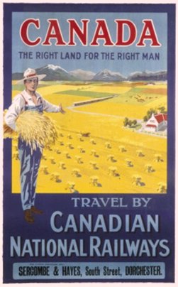
24. CALDER, W. Y. [British, active 1893-1924]. Canada The Right Land For The Right Man. Travel by Canadian National Railways. For Further Particulars Apply- Sercombe & Hayes, South Street, Dorchester. 40” x 25” (framed 44 x 29 ½). colour lithograph on paper showing wheat fields (poster) (restored crease). signed in stone. London: Canadian National Railways / Lochend Printing Co. Ltd. [c1920]. $2,500
25. CAMERON, Agnes Deans [1863-1912]. The New North Being Some Account of a Woman's Journey through Canada to the Arctic. 8vo. pp. xix, 398. with half-title. map, frontis. & numerous text illus. after photographs, many by the author. A nice bright copy in original cloth, colour map mounted on upper cover, t.e.g., others untrimmed (spine ends little frayed). New York & London: D.Appleton And Company, 1910. $200
First Edition. The author, a British Columbia school teacher and trustee, undertook the 10,000-mile journey herein described in 1908. She travelled from Chicago to the Arctic Ocean by way of Winnipeg, Calgary, Athabasca, Great Slave Lake, and the Mackenzie River, returning via the Peace River and Lesser Slave Lake.
Arctic Bib. 2657. Peel 3138. Smith 1397.
26. CAMPBELL, Marjorie Wilkins. McGillivray Lord of the Northwest. 8vo. pp. xiii, 337. frontis portrait. maps on endleaves. cloth (ex.-lib, spine discoloured). Toronto & Vancouver: Clark, Irwin & Company Limited, 1962. $35
First Edition.
27. CAMSELL, Charles. Guide To The Geology Of The Canadian National Parks On The Canadian Pacific Railway Between Calgary And Revelstoke. 8vo. pp. 70. folding table. numerous text illus. & 8 folding coloured maps & charts. wrs. (library markings on front wr.). Ottawa: Department of the Interior, 1914. $75
28. CANADA. DEPARTMENT OF THE INTERIOR. The Call Of Untrodden Ways. 12mo. pp. 24. text illus. pictorial wrs. [Ottawa: c1924]. $40
29. CANADA. MINISTRY OF IMMIGRATION AND COLONIZATION. Canada West [Cover Title]. 4to. pp. [1], 50, [1]. text on inside wrs. main text in double columns. illus. throughout, 6 foldout 4-page colour maps. colour pictorial wrs. (front wr. with crease & small stain in 1 corner). Ottawa: [c1920]. $150
Peel 2926n.
30. CANADA. MINISTRY OF THE INTERIOR. Canada West The Last Best West [Cover Title]. 4to. pp. 41. illus. colour maps. colour pictorial wrs. (edges rubbed & chipped). Ottawa: 1912. $100
Peel 2926n.
31. CANADA. PUBLIC ARCHIVES. NATIONAL MAP COLLECTION. Maps Of Indian Reserves And Settlements In The National Map Collection…Volume II: Alberta, Saskatchewan, Manitoba, Yukon Territory…Northwest Territories……Compiled by Linda Camponi… 4to. pp. xxiv, 153. numerous maps in the text (most full-page). pictorial wrs. Ottawa: 1981. $40
First Edition.
32. CANADA. PARLIAMENT. HOUSE OF COMMONS. SELECT COMMITTEEE ON IMMIGRATION AND COLONIZATION. Report…Printed by Order of Parliament. [Canada. House of Commons Journal, 1877, appendix no. 6]. 8vo. pp. 257. large folding lithographed map of Western Canada. modern cloth, original printed wrs. bound in (wrs. defective & backed). Ottawa: Printed by MacLean Roger & Co., 1877. $250
“Evidence on the agricultural potential of the West, submitted by J.Y.Shantz, A.G.B.Bannatyne, Hugh Sutherland, Thos. Spence, Mr. Hill, Mr. Fuller, and Col. Dennis.” (Peel)
Peel 799.
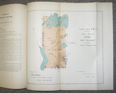
33. CANADA. PRIVY COUNCIL. Descriptions And Plans Of Certain Indian Reserves In The Province Of Manitoba And The North-West Territories. folio. pp. 113. 1 leaf of errata tipped in. 83 folding colour lithographed plans. new quarter calf. [Ottawa: 1889].
$3,500
The information regarding the extent and boundaries of the numerous Indian reservations in Manitoba, Saskatchewan, and Alberta allotted under Treaties 4, 6 and 7, and part of Treaty 2, was gathered for the guidance of Indian Agents and other employees of the Department of Indian Affairs, and for the use of the public, especially settlers desirous of taking up lands in the vicinity of the reserves. The descriptions and accompanying plans were prepared by direction of Edgar Dewdney, Indian Commissioner, from the original records of the Department, under the supervision of John C. Nelson, in charge of Indian Reserve Surveys. Each description provides details on area, situation and general features, the number of Indian families in the band, the name of the Chief, the name of the surveyor by whom the reserve was laid out, and the date of the survey.
Peel 1765.
34. THE CANADIAN ALPINE JOURNAL. Volume 49. 1966. 8vo. pp. x, 223. numerous illus. & maps (6 folding, 1 double-page). wrs. [Vancouver:] Alpine Club of Canada, 1966. $45
Including accounts of the first Canadian Himalayan expedition, 1964, the Baffin Island expedition, 1965, a Scottish expedition to the Canadian coast range, Mount Kennedy trip, SW Yukon, 1965, traverse of the Lillooet icecap, Selkirk scrambles, &c.
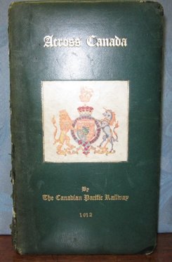
35. CANADIAN PACIFIC RAILWAY. Descriptive Timetable of the Tour of Their Royal Highnesses The Duke and Duchess of Connaught. Across Canada by The Canadian Pacific Railway. [Cover Title: Across Canada by The Canadian Pacific Railway. ]. narrow 8vo. pp. 3 p.l., 89. printed in red & dark brown ink. 26 plates. bound for presentation to H.R.H. Prince Arthur , third son of Queen Victoria and H.R.H. Albert in full padded dark green sheep, gilt title on front cover with mounted colour royal coat of arms, gilt inside dentelles, all edges gilt, dark green watered silk endleaves (spine damaged & with 3 cloth tape repairs, corners worn, internally very good). [Montreal: Canadian Pacific Railway], 1912. $2,000
Descriptive timetable of the western Canadian tour from Toronto to Vancouver and back by rail and steamship by the new Governor-General of Canada, H.R.H. Prince Arthur [William Patrick Albert, first Duke of Connaught and Strathearn] [1850-1942]. The royal party consisted of the Duke and Duchess, Princess Patricia, two ladies in waiting, Lt.-Col. H.C.Lowther, Capt. T.H.Rivers, 2 aides-de–camp, Major E.S.Worthington (medical officer), and Mr. W.R.Baker representing the CPR. The work is illustrated by photographic based views of the countryside and cities of western Canada. This would appear to be one of a limited number of copies specially bound for presentation. No records have been located.
Prince Arthur (Arthur William Patrick Albert, first Duke of Connaught and Strathearn) was posted to Canada on military duty in 1869-70, serving during the Red River Rebellion and the Fenian Raid of 1870. In 1911 he was appointed Governor-General of Canada, a position he held until 1916.
Not in Peel or Edwards and Lort. Not found in the Amicus data base, Library of Congress or British Library catalogues. No copies found in the Canadian auction records.
36. CHAMBERS, Ernest J[ohn] [1862-1925] (Compiler). Canada's Fertile Northland A Glimpse Of The Enormous Resources Of Part Of The Unexplored Regions Of The Dominion. Evidence Heard Before A Select Committee Of The Senate Of Canada During The Parliamentary Session Of 1906-7, And The Report Based Thereon.2 Volumes. 8vo. pp. 3 p.l., 139. 1 folding coloured map & 16 plates. 5 large folding coloured maps in separate volume. original gilt-stamped cloth (library bookplate & small sticker on lower spine of text vol., inner slipcase of atlas vol. broken at bottom edge). Ottawa: Government Printing Bureau, 1907. $300
Peel 3045.
37. CHAMBERS, Ernest J[ohn] 1862-1925] (Editor). The Great Mackenzie Basin Reports Of The Select Committees Of The Senate Sessions 1887 and 1888… 8vo. pp. 2 p.l., 80. 6 maps (5 coloured & 4 folding) & 13 plates (incl. frontis.). original cloth (bit soiled, head of spine frayed). Ottawa: Printed By S.E.Dawson, 1908. $100
Peel 1719.
38. CHAMBERS, Ernest J[ohn] [1862-1925]. The Royal North-West Mounted Police A Corps History By Captain…(Corps of Guides). 4to. pp. 160, lxxxvii (ads & list of subscribers). text in double columns. numerous illus. incl. frontis. & illus. in ads. endpaper ads. original gilt-stamped red & brown cloth, rebacked with spine mounted, endpapers preserved (covers bit soiled). rubberstamp on paste-downs of the Royal Empire Society, Montreal Branch. Montreal & Ottawa: Mortimer Press, [1906].$225
‘Souvenir Edition'. Chambers had been the correspondent of the Montreal Star during the North West Rebellion. Noteworthy are the numerous pages of advertising for grocers, insurance companies, engineers, builders and associated trades, horse-dealers, grocers, brewers, real estate brokers, saddlers, hotels, brewers, rifle companies, many from western Canada and many illustrated. A map showing the route of the Grand Trunk Pacific Railway and listing its directors and officers is stamped in gilt on the lower cover.
Peel 2678. Story p. 732.
39. CHAMBERS, Ernest J[ohn] [1862-1925] (Compiler). The Unexploited West A Compilation of all of the authentic information available at the present time as to the Natural Resources Of The Unexploited Regions of Northern Canada. 8vo. pp. xv, [1], 361, viii, xi. text illus. & maps. biblio. index. pictorial wrs. (spine & corners chipped). Ottawa: Railway Lands Branch of the Department of the Interior, Printed by J. dew L.Taché, 1914. $100
First Edition.
Peel 4001.
40. CHEADLE, Dr. [Walter Butler]. Cheadle's Journal being the Account o the First Journey across Canada undertaken for pleasure only, by Dr. Cheadle and Lord Milton 1862/1863 Edited by John Gellner.(The Canadian Heritage Series Library Edition Volume 5). 4to. pp. iv, 206. frontis. numerous full-page text illus., partly from Cheadle's own sketches, by Jean Redfern. cloth. slipcase (extremities bit frayed). Toronto, London & New York: Baxter Publishing, [1966]. $50
Limited Edition, signed by editor & publisher.
Peel 437.
41. [CHURCH, Herbert E. & Richard]. Making A Start In Canada Letters From Two Young Emigrants. With An Introduction By Alfred J. Church... 8vo. pp. xx, 224 + [4]ads. with half-title. few text diagrams. original gilt-stamped cloth. London: Seeley & Co., 1889. $400
First Edition. Herbert and Richard Church were eighteen and sixteen years of age when they emigrated to Canada in 1886. This book, edited by their father, contains letters describing the Church's farming experiences in Ontario and Alberta and travels in British Columbia.
Lowther 815. Peel 1770.
42. COAST PUBLISHING CO. The Rockies of Canada. Selected Copyright Camera Studies. oblong 8vo. 16 plates. wrs. Vancouver: nd. $50
43. CODY, H[iram] A[lfred]. An Apostle Of The North Memoirs Of the Right Reverend William Carpenter Bompas, D.D. First Bishop of Athabasca, 1874-1884, First Bishop of Mackenzie River, 1884-1891 First Bishop of Selkirk (Yukon), 1891-1906. 8vo. pp. 2 p.l., vii-xviii, 19-386. 42 illus. on 40 plates. gilt-stamped cloth (Canadian School of Missions bookplate & number on spine). Toronto: Musson Book Co. Limited & London: Seeley & Co. Limited, [1908]. $125
Peel 2913.
44. COLE, Jean Murray. Exile In The Wilderness The Biography Of Chief Factor Archibald McDonald 1790-1853. 8vo. pp. xviii, 268. 4 double-sided plates. maps on endpapers. biblio. index. bds. dw. [Don Mills:] Burns & MacEachern Limited, [1979]. $50
First Edition.
45. COLEMAN, A[rthur] P[hilemon] [1852-1939]. Glaciers of the Rockies and Selkirks. 8vo. pp. 29. illus. pictorial wrs. (tape stains along spine, library rubberstamp & sticker residue on front wr.). [Ottawa:] Department of the Interior, Dominion Parks Branch, [c1920]. $100
First Edition.
46. COLVILE, Eden [1819-1893]. London Correspondence Inward From…1849-1852 Edited By E.E.Rich... 8vo. pp. cxv, 300, [xv]. frontis. Unopened in original gilt-crested blue cloth, t.e.g., others uncut (spine sunned). London: The Hudson's Bay Record Society [Publication No. XIX], 1956. $125
Numbered Limited Edition.
TPL 5535.
47. DAWSON, S[imon] J[ames] [1820-1902]. Rapport Sur L'Exploration De La Contrée Située Entre Le Lac Supérieur et la Colonie de la Rivière Rouge, Et Entre Ce Dernier Endroit Et Les Rivières Assiniboine Et Saskatchewan. folio. pp. 47. 3 folding lithographed maps (2 partially coloured) contemporary half roan (shaken, head of spine torn). Toronto: John Lovell, 1859. $450
First Edition of the French Translation. The expedition, on which Dawson served as surveyor and naturalist, examined the route from Port Arthur on Lake Superior to Fort Garry (Winnipeg) and explored the country from Portage la Prairie to Lake Winnipeg, Lake Winnipegosis, the Saskatchewan River, Swan River and Fort Pelly, returning by way of Fort Ellice and the Assiniboine River. Dawson was one of the first to attract attention to the suitability for colonization of the territory west of the Red River. His report includes discussion of the Hudson's Bay Company's establishments and the native tribes of the region. Issued as part of the appendix to the Journal of the Legislative Assembly of the Province of Canada; a more extensive version with two maps was published the previous year.
Gagnon I 1064. Lande S607. Peel 342. cfSabin 18958. cfCasey I 2784. cfMorgan p. 96. cfTPL 3885. Wagner-Camp 322:2.
48. DEANE, R. Burton. Mounted Police Life in Canada A Record of Thirty-one Years' Service. 8vo. pp. 3 p.l., 311, [1]. folding map, 4 plates & 1 text illus. index. bds. dw. Toronto: Prospero Canadian Collection, 2001. $35
Facsimile Reprint.

49. DELISLE, Joseph Nicolas de [1688-1768] & BUACHE, Philippe [1700-1773]. Carte des Nouvelles Découvertes au Nord de la Mer du Sud, Tant à l'Est de la Siberie et du Kamtchatka, Qu' à l'Ouest de la Nouvelle France. Dressée sur les Mémoires de M r . Del'Isle Professeur Royal et de l'Académie des Sciences. Philippe Buache de la même Académie Et Présentée à l'Académie, dans son Assemblée publique du 8. Avril 1750. Par M r . De l'Isle. Publiée sous le Privilége de l'Académie des Sciences. Se vend à Paris [1752], Quay de l'Horloge du Palais, avec les Cartes de Guill. Delisle et de Phil. Buache. 18 ½” x 26 ¼” (47 x 66.4 cm). original & modern colour (name in ink, ‘C. Kribber', at lower plate mark & ink notes on verso eradicated with minimal show through at upper left, small pinhole at upper centre fold & minor creasing near centre fold). $4,000
First state of the famous Buache/Delisle map of the northwest coast. Delisle was privy to valuable Russian confidential information as a result of his involvement in the planning of the second Bering expedition. In 1752 he published his memoir and the Carte des Nouvelles Découvertes showing Russian discoveries in the north Pacific. This "...marked the beginning of a controversy which exercised a bizarre influence on the course of exploration along the Pacific coast of North America". (Cumming et al, pp. 225) The map depicts the Russian discoveries in 1723, 1732, and 1741, de Frondat's voyage of 1709, the route of the Galions in 1743, the Water of Wager &c. Delisle and Buache also incorporated information derived from De Fonte's fictitious account: an elaborate system of inland seas and straits, the enormous Sea of the West, and, most importantly, a Northwest Passage from the Pacific to the Atlantic.
The map has a broad top border containing the title within a cartouche and engravings of a native of Kamchatka and a North American Indian in the top corners.
Tooley, The Mapping of America, p. 34, No. 101. Kershaw, Early Printed Maps Of Canada, Vol. IV, 1201 & Plate 944. Cumming, The Exploration of North America , pp. 222-226. Armstrong, From Sea Unto Sea , 24. Glenbow Museum, The Canadian West Discovered , No. 6. Wagner, The Cartography of the Northwest Coast of America, 566.
50. DELISLE, Joseph Nicolas de [1688-1768] & BUACHE, Philippe [1700-1773]. / ROBERT DE VAUGONDY, Didier [1723-1786]. Carte Generale Des Découvertes De L'Amiral De Fonte, et autres Navigateurs Espagnols, Anglois et Russes… Par M. De l'Isle… Publiee a Paris en Septembre 1752. Suppl. 7 e Carte [Upper right corner]. [Inset Map: Carte dressée sur la lettre de l'Amiral de Fonte… ]. [Paris: 1779]. 11 ½” x 14 ¾” (29.6 x 37.4 cm). horizontal & vertical folds. modern colour. $575
Based on Buache/ Delisle's Carte Generale, Robert De Vaugondy's map was issued in the supplement to Diderot's Encyclopédie. The map shows the Russian discoveries in the North Pacific and their exploration routes. Based on De Fonte's fictitious account, the map shows the ‘Mer De L'Ouest', ‘Lac Valasco', ‘Lac Bernarda' and a system of inland seas and straits from the Pacific to the Atlantic forming a Northwest Passage.
Wagner 637 (series of 10 maps). Kershaw 1235 & Plate 973.
51. DENNY, Sir Cecil E. The Law Marches West…Edited And Arranged By W.B.Cameron… 8vo. pp. xvi, 319, [1]. folding map, frontis. portrait & 13 other plates. maps on endpapers. cloth (spine faded). Toronto: J.M.Dent And Sons (Canada) Ltd., [1939]. $75
First Edition.
Peel 3677.
52. DICKENS, F[rancis]. Dickens of the Mounted The Outstanding Long-Lost Letters of Inspector F. Dickens NWMP 1874-1886 Edited by Eric Nicol. 8vo. pp. 294, [2]ads. map & letter on end-leaves. cloth. dw. [Toronto: McClelland & Stewart Inc., 1989]. $35
First Edition.
53. DOMINION LANDS OFFICE. General Map Of Part Of The North-West Territory And Of Manitoba… The Burland Lithographic Co. Montreal. J[ohn] Johnston Chief Draftsman. Dominion Lands Office Department Of The Interior Ottawa, 31 st December, 1881. Lindsay Russell Surveyor General. 27 ¾” x 42” (entire sheet; 70.5 x 106.5 cm). colour lithograph. horizontal & vertical folds (margins chipped backed on linen, several tears & one hole, recent linen backing). $1,200
54. DOMINION LANDS OFFICE. North-West Territory Map Shewing Dominion Land Surveys Between West Boundary Of Manitoba And Third Principal Meridian… Preliminary Edition. The Burland Lithographic Co. Montreal. J[ohn] Johnston Chief Draftsman. Dominion Lands Office Department Of The Interior Ottawa, 31 st December, 1881. Lindsay Russell Chief Surveyor. 32 ½” x 38 ½” (entire sheet; 83 x 97 cm). black & white lithograph. horizontal & vertical folds. backed on linen (upper & lower margins chipped & tattered & small hole to fold, some cockling). $1,000
55. FLEMING, R. Harvey (Editor). Minutes Of Council Northern Department Of Rupert Land, 1821-31…With An Introduction By H.A.Innis… 8vo. pp. lxxvii, 480, xiii. frontis. unopened in original gilt-crested cloth, t.e.g., others uncut (few small spots on spine & slight soiling to covers). Toronto: Champlain Society [Hudson's Bay Company Series III] , 1940. $200
Limited to 550 copies, this one out of series.
Peel 176.
56. FLEMING, Sir Sandford [1827-1915]. Report On Surveys And Preliminary Operations On The Canadian Pacific Railway Up To January 1877. 8vo. pp. xvi, 431. 3 folding coloured maps & 4 folding plans. original cloth (recased, cloth soiled & spotted, extremities frayed, first map repaired along one fold with tiny loss). Ottawa: Printed By MacLean, Roger & Co., 1877. $600
First Edition.
Lowther 505. Peel 457.
57. FLEMING, Sir Sandford [1827-1915]. Reports And Documents With Reference To The Location Of The Line And A Western Terminal Harbour 1878. 8vo. pp. 104. 3 folding coloured maps. contemporary half chagrin (joints & extremities rubbed, covers stained & puckered). Ottawa: Printed By McLean, Roger & Co., 1878. $800
[BOUND WITH:] FLEMING, Sir Sandford. Report In Reference To The Canadian Pacific Railway…1879. 8vo. pp. 1 p.l., 142. folding coloured map. Ottawa: Printed By McLean, Roger & Co., 1879.
First Editions.
Lowther 523 & 556. Peel 871 (2nd item).
58. FLEMING, Sir Sandford [1827-1915]. Report And Documents In Reference To The Canadian Pacific Railway..1880. 8vo. pp. xii, [1 leaf], 373 [i.e. 383]. 5 folding coloured maps & 3 folding diagrams. original cloth. Ottawa: Printed By MacLean, Roger & Co., 1880. $600
First Edition.
Lowther 564. Peel 918.
59. FOOTNER, Hulbert. New Rivers of the North The Yarn Of Two Amateur Explorers Of The Head-Waters Of The Fraser, The Peace River, The Hay River, Alexandra Falls. 8vo. pp. 281. frontis & 23 double-sided plates. 1 map. cloth (extremities bit frayed). Toronto: McClelland & Stewart, [c1912]. $75
First Canadian Edition. “Canoe trip about 1910, which began and ended at Edmonton, included the Fraser, Crooked, Parsnip and Peace Rivers, and exploration of Hay River.” (Edwards & Lort)
Edwards & Lort 1383. Peel 3729.
60. FRANCHÈRE, Gabriel [1786-1863]. Narrative Of A Voyage To The Northwest Coast Of America In The Years 1811, 1812, 1813, And 1814 Or The First American Settlement Of The Pacific...Translated And Edited By J.V.Huntington. 12mo. pp. 376 + [6]ads. 3 wood-engraved plates. original blind-blocked cloth (extremities bit chipped & frayed, some foxing to plates & adjacent leaves). New York: Redfield, 1854. $950
First Edition of the English Translation of the most important source on John Jacob Astor's attempt in 1811 to establish the first American settlement on the Pacific Coast. Franchère, then in the employ of the Pacific Fur Company, was attached to Astor's expedition to the Columbia River to found a trading post at Astoria. His narrative describes the difficult voyage out in the Tonquin , by way of Cape Horn, and presents a faithful chronicle of events at Astoria from its founding until its surrender to the Northwest Company in 1813. There is much information relating to the growing rivalry between the two fur trading companies, the manners and customs of the Pacific Coast Indian tribes, and the traders' relations with them. Also included is an account of Franchère's five month overland return journey three years later, up the Columbia River, through the Rockies and across the Canadian prairies to Montreal. The work was originally published in French at Montreal in 1820, and was the major source for Washington Irving's Astoria . This English translation by Jedediah Vincent Huntington, edited by Huntington and Michel Bibaud, contains an additional chapter and appendix by Franchère, the latter providing further information regarding the fate of other members of the expedition.
Cowan p. 90. Field 558. Graff 1400. Hill p. 111. Howes F-310. Jones 1315. Lande 1180. Peel 80. Sabin 25432. Smith 3244. Strathern & Edwards 194 (i). Streeter VI 3718. TPL 985. Wagner-Camp 16. cfGagnon I 1401, cfVlach 331 (1st Edn., 1820). DCB IX pp. 279-80. Story p. 292.
61. FRANCHÈRE, Gabriel. Journal of a Voyage on the North West Coast. 8vo. pp. ixk, 330, xix. 4 plates & 3 maps (1 double-page). index. Uncut & unopened in gilt-crested cloth, t.e.g. Toronto: Champlain Society [Publication No. XLV], 1969. $250
Limited to 825 copies.
62. FRANCIS, R. Douglas. Images Of The West Responses to the Canadian Prairies. 8vo. pp. xviii, 268. numerous text illus. biblio. index.bds. dw. Saskatoon: Western Producer Prairie Books, [1989]. $40
First Edition.
63. FRANKLIN, John [1786-1847]. Narrative Of A Journey To The Shores Of The Polar Sea, In The Years 1819, 20, 21, And 22... 4to. pp. xvi, 768. with half-title & errata slip. 30 plates, engraved by Edward Finden & J.Curtis after drawings by Curtis, George Back & Robert Hood (12 hand-coloured - 9 of these aquatints). 4 folding engraved maps. 1 text illus. contemporary calf, gilt back (corners worn, plates offset, scattered light foxing). London: John Murray, 1823. $11,000
First Edition. The record of Franklin's first Arctic expedition, fraught with hardship and tragedy, constitutes one of the classics in the annals of travel literature. In all, the party travelled 5,500 miles overland and with the aid of canoes, exploring the territory from York Factory to the mouth of the Coppermine River on Coronation Gulf, east along the Arctic coast as far as Point Turnagain, and back across the Barren Lands. Provisions were poor and scant, and on the return journey, many crew members died of cold and starvation; the young naval artist Robert Hood was murdered and another executed for the crime. The work also includes accounts by Richardson and Back (pp. 449-61, 477-90) of the last leg of the desperate journey across the Barren Lands, as well as a valuable appendix on the natural history of the region and scientific observations on the aurora borealis and the magnetic needle, by Richardson, Hood, Franklin and Sabine.
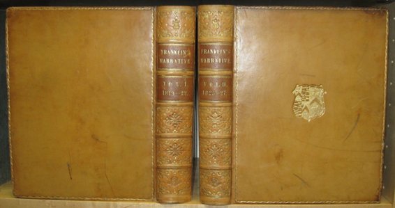
National Maritime Museum I 828. Sabin 25624 (34 plates). TPL 7092. Abbey, Travel , 635 (but 1 map dated Apr.). cfArctic Bib. 5194. cfGraff 1406. cfLande 1181. cfPeel 151. cfSmith 3251. cfWagner-Camp 23:1.
[UNIFORMLY BOUND WITH:] FRANKLIN, John [1786-1847]. Narrative Of A Second Expedition To The Shores Of The Polar Sea, In The Years 1825, 1826, And 1827... 4to. pp. xxiv, [xxi]-xxiv, 320, clvii, [1], [1 leaf]errata. 31 plates, engraved by Edward Finden after drawings by George Back & E.N.Kendall. 6 folding engraved maps (l partly coloured in outline). several text illus. (corners worn, plates offset, scattered light foxing). London: John Murray, 1828.
First Edition. Franklin's second overland expedition in 1825-27 formed part of a double-pronged assault on the western approaches to the Arctic, undertaken in conjunction with Beechey's voyage to Bering's Strait. The expedition proceeded across North-western Canada to Fort Franklin on Great Slave Lake, and down the Mackenzie to its mouth. There a party under Richardson and Kendall split to explore eastward along the coast to the mouth of the Coppermine, while Franklin and Back headed westward along the coast toward Kotzebue Sound where they were to join up with Beechey. Franklin, however, turned back at Return Reef at about 149 ° west, while one of Beechey's vessels managed to penetrate only as far as Point Barrow, several hundred miles away. The narrative includes descriptions of the country traversed and of encounters with Esquimaux, notes on weather conditions, the Dogrib Indians, the burning coal cliffs beyond Cape Bathurst, &c.
Abbey, Travel , 635. Arctic Bib. 5198. Graff 1407. Lande 1182. National Maritime Museum I 843. Peel 163. Sabin 25628 (7 maps). Smith 3255. Streeter VI 3699. TPL 1434 (5 maps). Wagner-Camp 35:1.
64. FREEMAN, Lewis R. The Nearing North. 8vo. pp. xii, 385. frontis. & 15 double-sided plates. cloth (spine ends frayed & lettering dull). New York: Dodd, Mead & Company, [1928]. $75
First Edition. “The journalist describes his river trips in northern Canada, on the Slave, Mackenzie and Nelson, and others; the Hudson Bay Railroad to the end of steel, and work fo the Hudson's Bay Co. throughout these regions.” (Arctic Bib.) “Includes an account of the author's travels in northern B.C. in 1927.
Arctic Bib. 5258. Edwards & Lort 1421. Not in Peel.
65. FRIESEN, Gerald. The Canadian Prairies A History. 8vo. pp. xv, 524. 10 double-sided plates. index. bds. dw. Toronto & London: University of Toronto Press, [1984]. $40
First Edition.
66. GORDON, Daniel M[iner] [1845-1925]. Mountain And Prairie; A Journey From Victoria To Winnipeg, Via Peace River Pass. 8vo. pp. x, 310. 4 folding maps & 8 plates. original black & gilt-stamped cloth (light wear & light soiling to cloth). Montreal: Dawson Brothers, 1880. $200
First Canadian Edition. In 1879, Gordon accompanied the expedition appointed to examine possible routes for the Canadian Pacific Railway to connect the Prairies with the Pacific. The expedition travelled from Fort Simpson up the Skeena, then on to Lake Babine and Fort Macleod. There the party divided, one group choosing to cross the Rockies via Pine River Pass, the other, including the author, descending the Peace River to Dunvegan.
Lowther 576. Smith 3679. Peel 873.
67. GOULD, Ed. Oil The History of Canada's Oil & Gas Industry. 4to. pp. 288. profusely illus. illlus. on endpapers. bds. dw. (rubbed). [Victoria:] Hancock House Publishers. [1976]. $150
First Edition. Copy presented to Dr. Morton Shulman by the Calgary Section of the Petroleum Society of the Canadian Institute of Mining and Metallurgy in appreciation of his presentation at the first Annual General Meeting held at Calgary on June 26, 1980 with special illuminated & calligraphic leaf by Leonard S. Bowman, & a one-page typed explanatory legend signed by the artist. Symbolically woven into the floral and leaf arrangement of the illuminated leaf is a drill rig with a drill stem ending in a drop of oil.
68. GRAY, James H. Men Against the Desert. 8vo. pp. xiv, 250. b/w title illus, numerous text illus. index. cloth (tail of spine slightly frayed). dw. (light wear). [Saskatoon]: Western Producer Prairie Book, 1967. $50
First Edition. Agricultural farming in the Palliser triangle region of Saskatchewan and Alberta in the 1930's.
69. GREAT BRITAIN. COLONIAL OFFICE. Papers Relative To The Exploration Of The Country Between Lake Superior And The Red River Settlement. Presented to both Houses of Parliament by Command of Her Majesty, June 1859. folio. pp. 163, [1 leaf]. 4 folding hand-colouring lithographed maps. map & diagram in text. modern quarter cloth. London: Printed by George Edward Eyre and William Spottiswoode, 1859. $750
Contains reports by Simon James Dawson and Henry Youle Hind on the Canadian Exploration Expedition of 1857-58. The expedition surveyed and explored the country between Lake Superior and the Red River and from Lake Winnipeg to the Saskatchewan River. The volume includes four folding maps: ‘Plan Shewing the Proposed Route from Lake Superior to Red River Settlement Compiled from Maps of Messrs. Dawson and Napier', ‘Map of Part of the Valley of Red River North Of The 49 th Parallel…', ‘Copy of Sketch Shewing the Region Explored by S.J.Dawson & his party, Between Red River And The Great Saskatchewan; July 1 st . 1858', ‘Copy Of Thompson's Map shewing the different tracks Of The Saskatchewan And Assiniboine Exploring Expedition, In charge of Professor H.Y.Hind. June 14 th to Sept. 4 th 1858'.
TPL 3908. Sabin 38673. Peel 350n. Wagner-Camp 301:4.
70. HAIG, Kennethe M[acmahon]. Brave Harvest The Life Story of E. Cora Hind, LL. D. 12mo. pp. vii, [1 leaf], 275. frontis portrait. cloth (extremities bit frayed). dw. (dw. extremely tattered). Toronto: Thomas Allen, Limited, 1945. $30
First Edition.
Peel 6505.
71. HARMON, Daniel Williams [1778-1843]. A Journal Of Voyages And Travels In The Interior Of North America… 8vo. pp. xxiii, [1] blank, [25]-432. with the half-title & the errata slip (mounted on rear paste-down). engraved frontis. portrait. lacking folding engraved map. contemporary sheep (covers worn, extremities chipped, some browning & foxing throughout as usual). Andover: Printed By Flagg And Gould, 1820. $800
First Edition. Although the authenticity of the narrative suffers slightly from the revisions made by the moralistic editor, Daniel Haskel, Harmon's journal remains one of the most important accounts of the fur-trade and the Canadian north-west. Harmon, in the employ of the North West Company, spent nineteen years among the aboriginals in the Swan River, Athabaska, Nipigon, and Rainy River districts, 1800-19. The map is based on that of Alexander Mackenzie drawn by Arrowsmith, but with some additions and corrections. It shows the country between Quebec and the north-west coast, with designations for the territories occupied by the various native tribes. The narrative is followed by ‘An Account of the Indians Living West of the Rocky Mountain', ‘A General Account of the Indians on the East Side of the Rocky Mountain', vocabularies of the Cree and the Tacully or Carrier Tongue, and ‘A Concise Account of the Principle Animals Which are Found in the North Western Part of North America'.
Bell H42. Field 656. Gagnon I 1609. Graff 1786. Howes H-205. Lande 1216. Lowther 245. Matthews 537. Peel 117. Pilling, Algonquian, p. 222. Story p. 345. Streeter VI 3692. TPL 1171. Wagner-Camp 17.
72. HARMON, Daniel William. Sixteen Years in the Indian Country the Journal of…1800 - 1816 Edited with an Introduction by W. Kaye Lamb. 8vo. pp. xxviii, 1 p.l., 277. frontis portrait, 4 text maps, 1 text illus. maps on end-leaves. index. cloth. 2 different dws. (edges of dws. chipped). Toronto: The Macmillan Company of Canada Limited, 1957. $60
73. HARRISON, Julia D. Métis People between Two Worlds. 4to. pp. 160. numerous text illus. (some colour) & maps. biblio. index. pictorial wrs. [Calgary], Vancouver & Toronto: Glenbow-Alberta Institute in association with Douglas & McIntyre, 1985. $40
First Edition.
74. HARVISON, C. W. The Horsemen. 8vo. pp. xiv, [1 leaf], 271. 35 illus. on 8 double-sided plates. index. cloth. dw. (some wear to edges of dw. & with remains of sticker on front). Toronto/Montreal: McClelland And Stewart Limited, [1968]. $40
Second Printing.
75. HASELL, F[rances] H[atton] Eva [1887-1974]. Canyons, Cans And Caravans. 12mo. pp. 320. 12 plates (11 double-sided). maps on endpapers. decorative cloth (spine ends faded). dw. (edges of dw. chipped). London…: Society For Promoting Christian Knowledge, 1930. $80
First Edition. Hasell organized the first Sunday school motorized caravans. The present work relates her summer tours in the Diocese of Brandon, Manitoba, 1925, Diocese of Kootenay, 1926 and 1927, and Diocese of Caledonia, 1928 and 1929.
Edwards & Lort 1680. Peel 5336.
76. HAYDON, A[rthur] L[incoln] [1872-1954]. The Riders Of The Plains Adventures And Romance With The North-West Mounted Police 1873-1910. 8vo. pp. xvi, 385, [1]. 4 maps (2 folding, 2 full-page in text), 2 full-page text illus. & 27 plates. index. original cloth (cloth stained, extremities & joints frayed, spine lettering over-painted in white, library stamps on endpapers & 1 in text). London: Andrew Melrose & Toronto: Copp Clark Co. Limited, 1910. $100
Third Impression.
cfPeel 3435.
77. HAYDON, A.L. The Riders Of The Plains A Record Of The Royal North-West Mounted Police Of Canada 1873-1910. 12mo. pp. xxiv, 385. frontis portrait, 26 plates, text illus., maps & diagrams (2 folding). index. cloth. Edmonton: M.G. Hurtig Ltd., [1971]. $50
Peel 3435n.
78. HAYES, Derek. Historical Atlas of the North Pacific Ocean Maps of Discovery and Scientific Exploration 1500-2009 Published under the auspices of the North Pacific Marine Science Organization. 4to. pp. 224. numerous illus. (many colour). index. biblio. bds. dw. Vancouver/Toronto: Douglas & McIntyre, [2001]. $75
First Canadian Edition.
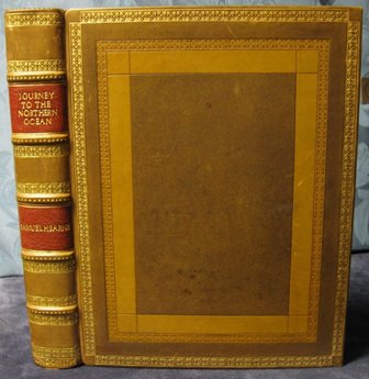
79. HEARNE, Samuel [1845-1792]. A Journey From Prince Of Wale's Fort in Hudson's Bay, To The Northern Ocean. Undertaken By Order Of The Hudson's Bay Company for the Discovery of Copper Mines, A North West Passage, etc. In The Years 1769, 1770, 1771, & 1772. 4to. pp. xliv(inc. errata), 458, [2]ads & directions to binder. 5 folding engraved maps (1 with routes in colour) & 4 engraved plates (3 double-page). modern gilt-stamped paneled calf by Annegret Hunter-Elsenbach (first map with few small tears repaired – no loss, some foxing to maps & plates & neighbouring leaves). London: Printed for A.Strahan and T.Cadell; And Sold by T.Cadell Jun. And W.Davies..., 1795. $9,250
First Edition of a classic of North American travel. Hearne's journal holds an especially honoured place in the annals of Arctic exploration, and Hearne “will always be remembered as the first white man that ever gazed on the dreary expanse of the Arctic or Frozen Ocean from the northern shores of the Continent of America.” (Rich) In 1769, he was sent by the Hudson's Bay Company to find a north-west passage from Hudson's Bay and to investigate Indian reports regarding the existence of copper deposits to the north. Hearne made two false starts, but on his third attempt, accompanied by the Chipewyan guide Matonabbie, he succeeded in crossing the Barren Lands and reached the Coppermine River, which he descended to the Arctic Coast. Hearne also discovered the Great Slave Lake and recorded valuable information regarding the natural history and Indian tribes of the region traversed.
Shortly following his return, Hearne submitted his report to the Hudson's Bay Company, who kept it secret for some thirteen years. Its final publication, three years after his death, was due to the celebrated French navigator La Pérouse, who found Hearne's manuscript when he captured Fort Albany, Hudson's Bay, in 1781-82. When Fort Albany was subsequently surrendered to the British, La Pérouse stipulated, as one of the conditions of the surrender, that Hearne's manuscript be printed.
Bell H94. Cox I p. 171. Hill p. 141. Lande 1220. Morgan p. 180. Peel 41. Pilling, Athapascan , p. 40. Sabin 31181 & JCB 3729 (calling for 4 maps & 8 plates). Story pp. 351-52. Streeter VI 3652. TPL 445 (imperfect). Winsor VIII p. 70.
80. HEARNE, Samuel [1845-1792]. A Journey From Prince Of Wale's Fort, in Hudson's Bay, To The Northern Ocean. Undertaken By Order of the Hudson's Bay Company For The Discovery Of Copper Mines, A North West Passage, etc. In The Years 1769, 1770, 1771, & 1772. 8vo. pp. 1 p.l., l, 459, [1]plate list. with half-title. 5 folding engraved maps & plans & 4 folding engraved plates (Plate 2 supplied from another copy). 19th century full red morocco, all edges gilt (bit rubbed with several small surface abrasions). school prize inscription dated 1832. Dublin: Printed For P.Byrne And J.Rice, 1796. $2,500
First Dublin Edition.
Cox II p. 171. Field 677. Peel 41n. Sabin 31182. Smith 4284.
81. HEIDENREICH, Conrad E. & Arthur J. RAY. The Early Fur Trades A Study in Cultural Interaction. oblong 4to. pp. 95. numerous text maps & illus. biblio. wrs. [Toronto:] McClelland and Stewart Limited, [1976]. $30
First Edition.
82. HENRY, Alexander [1739-1824]. Travels And Adventures In Canada And The Indian Territories, Between The Years 1760 And 1776. In Two Parts. 8vo. pp. vi, [1 leaf], 330, [1 leaf]errata. complete with the engraved frontis. portrait by P.Maverick which is often wanting. Uncut in original bds. (small nick in spine, 1 prelim misbound, lacking front flyleaf, paper lightly embrowned). ownership entry of bibliographer Frederick Müller. New York: Printed And Published By I.Riley, 1809. $2,500
First Edition. A classic of Canadian travel literature and one of the most vivid and authentic accounts of the fur trade in the Canadian West . Henry came to Canada shortly after the British conquest in 1760, and became one of the first fur traders from the British colonies to penetrate the Great Lakes region which was formerly controlled by the French . He spent sixteen years in the west, travelling as far as the valley of the Saskatchewan, before retiring to Montreal as a general merchant. His narrative includes a first-hand account of the Indian uprising of 1763 at Michilimackinac , one of the primary sources used by Francis Parkman when writing The Conspiracy of Pontiac . Henry himself narrowly escaped the massacre, but was subsequently captured and held prisoner by the northern Indians. The description of his lengthy captivity contains much valuable information regarding native manners and customs.
Bell H129. Field 686. Gagnon I 1652. Graff 1866. Howes H-420. Jones 732. Lande 1224. Peel 45. Sabin 31383. Shaw & Shoemaker 17737. TPL 484. Wagner-Camp 7.
83. HENRY, Alexander [1739-1824]. Travels and Adventures in the Years 1760-1776 Edited With Historical Introduction And Notes By Milo Milton Quaife. 16mo. pp. xxxii, 340. frontis. portrait & folding map. index. cloth (spine ends trifle frayed). Chicago: The Lakeside Press, R.R.Donnelley & Sons Company, 1921. $125
Peel 45n
84. HENRY, Alexander [1739-1824]. The Journal. 2 Vols. 8vo. pp. lxxi, 328, xxv; 5 p.l., [329]-781, xxiii. 11 plates & 5 maps (1 folding). index. gilt-crested cloth, t.e.g. Toronto: Champlain Society [Publication Nos. LVI-LVII], 1988-1992. $350
Limited to 1250 copies.
85. HIND, Henry Youle [1823-1908]. Narrative of the Canadian Red River Exploring Expedition of 1857, and of the Assiniboine and Saskatchewan Exploring Expeditions of 1858. In Two Volumes. 8vo. pp. xx, 494; xvi, 472, [3]ads. with half-titles. 8 engraved maps & plans (all coloured; 3 folding, incl. one sheet showing 4 profiles), 20 chromoxylographs & numerous wood-engraved text illus. A fine set in modern quarter morocco, all edges gilt (light foxing to outer leaves). London: Longman, Green, Longman, and Roberts, 1860. $2,000
First Edition. Hind, a professor of chemistry at the University of Toronto, was engaged as a geologist by the Canadian Government in 1857 and 1858 on the surveying expeditions which explored the country between Lake Superior and the Red River, and between the Red River and the south branch of the Saskatchewan. The exploration was conducted with the view to establishing the possibility of an emigrant route west from Lake Superior. This is Hind's personal account of the expeditions (official government reports were also issued), in which he devotes considerable detailed discussion to the habits and customs of the Cree and Chippeway Indians, with whom he lived virtually constantly during that period. The attractive chromoxylograph plates (wood engravings tinted from another engraved block in one, two or three colours) depict topographical views and scenes from Indian life. All of the illustrations are after photographs taken by Humphrey Lloyd Hime, photographer of the expedition, or after sketches by John Fleming, assistant surveyor and draughtsman.
Abbey, Travel , 630. Field 699. Graff 1892. Lande 1235. Morgan p. 188. Peel 366. Pilling, Siouan , p. 36. Sabin 31934. Wagner-Camp 361. Watters. p. 966. TPL 3820. Story p. 358.
86. HIND, Henry Youle. Narrative of the Canadian Red River Exploring Expedition of 1857, and of the Assiniboine and Saskatchewan Exploring Expeditions of 1858. 2 Volumes in 1. 8vo. pp. xv, xiv, 494; xiv, 472. 8 engraved maps & plans (all coloured; 3 folding, incl. one sheet showing 4 profiles), 20 colour plates & numerous wood-engraved text illus. index. cloth. dw. (price-clipped). Edmonton: M.G.Hurtig Ltd., [1971]. $125
87. HIND, Henry Youle [1823-1908]. North-West Territory. Reports Of Progress; Together With A Preliminary And General Report On The Assiniboine And Saskatchewan Exploring Expedition, Made Under Instructions From The Provincial Secretary, Canada...Printed By Order of the Legislative Assembly. folio. pp. xii, 201, [5]. complete with half-title. 7 lithographed maps on 6 folding sheets (several coloured). 2 folding lithographed plates (1 coloured). 3 wood-engraved plates. numerous wood-engravings in the text. text in double columns. original half roan (binding worn & stained). Toronto: Printed by John Lovell, 1859. $750
In 1857 and 1858, Hind was engaged by the Canadian government as geologist and commander respectively of the surveying expeditions which explored the country between Lake Superior and the Red River, and between the Red River and the south branch of the Saskatchewan River. The exploration was conducted primarily with the view of establishing the possibility of an emigrant route west from Lake Superior. Included in the report are chapters on Indian antiquities, manners, customs and superstitions and observations on geology, climate and agricultural potentialities of the northwest.
TPL 3912. Peel 367. Sabin 31937. Lande 1233. Morgan p. 188. cfGagnon I 1670.
88. HODGSON, Fraser. Once Upon A Lifetime. 8vo. pp. 1 p.l., 414. text illus. cloth (spotting to upper edge). dw. (tear along front fold). Saskatoon: Modern Press Prairie Books Service, 1966. $50
First Edition. Mostly set in Swift Current, Saskatchewan and Lethbridge, Alberta.
89. HOMER, A.N. The Imperial Highway. 4to. pp. 118, xli(ads). frontis. & numerous text illus. after photographs. padded cloth (soiled, 2 waterstains on rear cover). London: Sir Joseph Causton & Sons Limited, [c1913]. $100
First Edition. Travels across Canada and to the Far East (Japan and China), via the Canadian Pacific Railway and the ‘Empress of Japan'. Most of the work relates to Western Canada.
Not in Peel.
90. HORETZKY, Charles [1839-1900]. Canada On The Pacific: Being An Account Of A Journey From Edmonton To The Pacific By The Peace River Valley; And Of A Winter Voyage Along The Western Coast Of The Dominion... 8vo. pp. 2 p.l., 244. with half-title. 1 folding lithographed map & 1 folding plan. original cloth, rebacked with spine mounted. American Museum of Natural History bookplate & blindstamp. Montreal: Dawson Brothers, 1874. $250
First Edition of Horetzky's account of the Sandford Fleming expedition to the Pacific in 1872 to determine the best route for the transcontinental railway. Horetzky, who was the photographer on the expedition, travelled from Fort Edmonton to Victoria, via the Peace, Skeena and Naas Rivers, and from Nanaimo to San Francisco. His work also contains chapters on the geology of Vancouver Island, the Canada Pacific Route, and the Indians of British Columbia.
Dionne III 1602. Lowther 466. Peel 706. Smith 4623.
91. HORRALL, S.W. The Pictorial History of the Royal Canadian Mounted Police. 4to. pp. 256. profusely illus. index. bds. dw. (edges of dw. chipped). Toronto…: McGraw-Hill Ryerson Limited, [1973]. $60
First Edition.
92. HOWARD, Joseph Kinsley. Strange Empire A Narrative of the Northwest. 8vo. pp. [1 leaf], xii, 601. 11 text maps (5 full-page). biblio. index. cloth. dw. (edges tattered, cello tape repair to lower rear dw.). New York: William Morrow And Company, 1952. $50
Second Printing.
Peel 1463.
93. (HUDSON'S BAY COMPANY). GREAT BRITAIN. PARLIAMENT. HOUSE OF COMMONS. 1749. Report From The Committee Appointed To Inquire into the State and Condition of the Countries Adjoining to Hudson's Bay, And Of The Trade Carried On There. folio. pp. 1 p.l., [215]-286. text in double columns. A fine copy in modern quarter calf. [London: c1780]. $2,500
Later issue of one of the most important reports on the Hudson's Bay Company. The parliamentary investigation into the activities of the Hudson's Bay Company was undertaken as a result of a petition made to the Lords in Council in 1749 aimed at depriving the Company of its charter. The petitioners argued that the charter of 1670, granting sole rights of trade and commerce in the entire area beyond the entrance of the Hudson Straits, was either invalid or forfeited, and requested an incorporation giving them similar rights over the adjacent region. Arthur Dobbs had provided the initial stimulus and basic grounding for the petition; his was the most sustained and vociferous attack on the meanness, rapacity, secrecy and jealousy of the Hudson's Bay Company, alleging that their policies and attitudes had thrown the fur trade into the hands of the French in Canada and were stifling the exploration of the Canadian North-West.
Among the travelers, traders and merchants summoned as witnesses to give testimony before the committee were Joseph Robson, Matthew Serjeant, Arthur Dobbs, and William Moore. Appended is the Hudson's Bay Company Charter as well as the valuable narrative of French Canadian fur trader Joseph La France, describing the state of the French fortresses in Montreal and Quebec, and their lucrative trade with the Indians. The Papers Presented to the Committee contain information regarding voyages undertaken in search of the north-west passage, sales made by the Hudson's Bay Company, Henry Kelsey's journals of his attempt to open commerce with the Naywatamee Indians in 1691-92, &c.
Although the impeachment failed, and the monopoly was to continue for another hundred years, it did alarm the Company into initiating serious and concerted exploration of the unknown western reaches of the Charter.
TPL 213. Lande 1203. Vlach 353. Gagnon I 1712. Dionne II 470. Peel 26. cfJCB I 906. cfSabin 33548. cfStreeter VI 3644. Winsor VIII, Chapt. 1.
94. (HUDSON'S BAY COMPANY). GREAT BRITAIN. COLONIAL OFFICE. Hudson's Bay Company. Papers presented by Command of Her Majesty to The House of Commons, in pursuance of an Address praying that Her Majesty would be graciously pleased to direct that such Means as to Her Majesty shall seem most fitting and effectual, be taken to ascertain the Legality of the Powers in respect to Territory, Trade, Taxation and Government, which are, or recently have been claimed or exercised by the Hudson's Bay Company, on the Continent of North America, under the Charter of his Majesty King Charles the Second, issued in the Year 1670, or in Virtue of any other Right or Title, except those conveyed by or under the Act 43 Geo. 3, c. 138 (extending the Criminal Jurisdiction of Canadian Courts), and 1 & 2 Geo. 4, c. 66, intituled, “An Act for regulating the Fur Trade, and establishing a Criminal and Civil Jurisdiction within certain Parts of North America”…11 July 1850. B.Hawes, Ordered, by The House of Commons, to be Printed, 12 July 1850. [Parliamentary Paper, 1850, No. 542]. folio. pp. 15, [1 leaf]blank except for docket title on verso. large folding coloured lithographed map. new quarter cloth over early marbled wrs. [London: 1850]. $1,250
Papers relating to the challenging of the legal validity of the Hudson's Bay Company's charter by Alexander Kennedy Isbister [1822-1883] on behalf of the inhabitants of the Red River Settlement. Isbister championed the campaign for free trade rights in Red River, heading a delegation to the British government in 1847, lobbying members of parliament, writing pamphlets, and conducting an extensive correspondence with the Colonial Office, presenting copious evidence to prove that the Company was neglecting the welfare of the aboriginals and stifling the economic development of the colony.
Peel 270. TPL 3077. DCB XI p. 445.
95. HUGHES, Katherine. Father Lacombe The Black-Robe Voyageur. 8vo. pp. xxii, 471. frontis portrait. cloth. Toronto: McClelland & Stewart, [1920]. $50
Peel 3597n.
96. HUYDA, Richard J. Camera in the Interior: 1958. H. J. Hime, Photographer. The Assiniboine and Saskatchewan Exploring Expedition. oblong 4to. pp. [48], 55, [1]. numerous illus. folding map. biblio. cloth. dw. (some chips to dw.). Toronto: The Coach House Press, [1975]. $50
First Edition.
97. [INNES, Campbell] (Editor). The Story of the Press Written by pioneers intimate with the early history of our North-West. 8vo. pp. 106. text illus. pictorial wrs. (2 small holes in spine). Battleford, Saskatchewan: Canadian North-West Historical Society [Vol. I, No. IV, Pt. 1], 1928. $40
First Edition. Including ‘The Nor-Wester – 1859' by Geo. B.Winship et al., ‘The Saskatchewan Herald – 1878' by R.C.Laurie, ‘The Prince Albert Times – 1882' by Mrs. D.J. Rose & W.H.Newlands, ‘The Macleod Gazette – 1882' by Thos. Clarke, ‘The Calgary Herald – 1883' by C.A.Hayden, ‘The Regina Leader – 1883' by J.R.C.Honeyman, ‘The Medicine Hat Times – 1884' byu J.W.Morrow & Lieut.-Gov. Newlands, ‘The Lethbridge News – 1885' by Edward Hagell, and ‘Reporting in –‘85' by Howard Angus Kennedy. The second projected volume was never published.
Peel 1466.
98. JENISH, D'Arcy. Epic Wanderer David Thompson And The Mapping Of The Canadian West. 8vo. pp. 5 p.l., 309. numerous text illus. maps on endleaves. biblio. index. cloth. dw. Lincoln: University Of Nebraska Press, [2003]. $45
First Edition.
99. JENNINGS, John. The Strange Brigade A Story of the Red River and the Opening of the Canadian West. 8vo. pp. x, 304. maps on endpapers. cloth (wear to extremities). Boston: Little, Brown and Company, [1952]. $35
First Edition.
Peel 7340.
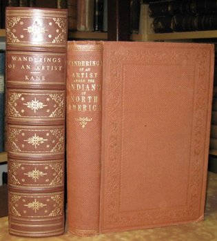
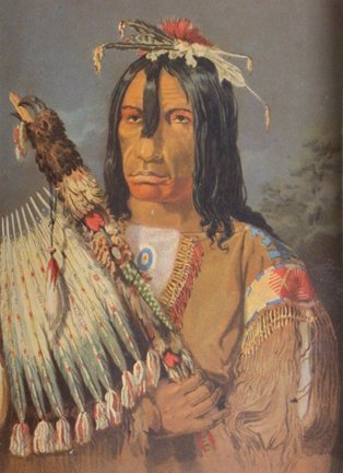
100. KANE, Paul [1810-1871]. Wanderings Of An Artist Among The Indians Of North America From Canada To Vancouver Island And Oregon Through The Hudson's Bay Territory And Back Again. 8vo. pp. xvii, [1], 455, [1]blank, [8]appendix. with half-title. folding coloured engraved map. 8 coloured lithographed plates with tissue guards. 13 wood-engraved text illus. original blind-stamped cloth (small stain on spine otherwise a fine copy). modern quarter calf clamshell box with inner cloth folder. London: Longman, Brown, Green, Longmans, and Roberts, 1859. $10,000
First Edition of this fascinating record of the western travels of one of the most famous nineteenth century Canadian painters. Inspired by George Catlin, whom he met during a visit to Europe, Kane determined to sketch and paint a series of pictures illustrative of North American Indians and scenery. He set out for the west in June of 1845, “with no companions but [his] portfolio and box of paints, [his] gun, and a stock of ammunition”, spending the season in the Lake Huron and Lake Michigan region, chiefly among the Ojibway. For the next three years, he travelled further westward, mostly in company with Hudson's Bay Company fur trade brigades, through the territories of the Red River settlements and the valley of the Saskatchewan, across the Rocky Mountains, down the Columbia to Puget Sound, and north to Vancouver Island.
Kane brought back hundreds of detailed sketches: portraits of Indian chiefs, warriors, and medicine men, buffalo hunting and fishing scenes, portrayals of native dances and secret ceremonials, views of Hudson's Bay Company posts. Of the paintings which he executed from his sketches, the most important was the series of one hundred canvases commissioned by prominent Canadian financier and politician, George William Allan of Toronto. Eight of these, which are now in the Royal Ontario Museum, are reproduced as coloured lithographs in this narrative.
Cowan pp. 126-27. Field 811. Graff 2262. Howes K-7. Jones 1412. Lande 1258. Peel 253. Sabin 37007. Smith 5392. Strathern & Edwards 290 (7 plates). Streeter VI 3727. TPL 2911. Wagner-Camp 332:1. DCB X pp. 389-393. Story p. 398.
101. KELSEY, [Henry] [c1670-c1724]. The Kelsey Papers With An Introduction By Arthur G.Doughty…& Chester Martin. 8vo. pp. lxxxiii, 128. with half-title. folding coloured map & frontis. facsimile. Uncut & unopened in original printed wrs. Ottawa: Public Archives of Canada & Public Record Office of Northern Ireland, Printed by F.A.Acland, 1929. $150
First Edition. "Printed for the first time from original mss. in the collection of Arthur Dobbs, 1689-1765, now in the Public Record Office, Northern Ireland. Kelsey was employed in Hudson's Bay by the Company before June 1688, and was the first white man on the Canadian prairie. Eleven papers describe his journeys to explore the interior [as far as northern Saskatchewan] 1689-92, (his records were repudiated by Dobbs and Robson in their attacks on the Company's administration), and describe events of the French invasion of the Bay territory after 1694, the Company's re-occupation after the Peace of Utrecht, and trading operations between 1688 and 1722 when Kelsey, then governor of York Fort, was recalled." (TPL) Also included is an account of Indian beliefs and superstitions.
Peel 5. TPL 162. Story p. 399.
102. KENNEDY, Howard Angus [1861-1938]. The Book of the West… 12mo. pp. xiii, [3], 205, [1]. 1 full-page map, 7 plates (6 double-page), & several text illus. pictorial wrs. (lacking rear wr., spine & edges of front wr. chipped). Toronto: Ryerson Press, [1925]. $50
First Edition.
Edwards & Lort 1978. Peel 4997.
103. KENYON, Charles R[ichard]. The Young Ranchmen Or Perils Of Pioneering In The Wild West. 8vo. pp. 282. with half-title. 4 plates & numerous text illus. original gilt-stamped pictorial cloth (spine dull & ends frayed). London: W. & R.Chambers, Limited, 1891. $175
First Edition. Juvenile fiction set in the Canadian West.
cfPeel 1225.
104. KITTO, F[ranklin] H[ugo]. The Peace River Country Canada Its Resources And Opportunities. 8vo. pp. 115, [1]. tipped-in erratum. text illus. & maps. pictorial wrs. Ottawa: Department of the Interior, 1930. $50
Third Edition, Revised.
Peel 4402n.
105. LANGELIER, J[ean] C[hrysostome] [d. 1910]. Étude Sur Les Territoires du Nord-Ouest Du Canada. 8vo. pp. iv, [5]-69. disbound (marginal staining to outer leaves). Montreal: Eusèbe Senécal, 1873. $200
First Edition.
Casey I 3890. Peel 674. cfDionne I 1287 & cfGagnon I 1946 (citing date 1874).
106. LENT, D[ora] Geneva. West Of The Mountains James Sinclair and the Hudson's Bay Company. 8vo. pp. xvii, [1 leaf], 334. 4 full-page maps & 15 illus. on 4 double-sided plates. biblio. index. cloth. dw. (edges of dw. chipped). Seattle: University of Washington Press, 1963. $75
First Edition.
107. LOKEN, Gulbrand. A History of Canada's Peoples From Fjord to Frontier A History of the Norwegians in Canada. 8vo. pp. viii, 264. frontis. & 8 double-sided plates. biblio. index. cloth. dw. [Toronto]: McClelland & Stewart Ltd., in association with the Multiculturalism Directorate, Department of the Secretary of State…, [1980]. $50
First Edition.
108. LONGSTRETH, T[homas] Morris. The Silent Force Scenes From The Life Of The Mounted Police Of Canada. 8vo. pp. xiv, 383. 33 plates (incl. frontis). 2 text illus. 2 folding maps. biblio. index. cloth (spotted, extremities frayed). New York & London: The Century Co., [1927]. $75
First Edition.
Peel 4756.
109. MACBETH, R[oderick] G[eorge]. The Romance of Western Canada. 12mo. pp. xii, 309. 13 plates (incl. frontis portrait). cloth (old ownership entry, o/w very fine copy). Toronto: William Briggs, 1918. $125
First Edition.
Peel 4405.
110. MACBETH, R[oderick]. G[eorge]. Policing The Plains Being The Real-Life Of The Famous Royal North-West Mounted Police. 8vo. pp. 320. frontis & 43 illus. & portraits on 15 double-sided plates. cloth. (spine faded, occasional foxing, repair to outer blank margin of title). London, New York & Toronto: Hodder And Stoughton, Ltd., [1921].
First Edition. $100
Peel 4698.
111. MACDONALD, J[ohn] S[tuart]. The Dominion Telegraph. 8vo. pp. 64. folding map. 1 portrait. pictorial wrs. Battleford, Saskatchewan: Canadian North-West Historical Society [Vol. I, No. VI.], 1930. $40
First Edition. “The story of the building of the telegraph line from Red River to Edmonton.” (Peel)
Peel 5461.
112. MACDONALD, Malcolm. Down North. 8vo. pp. xi, 274. frontis. map. illus. on endleaves. biblio. index. cloth. dw. (edges of dw. chipped). Signed by the Author. London…: Oxford University Press, 1943. $65
First Edition. “The British High Commissioner in Canada describes a two-week trans-Canada trip in August, 1942, which crossed northern B.C. from Dawson Creek to Watson Lake. Includes some mention of the Alaska Highway.” (Edwards & Lort)
Edwards & Lort 2224. Not in Peel.
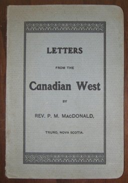
113. MACDONALD, Rev. P[eter] M[cLaren] [1868-1960]. Letters From The Canadian West. 8vo. pp. 55. original printed wrs. (bit soiled, slightly chipped at tail of spine). Truro, Nova Scotia: np, [1903]. $200
First Separate Edition. The letters, originally published in The Morning Chronicle, give the author's impressions of Winnipeg, Brandon, Assiniboia, Moosejaw, Swift Current, Calgary, Edmonton, Vancouver, Victoria, Seattle, New Westminster, Revelstoke, Nelson, Medicine Hat, North Portal, Minneapolis, Saint Paul, Sault Ste. Marie, Manitoulin.
Peel 2696. Smith 6299.
114. McDOUGALL, John. Parsons on the Plains…Edited by Thomas Bredin. 8vo. pp. 5 p.l., 193, [1]. 4 full-page illus. cloth. dw. Review Copy, with laid in slip. [Toronto]: Longman Canada Limited, [1971]. $40
First Edition Thus .
115. McDOUGALL, [Rev. John] [1842-1917]. “Wa-pee Moos-tooch” or “White Buffalo” The Hero of a Hundred Battles. A Tale of Life in Canada's Great West During The Early Years of the Last Century. 8vo. pp. 4 p.l., 336. 5 plates. original pictorial cloth (some light wear). [Calgary: Printed for the Author by the Herald Job Printing Co., Ltd.], 1908. $150
First Edition. Juvenile fiction.
Peel 73. Watters p. 334. Not in Osborne.
116. MACEWAN, [John Walter] Grant. The Sodbusters. 8vo. pp. 240. colour frontis, numerous text illus. index. cloth (spine discoloured & faded). Edinburgh, Toronto & New York: Thomas Nelson & Sons Limited, [1948]. $40
First Edition.
Peel 7037.
117. MACGIBBON, D[uncan] A[lexander]. The Canadian Grain Trade 1931-1951. 8vo. pp. ix, [1], 227. index. cloth. Toronto: University Of Toronto Press, 1952. $40
First Edition.
Peel 7278.
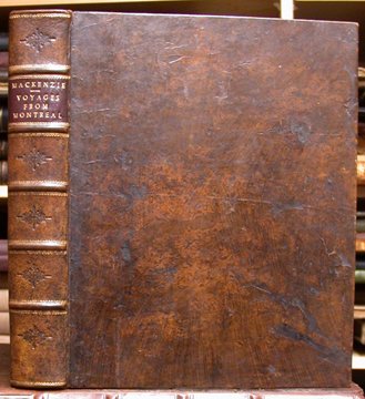
118. MACKENZIE, Alexander [1764-1820]. Voyages From Montreal, On The River St. Laurence, Through the Continent of North-America, To The Frozen And Pacific Oceans; In the Years 1789 and 1793... 4to. pp. 2 p.l., viii, cxxxii, 412, [2]errata. complete with half-title. 3 large folding engraved maps (1 coloured in outline). engraved frontis. portrait. contemporary calf, rebacked (some scraping to leather, paper lightly embrowned, some scattered foxing, 1 map with repairs to some folds with slight paper loss but no loss of image). London: Printed for T.Cadell and W.Davies..., 1801. $12,000
First Edition of “the earliest expedition made by a white man in this direction. His investigations, although pursued at so early a period of Arctic exploration, were remarkable for their accuracy; Sir John Franklin more than once expressed his surprise at being able to corroborate their correctness in his own explorations. Some Indian vocabularies are included...". (Sabin)
Mackenzie's journals recount his two expeditions undertaken on behalf of the North West Company in its attempt to break the Hudson's Bay Company monopoly of the fur trade. The first expedition, in 1789, from Fort Chipewyan on Lake Athabaska down what is now known as the Mackenzie River to the Arctic constitutes the first trip to the Arctic from the Canadian prairies ; the second, in 1792-93, from Fort Chipewyan over the Rocky Mountains by the Peace and Fraser Rivers to the Pacific, is distinguished as the first overland expedition to reach the Pacific, north of Mexico . The maps are the earliest done of certain parts of Canada. Also included is a lengthy account of the development of the fur trade in the North West, generally attributed to the author's cousin, Roderick Mackenzie.
Bell M20. Hill pp. 187-88. Howes M-133. Lande 1317. Morgan p. 240. Peel 55. Sabin 43714. Smith 6382. Strathern 343. Streeter VI 3653. TPL 658. Vlach 511. Wagner-Camp 1. Winsor VIII p. 34.
119. McLEAN, John [1799-1890]. Notes Of A Twenty-Five Year's Service In The Hudson's Bay Territory. 2 Volumes. 12mo. pp. 1 p.l., [v]-xii, [13]-308; vii, [1]blank, [9]-328. lacking half-titles. modern cloth. London: Richard Bentley, 1849. $1,500
First Edition. A vivid and entertaining memoir of life in the service of the Hudson's Bay Company, about whose methods of operation the author is able to provide some candid, insightful, and critical comments. McLean joined the Company in 1821, and was successively stationed in the Ottawa Valley, the North-West, on the Pacific Coast, in Hudson's Bay, and in Labrador. He retired in 1845 to Guelph, Ontario, where he wrote this book. Of particular value is the section dealing with the Labrador Peninsula, a little known area at the time, and one which McLean is credited with being the first white man to traverse in its entirely. There he discovered the Grand Falls on the Northwest River. The life and customs of the various Canadian native tribes and Esquimaux are described with some detail, especially in their relations with the Hudson's Bay Company. “One of the classics of wilderness travel.” (TPL)
Bell M30. Field 996. Graff 2640. Lande 1322. Morgan p. 271. O'Dea 535a. Peel 225. Sabin 43514. Smith 6418. Strathern 346. Streeter VI 3712. TPL 2729. Wagner-Camp 169. Winsor VIII p. 74.
120. McLAURIN, Rev. C[olin] C[ampbell]. Pioneering In Western Canada A Story Of The Baptists. 8vo. pp. 8 p.l., 401, [1]. frontis. portrait & 16 double-sided plates. cloth (lacking front free-endpaper). dw. (badly tattered). Presentation copy, from Marjorie Pearson, the writer of the ‘Epilogue, with tipped-in card indicating how one might obtain a copy of the book and assist Mr. McLaurin (“I think the printers are pressing him.”). Calgary: The Author, 1939. $60
First Edition, Limited to 400 copies.
Edwards & Lort 2296. Lowther 1794. Peel 6300.
121. MACLEAN, John [1851-1928]. Canadian Savage Folk. The Native Tribes Of Canada. 8vo. pp. viii, [9]-641. frontis. portrait & 94 text illus. (many full-page). A tight, bright copy in original black & gilt-stamped cloth. Toronto: William Briggs…, 1896. $300
First Edition. The author, a Methodist missionary, was stationed at the Blood Indian Reserve near Fort Macleod, Alberta, from 1880 to 1889, and afterwards served in various western charges until his retirement in 1911. This substantial work is understandably largely devoted to the western tribes, although Eastern Canada is not neglected.
Peel 2280.
122. McMICKING, Thomas. Overland from Canada to British Columia…Edited by Joanne Leduc… 8vo. pp. xl, [1 leaf], 121. 6 colour illus. on 2 double-sided plates & numerous text illus. after drawings by W.G.R.Hind. 4 other double-sided plates. 1 double-page map. biblio. index. cloth. dw. Vancouver & London: University of British Columbia Press, [1981]. $40
First Edition.
123. McPHAIL, Alexander James [1883-1931]. The Diary Of Alexander James McPhail. Edited by Harold A. Innis. 8vo. pp. xi, [1 leaf], 289. 2 plates. index. cloth. Toronto: University of Toronto Press 1940. $100
First Edition.
Peel 5567.
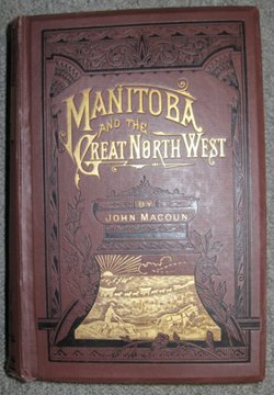
124. "MAC", Captain. Canada; The Country, its People, Religions, Politics, Rulers, and its apparent Future, Being A Compendium Of Travel From The Atlantic To The Pacific, The Great Lakes, Manitoba, the North-West, and British Columbia... 8vo. pp. 1 p.l., 353, [22]ads. numerous text illus. (most full-page). original blind-stamped cloth. Montreal: 1882. $150
Enlarged Edition.
Dionne III 1931.
125. MACOUN, John [1832-1920]. Manitoba And The Great North-West: The Field For Investment; The Home Of The Emigrant, Being A Full And Complete History of the Country…To Which Has Been Added The Educational & Religious History Of Manitoba & The North-West, by George M.Grant…Also Montana And The Bow River District Compared For Grazing Purposes, by Alexander Begg…Sketch Of The Rise And Progress Of Winnipeg, by J.C.McLagan… 8vo. pp. 1 p.l., xxii, [17]-687, [1]blank, [3]ads. with half-title. 3 tinted lithographs incl. folding frontis. birds-eye view of Winnipeg & birds-eye view of Emerson, coloured lithographed diagram, 2 large colour lithographed maps of Canada & the North-West Territory & Manitoba, large folding lithographed street map of Winnipeg, & 13 full-page illus. original black & gilt-stamped cloth (some light wear to joints & extremities, few map tears – no loss, several tears in Winnipeg map with acidic repairs – no loss). Guelph, Ont.: The World Publishing Company, 1882. $450
First Edition of this encyclopedic propagandistic work on Manitoba and the north-west, including chapters on geography, climate, wheat, cereals and root crops, water supply, stock raising, timber supply, minerals, flora and fauna, cities and settlements, Winnipeg, native races, North-West Mounted Police, railroads, advice to immigrants, settlers and travellers, &c. Macoun, a naturalist, was invited by Sandford Fleming, chief engineer of the Pacific Railway, to take part in a survey of its projected route westward. During the course of five separate surveys conducted between 1872 to 1881, he examined the agricultural potential of various western regions and incorrectly concluded that all of the northwest was ideally suited for agriculture, even the arid plains of southern Saskatchewan and Alberta. It was on the basis of his evaluation that the CPR was re-routed across the southern prairies.
Peel 1081.
126. MARTIN, R[obert] M[ontgomery] [1803-1868]. The Hudson's Bay Territories And Vancouver's Island, With An Exposition Of The Chartered Rights, Conduct, And Policy Of The Honble Hudson's Bay Corporation. 8vo. pp. vii, [1]errata, 173, [1] + [28]ads. folding engraved map, coloured in outline & 1 wood engraving in the text. original blind-stamped cloth (spine dull & with small tear to head of spine). London: T.And W.Boone, 1849. $900
First Trade Edition. An investigation of the policy, conduct and operations of the Hudson's Bay Company on the Pacific coast and in the Canadian north-west. Martin presents a glowing and enthusiastic appraisal, and argues that the Hudson's Bay Company is eminently suited to the task of promoting the settlement of Vancouver Island, a responsibility with which it had just been entrusted. The map indicates the positions of the forts and principal stations of the Hudson's Bay Company at the time.
Bell M179. Gagnon I 2277. Lande 1341. Morgan p. 251. Peel 255. Sabin 44915. Smith 6571. Strathern 356(i). TPL 2920. cfLowther 8.
127. MASSON, L[ouis François] R[odrigue] [1833-1903] (Editor). Les Bourgeois De La Compagnie Du Nord-Ouest: Récits De Voyages, Lettres Et Rapports Inédits Relatifs Au Nord-Ouest Canadien. Publiés Avec Une Esquisse Historique Et Des Annotations. 2 Volumes. 8vo. pp. ix, 154, 413, [2]incl. errata; vi, [blank leaf], 499. large folding coloured lithographed map. A very nice set in modern half hard-grained morocco. Quebec: A.Côté et Cie., 1889-1890. $1,350
First Edition. A valuable collection of hitherto unpublished journals, accounts, and letters relating to the history of the North West Company and the state of the fur trade in the Canadian and American northwest and the Great Lakes, Upper Missouri and Rocky Mountain regions, including: Roderick McKenzie's Reminiscences , being chiefly a synopsis of letters from Sir Alexander Mackenzie; W.F.Wentzel's letters to R.McKenzie; John McDonnell's account of Red River (c. 1797); François Antoine Larocque's Missouri journal (1804-05); Simon Fraser's journal of a voyage from the Rocky Mountains to the Pacific coast (1808); Samuel Wilcox's Narrative of circumstances attending the death of the late Benjamin Frobisher, Esq., a partner in the North-West Company (1819), James McKenzie's Some account of the King's Posts, the Labrador coast and, Journal of a canoe trip through those countries, in 1808 , John Johnston's description of the country around Lakes Superior and Huron (1809), Peter Grant on the Sauteax Indians (1804); a list of 'bourgeois, commis, engagés et voyageurs' of the North West Company, &c. The large Map of the North West Territories was drawn by Gustave Rinfret.
The collection was originally conceived and begun by Roderick McKenzie, who retired from service with the North West Company in 1806, but it was considerably expanded by his son-in-law Masson, who has also provided an introduction, annotations, and short biographies, all of which greatly enhance the value of the work.
Dionne I 2170. Gagnon I 2282. Graff 2705. Howes M-385. Lande 1343. Peel 159. Smith 6596. Strathern 358. Streeter VI 3749. TPL 1174. Wagner-Camp 7n.
128. MATHERS, C[harles] W[esley] [1869-1950]. The Far North [Cover Title]. oblong 4to. [ff. 27]. 27 mounted photographic illus. wrs., mounted photographic illus. on upper wr., corded tie (wrs. rubbed, corners or wrs. curled, small stain on upper wr., some leaves sprung). [Edmonton: 1902]. $175
C.W. Mathers began his photographic career with the Edmonton branch studio of the Calgary photographic partnership of Boorne & May. According to Alberta photohistorian Brock Silversides, Mathers was Edmonton's only photographer for several years, including the first two years of the Klondike Gold Rush. In 1901 he travelled with a Hudson's Bay Company trader to Fort MacPherson on the Peel River, and was able to take the first professional photographs of Inuit in the region. Mathers sold his business in 1904 and moved to Vancouver, B.C.
129. MESSITER, Charles Alston [b. 1841]. Sport And Adventures Among The North-American Indians. 8vo. pp. xvi, [1], 368. with half-title. 9 illus. by Charles Whymper. original pictorial cloth (extremities rubbed). London: R.H.Porter, 1890. $350
First Edition. Messiter travelled extensively in the Canadian and American West (Saskatchewan, Manitoba, Missouri, and Texas), partly in company with Milton and Cheadle. The winter of 1862-63 he spent in the Thickwood Hills northwest of Fort Carlton in Saskatchewan. His narrative relates his sporting adventures in pursuit of grizzlies, moose, buffalo, wild geese and grouse, and includes much of interest relating to the manners and customs of the Sioux, Cree and Caddo Indian tribes.
Peel 444.
130. MILTON, [William Fitzwilliam], Viscount & CHEADLE, W[alter] B[utler]. The North-West Passage By Land. Being The Narrative Of An Expedition From The Atlantic To The Pacific, Undertaken With The View Of Exploring A Route Across The Continent To British Columbia Through British Territory, By One Of the Northern Passes In The Rocky Mountains. 8vo. pp. xxiv, 400, + [pp. 16]publisher's catalogue. with half-title. 22 wood-engraved plates (1 double-illus.). 2 folding engraved maps by Arrowsmith (1 in front pocket, some hand-colouring). original blind & gilt-stamped cloth, recased preserving endpapers (extremities trifle frayed, very occasional light foxing). London: Cassell, Petter, And Galpin, [1865]. $750
Third Edition. A lively narrative of an overland expedition across Canada, through the Yellow Head Pass in the northern Rocky Mountains, to British Columbia. After a difficult and risky crossing of the Rockies, the party reached Kamloops, and from there journeyed to Westminster and Victoria, returning to the mainland to visit the Cariboo gold diggings. Despite the dual attribution, the work was in fact written by Cheadle.
Peel 446n. Sabin 24631. Smith 6846. Wagner-Camp 420:4. cfGraff 2809. cfLowther 257. cfTPL 4340.
131. MILTON, [William Wentworth-Fitzwilliam], Viscount [1839-1877] & CHEADLE, W[alter] B[utler] [1835-1910]. Voyage De L'Atlantique Au Pacifique À Travers Le Canada, Les Montagnes Rocheuses Et La Colombie Anglaise. 8vo. pp. 4 p.l., 387, [1]. with half-title. 22 wood-engraved plates (1 double-illus.). 2 double-page maps. contemporary quarter chagrin, gilt back, all edges gilt (bit rubbed, some foxing mainly to plates & adjacent leaves). Paris: Hachette Et Cie., 1866. $400
First Edition of the French Translation by J.Belin-De Launay.
Dionne II 1508. Smith 6853. TPL 4342. cfGraff 2809. cfLowther 257. cfPeel 249. cfSabin 24631. cfStreeter VI 3735. cfWagner-Camp 420.
132. MITCHELL, B[enjamin] W[iestling]. Trail Life In The Canadian Rockies.
12mo. pp. xii, [2], 269. 16 double-sided plates. cloth (small stains on spine). New York: Macmillan Company, 1924. $75
First Edition.
Edwards & Lort 2443.
133. MORRIS, Alexander [1826-1889]. The Treaties Of Canada With The Indians Of Manitoba And The North-West Territories, Including The Negotiations On Which They Were Based, And Other Information Relating Thereto. 8vo. pp. 373 + [5]ads. original blind & gilt-stamped cloth (rubbed, extremities bit frayed). Toronto: Belfords, Clarke & Co., 1880. $225
First Edition. “A valuable source book by one who played a leading role in settling the Indians' claims.” (Peel)
Peel 940.
134. MÜLLER, Gerard Friedrich [1705-1783]. Nouvelle Carte Des Decouvertes Faites Par Des Vaisseaux Russiens Aux Côtes Inconnues De l'Amérique Septenrionale Avec Les Pais Adiacents Dressée Sur Des Memoires authentiques… A St. Petersbourg a l'Academie Imperiale des Sciences 1784. 19 ¾” x 26 ¼”. original outline colour. $3,000
Müller's Nouvelle Carte “…is one of the most important maps of the northwest coast produced in the eighteenth century and the first to delineate the area with accuracy.” (Verner & Stuart-Stubbs). First published in 1754, several editions of the map were published over a thirty year period. The important 1773 revisions, including the revised Alaska outline, were maintained in the 1784 edition.
Müller was the supervisor of the Geographic Department of the Akademiya Nauk. His Nouvelle Carte was the first official map to show the Russian discoveries in the North Pacific. “The map illustrates the official Russian viewpoint that not only was the land sighted by the Russians at the farthest east part of the American mainland, but most of the coastline glimpsed on the return voyage, as well as the land seen by Gwosdev in 1732 opposite the eastern tip of Asia.” (Cummings et Al p. 255). The map shows the exploration routes of Bering and Chrikov in 1741 and Dezhnev's voyage from the mouth of the Kolyma River eastward and around the Chukotsk Cape.
Cummings, The Exploration of North America, p. 225. Bagrow, A History Of Russian Cartography Up To 1800, pp. 163. Medushevskya, ‘Cartographic Sources For The History Of Russian Geographical Discoveries In The Pacific Ocean', Cartographica, Monograph No. 13/75, pp. 71-73. Tooley, Landmarks of Mapmaking, p. 131. Falk, Alaskan Maps, 1784-10. cfWagner 591. cfGlenbow Museum, The Canadian West Discovered, p. 34. cfKershaw 1114. cfFite & Freeman, A Book Of Old Maps, 51 . cfVerner & Stuart-Stubbs, The North Part Of America, 38 & p. 275.
135. MUNSTERJELM, Erik. The Wind and the Caribou Hunting And Trapping In Northern Canada. 8vo. pp. vi, 234. folding map. cloth. dw. (edges of dw. little chipped). Toronto: Macmillan Company of Canada Limited, 1953. $75
First Edition. Hunting and trapping adventures around Lake Athabaska in Alberta and Saskatchewan
136. [MURPHY], Emily [Gowan] Ferguson. Janey Canuck in the West. 16mo. pp. 224. frontis portrait. cloth (cloth discoloured, rear joint cracked). London & Toronto: J. M. Dent & Sons, Ltd., [1919]. $30
Peel 3422n.
137. NORTH-WEST TERRITORIES. LEGISLATIVE COUNCIL. Journals Of The Council Of The North-West Territories Of Canada. Fourth Legislative Session, Begun And Holden At Battleford, On The 16 th Day Of May, And Closed On The 11 th Day Of June, 1881. Honorable David Laird, Lieutenant-Governor. Session Of 1881. 8vo. pp. 36, v. original printed wrs. (wrs. tattered & detached). Regina: Printed by Amédée E. Forget…, 1886. $60
See Peel 1683.
138. OLIVER, E[dmund] H[enry] (Editor). The Canadian North-West Its Early Development And Legislative Records Minutes Of The Councils Of The Red River Colony And The Northern Department Of Rupert's Land. [Publications of the Canadian Archives No. 9]. 2 Volumes. 8vo. pp. 688; 1 p.l., [689]-1348. as often, without the 6 folding maps issued in a separate volume. wrs. (spine of Vol. II with tape repairs). Ottawa: Government Printing Bureau, 1914-15. $150
First Edition.
Peel 4151.
139. OPPEN, William A. (Compiler). The Riel Rebellions: A Cartographic History… (Cartographica Monograph No. 21-22 1978, Special Edition). oblong folio. pp. x, 107, [1]. b/w maps. bds. (ex-lib – many library markings). [Toronto]: University of Toronto Press in association with the Public Archives of Canada and the Canadian Government Publishing Centre, [1979]. $50
140. OUTRAM, Sir James [1864-1925]. In The Heart Of The Canadian Rockies. 8vo. pp. xii, [2], 466, [2]ads. 2 (of 3) colour maps – lacking the folding map (apparently never bound in) & 46 plates. original pictorial cloth (rubbed, recased). New York: Macmillan Company, 1905. $150
First Edition. Outram made the first ascents of Mounts Assiniboine, Lyell, Bryce, Columbia, Forbes, and other peaks.
Edwards & Lort 2681. Lowther 1545. cfNeate 592.
141. PALLISER, John [1807-1887]. Exploration – British North America. Papers Relative To The Exploration By Captain Palliser Of That Portion Of British North America Which Lies Between the Northern Branch Of The River Saskatchewan And The Frontier Of The United States, And Between The Red River And Rocky Mountains... folio. pp. 64. 8 maps & diagrams lithographed by John Arrowsmith (1 folding & 6 coloured). modern bds. (some spotting to maps). London: Printed By George Edward Eyre And William Spottiswoode, 1859. $4,500
First Edition of the first part of the four-volume report of the important 1857-59 exploring expedition to Western Canada led by Captain Palliser. In 1856 Palliser submitted a proposal to the Royal Geographical Society outlining his plan to explore the southern prairies of British North America and adjacent passes through the Rocky Mountains. At the request of the Under-Secretary of State for the Colonies, the plans were revised to include the old North West Company canoe route from Fort William to Red River. The expedition eventually received the official approval of the British government and an initial Treasury appropriation of 5,000 pounds.
Included here are Palliser's instructions and eight reports on the progress of the expedition's explorations from Lake Superior to the Rocky Mountains. “[Palliser's] reports...provided the first comprehensive, careful, and impartial observations to be published about the southern prairies and Rocky Mountains in what is now Canada ...They added considerably to geographical knowledge of the region, and established that an extensive “fertile belt”, well suited for stock-raising and cultivation, bordered the semi-arid prairie land to the south which is today known as “Palliser's Triangle”.” (DCB XI, pp. 663)
The accompanying maps and diagrams include a large folding map of the ‘...Country Between The Red River Settlement And The Rocky Mountains; showing the Various Routes of the Expedition...'.
TPL 3928. Sabin 58332. Graff 3167. Howes P-42. Lande 1377. Lowther 96. Peel 392. DCB XI pp. 661-64. Story pp. 622-23.
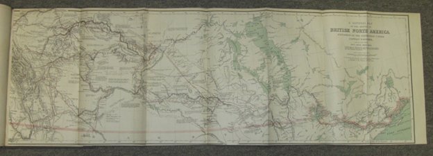
142. PALLISER, John [1807-1887]. Index To Captain Palliser's Reports.. [Drop Title]. folio. pp. 3. 5 folding coloured maps lithographed by Stanford. modern bds. [London: Printed By George Edward Eyre And William Spottiswoode, 1865]. $4,000
The maps and diagrams include the first accurate map of Western Canada: ‘A General Map of the Routes In British North America Explored By The Expedition Under Captain Palliser; geological maps of the south-east of Vancouver Island and of Nanaimo, a plan of Nanaimo showing the coal mines, &c.
Graff 3167. Howes P-42. Lande 1379. Lowther 208. Peel 406. DCB XI pp. 661-64. Story pp. 622-23. This index volume not in TPL or Sabin.
143. PALLISER, John [1807-1887]. The Papers Of The Palliser Expedition 1857-1860. Edited With An Introduction And Notes By Irene M.Spry. 8vo. pp. cxxxviii, 694, xix. frontis. large folding map in rear pocket. original gilt-crested cloth, t.e.g., others uncut. Toronto: Champlain Society [Publication No. XLIV], 1968. $250
Limited to 825 numbered copies.
Peel 223.
144. PATTERSON, R[aymond] M[urray]. The Buffalo Head. 8vo. pp. xiii, 273. 8 double-sided plates. maps on endleaves. quarter cloth. dw. (small tear to upper spine). New York: William Sloane Associates, 1961. $75
First Edition. “Cattle ranching in the Alberta foothills of the Rockies in the 1930's, including some experiences on the B.C. side.” (Edwards & Lort)
Edwards & Lort 2738.
145. PÉNARD, J[ean] M[arie]. The Vicar Apostolic Of Keewatin, Canada Bishop Ovide Charlebois, O.M.I. (1862-1933)…Translated…By Mary Agatha Gray. 8vo. pp. 241, [1 lea]. frontis. portrait, 8 double-sided plates, 1 double-page map & 1 text facsimile. later cloth (library rubberstamp & number on lower spine). Montreal: Librairie Beauchemin Limitée, 1939. $45
First Edition of the English Translation. Charlebois served as a missionary along the Saskatchewan River, 1887-1903 and was director of the Duck Lake Indian School from 1903-1910, before he was appointed apostolic vicar of Keewatin in 1910.
Peel 5713.
146. PHILLIPS, W[alter] J[oseph] & Frederick NIVEN. Colour In The Canadian Rockies. 8vo. pp. x, [11]-125. 32 colour plates & numerous text illus. maps on endpapers. index. cloth. dw. (edges of dw. tattered, former owner's name inked out on front flyleaf). Toronto: Thomas Nelson And Sons Ltd., 1954. $150
147. PULLEN-BURRY, B[essie]. From Halifax To Vancouver. 8vo. pp. xvi, 352, [32]ads. 40 plates. cloth (spine dull & ends frayed, split in lower front joint). London: Mills And Boon, Limited, [1912]. $125
First Edition. Pp. 183-352 relate to the West: Winnipeg, North-West Mounted Police, Saskatoon, Edmonton, Calgary, the Rockies, Banff, Yoho Valley, the Selkirks, the Kootenays, Okanagan, Vancouver, Prince Rupert, and New Westminster.
Edwards & Lort 2924. Peel 3795n.
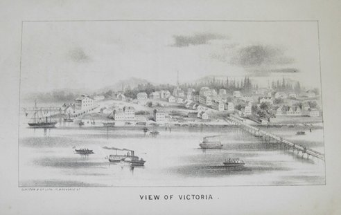
148. RAWLINGS, Th o mas. The Confederation Of The British North American Provinces Their Past History And Future Prospects; Including Also British Columbia & Hudson's Bay Territory; With A Map, And Suggestions In Reference To The True And Only Practicable Route From The Atlantic To The Pacific Ocean. 8vo.. pp. ix, [1], [1 leaf], 244. large folding lithographed map & 4 lithographed plates. original blind-stamped cloth (some foxing to outer leaves, otherwise in excellent condition). Author's Presentation Copy. London: Sampson Low, Son, And Marston, 1865. $700
First Edition. Rawlings, who had lived in North America for several years before 1863, was one of the most enthusiastic and persistent advocates of the transcontinental railway. The folding map shows the proposed route, and the plates include two early views of Victoria, B.C. & one of St. Paul, Minnesota. Rawlings discusses the colonization, economic situation, natural resources and future prospects of the Eastern provinces, Upper and Lower Canada, the Hudson's Bay Territory (Saskatchewan, the Red River Settlement, Rocky Mountains), British Columbia and Vancouver Island (the gold regions), the northern United States, emigration, and the railway system of North America.
Gagnon II 2922. Lande 1408. Lowther 260. Morgan p. 317. Peel 462. Sabin 68006. TPL 4442.
149. REES, Ronald. Land of Earth and Sky Landscape Painting of Western Canada. 4to. pp. [8], 148. 80 colour & 25 b/w illus. index. biblio. cloth. dw. Saskatoon: Western Producer Prairie Books, [1984]. $65
First Edition.
150. RENDER, Lorne E. The Mountain and the Sky. folio. pp. 223, [1]. 203 illus. (many colour). index. biblio. cloth (some spotting to cloth). dw. (dw. rubbed & edges worn). [Calgary]: Glenbow-Alberta Institute & McClelland and Stewart, [1974]. $60
First Edition.
151. RICH, E[dwin] E[rnest] (Editor). Copy-Book Of Letters Outward &c Begins 29 th May, 1680 Ends 5 July, 1687. 8vo. pp. xli, 415, [1], x. 5 maps (4 folding). Unopened in original gilt-crested blue cloth, t.e.g., others uncut. [Toronto]: Published by The Champlain Society for The Hudson's Bay Record Society [Publication No. XI], 1948. $150
Numbered Limited Edition.
TPL 4677.
152. RICH, E.E. The Fur Trade And The Northwest To 1857. 8vo. pp. xii, 336, [2]. 8 double-sided plates. 6 maps, 1 double-sided. biblio. index. cloth. dw. (couple chips & short tears to edges). [Toronto]: McClelland & Stewart, [1967]. $50
First Edition.
153. RICH, E[dwin] E[rnest] (Editor). Hudson's Bay Copy Booke Of Letters Commissions Instructions Outward 1688-1696. 8vo. pp. lxii, 357, xiv, [1]. Unopened in original crested blue cloth, t.e.g., others uncut. [Toronto]: Published by The Champlain Society for The Hudson's Bay Record Society [Publication No. XX], 1957. $125
Numbered Limited Edition.
154. RICH, E.E. (Editor). Minutes Of The Hudson's Bay Company 1671-1674. 8vo. pp. lxviii, 276, xiii. original gilt-crested cloth, t.e.g, others uncut. Toronto: Champlain Society [Hudson's Bay Company Series V], 1942. $150
Limited to 550 copies.
155. RICH, E.E. (Editor). Minutes Of The Hudson's Bay Company…1679-82. 2 Volumes. 8vo. pp. xlvi, 378, [2], xv; xlvi, 368, xv. frontis. portrait. unopened in original gilt-crested cloth, t.e.g, others uncut. Toronto: Champlain Society [Hudson's Bay Company Series VIII & IX], 1945-46. $275
Limited to 550 copies , these copies out of series.
156. RIEL, Louis [David] [1844-1885]. The Collected Writings… 5 Volumes. 8vo. text in French & English. illus., maps & facsimiles. biblio. index. cloth. slipcase. [Edmonton:] University of Alberta Press, [1985]. $250
First Edition.
157. (RIEL). BAYER, Ch[arles] & E.PARAGE. Riel Drame Historique En Quatre Actes Et Un Prologue Cinq Tableaux. 8vo. pp. 75, [1]errata. with half-title. disbound. Scarce. Montreal: Imprimerie De “L'Étendard”, 1886. $400
First Edition. “Melodramatic defence of Riel by two professors from France, who considered Riel nearly a saint. First public reading was in March 1886.” (Peel)
Peel 1571. Not in Casey.
158. (RIEL). CANADA. DEPARTMENT OF THE SECRETARY OF STATE. Return To An Address Of The House Of Commons, dated 1st March, 1886; - For a copy of the Report of the Medical men appointed by the Government to enquire into the mental condition of Louis Riel, after his conviction [Drop Title] [Canada. Sessional papers, 1886, no. 43]. with 3 other returns related to the claims of the Métis in the North-West Territories, & the evidence & charges in the trials of participants in the North-West Rebellion (pagination continuous). 8vo. pp. 389. modern wrs. [Ottawa: 1886]. $600
Bowing to petitions flooding in from French Canada requesting the commutation of the death sentence against Riel and the urging of his French Canadian cabinet colleagues, Prime Minister Macdonald agreed to have Riel's mental condition re-examined. Three doctors were instructed by the government to report on whether Riel was a reasonable and accountable being who could properly be executed: Dr. Jukes of Regina, Dr. Michael Lavel, warden at the Kingston penitentiary, and Dr. François Xavier Valade of Ottawa. The consultation was undertaken in secrecy and Valade's dissenting opinion was falsified in the official report submitted to parliament.
Peel 1403 (1st return, pp. 288).
159. (RIEL). CHAPLEAU, J[oseph] A[dolphe] [1840-1898]. Discours…À L'Occasion De La Motion Censurant Le Ministère Pour Avoir Permis l'Exécution De Louis Riel (Compte-Rendu Officiel) Séance du 24 Mars [Cover Title]. 8vo. pp. 39. original printed wrs. (short tear to top of front wr.). Montreal : Imprimerie Générale, 1886. $175
First Edition.
Peel 1399.
160. (RIEL). CHAPLEAU, J[oseph] A[dolphe] [1840-1898]. La Question Riel Lettre [Cover Title]. 8vo. pp. 14. original printed wrs. (removed from a bound volume, lacking rear free-endpaper). np : [1885]. $150
First Edition.
Peel 1401.
161. (RIEL). CHAPLEAU, J[oseph] A[dolphe] [1840-1898]. Speech…On The Motion Made, Before The House Of Commons, On The 11th March, 1886, To Blame The Government For Having Allowed The Execution Of Louis Riel (From The Official Debates). House of Commons March 24th, 1886 [Cover Title]. 8vo. pp. 40. original printed wrs. (short tear to top of front wr.). Montreal : Imprimerie Générale, 1886. $175
First Edition in English.
Peel 1399. Casey II 911.
162. (RIEL). [FILTEAU, J.C.] (Compiler). Le Véritable Riel Tel Que Dépeint Dans Des Lettres De Sa Grandeur Mgr Grandin, Évêque De Saint-Albert, Du Revd P. Leduc, Vicaire-Général De Saint-Albert, Du Revd P. André, Supérieur Des Missions Du District De Carleton, Des Révds Pères Touze, Fourmond, Vegreville, Moulin Et Lecoq, Missionnaires Du Nord-Ouest, D'Une Religieuse De Batoche, Etc., Etc. Suivi D'Extraits Des Mandements De Nos Seigneurs Les Évêques Concernant L'Agitation Riel. 8vo. pp. 63. self-wrs. Scarce. Montreal: Imprimerie Générale, 1887. $200
Casey II 1150. Dionne I 2039. Peel 1440.
163. (RIEL). THE GIBBET OF REGINA The Truth About Riel Sir John A. Macdonald And His Cabinet Before Public Opinion By One Who Knows. 8vo. pp. 200. 3 portraits (incl. frontis.). original printed wrs. (some chipping to wr. edges & head of spine). New York: Thompson & Moreau, 1886. $150
First Edition.
Peel 1515.
164. (RIEL). MONTPETIT, A[ndré] N[apoléon] [1840-1898]. Louis Riel À La Rivière-Du-Loup. 12mo. pp. lxii, [blank leaf], 111. original printed wrs. illus. with portraits of Riel & Dumont (bit tatty). Lévis: Imprimerie Mercier & Cie., 1885. $400
First Edition. Very scarce. “Riel was known to be in eastern Canada after he had signed the register of the House of Commons in Ottawa. Pranksters entertained and fêted a Riel impersonator in Cacouna, near Rivière-du-Loup, a sympathetic Quebec community.” (Peel)
Dionne I 1929. Gagnon I 2426. Peel 753. Not in Casey.
165. (RIEL). TACHÉ, [Alexandre Antonin] 1823-1894] & [Louis François Richer LAFLÈCHE 1818-1898]. Opinion De Leurs Grandeurs Mgr. Taché et Mgr. Laflèche... folio broadside. 46 x 31 cm. text in double columns. (slight chipping to edges). [np: c1887]. $2,000
Two letters by L.F.R.Laflèche, Bishop of Trois-Rivières, and A.A.Taché, Archbishop of St. Boniface, who played a major role in attempting to quell the popular agitation in Quebec against Riel's execution. Very scarce.
Lande 1403. Not in Peel.
166. (RIEL). THOMPSON, [John Sparrow] D[avid] [1844-1894]. Discours Sur La Question Riel Prononcé Le 22 Mars, 1886, À La Chambre Des Communes [Drop Title]. 8vo. pp. 54, [2]. 4 full-page native portraits & 2 full-page illus. disbound (slight chipping to edges of outer leaves). np: [1886]. $125
First Edition in French.
Peel 1551.
167. (RIEL). TREMBLAY, Ernest [1852-1904]. Riel Réponse À Monsieur J.A.Chapleau. 8vo. pp. 80. disbound. St. Hyacinthe: Des Presses À Vapeur De “L'Union”, 1885. $175
First Edition.
Casey I 862. Dionne I 1948. Lande 2228. Peel 1555.
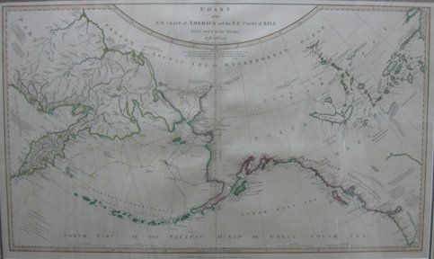
168. ROBERTS, Lieutenant Henry. Chart of the N.W. Coast of America and the N.E. Coast of Asia, Explored in the Years 1778 and 1779. Prepared by Lieut. Henry. Roberts under the immediate inspection of Capt. Cook. London: Published by Wm. Faden… July 24, 1784. 2d. Edition. Published January 1 st . 1794. 17” x 27 ½” (43.2 x 69.8 cm). original outline colour. $1,500
Second state, revised and updated, to include new geographical information on Siberia, Kamchatka and the Aleutian Islands. Roberts' chart of the northwest coast of America and the Canadian interior traces Cook's explorations on the coast and Mackenzie and Hearne's inland expeditions. Descriptive notes on rivers and lakes (Great Slave Lake, Coppermine River &c.) are provided. The Buache/Delisle Sea of the West is given a tentative location: “Sea of the West of Philippe Buache in 1752, communicating with the Mishinip (Great Water) Lake, which appears to be the Arathepescow Lake of Mr. Dalrymple”.
cfWagner 700 (1784 edition). Tooley, The Mapping of America, p. 92.64(b). Kershaw 1152 & Plate 901.
169. ROBERTS, Lieutenant Henry / SCHRAEMBL, Franz Anton [1751-1803]. Karte von den N.W. Amerikanischen und N. OE. Asiatischen Küsten, Nach den Untersuchungen des Kapit: Cook in den Jah: 1778. und 1779. entworsen von Henrich Roberts Lieut: Neu herausgegeben v. F.A. Schraembl. MDCCLXXXVII. Zu finden in eigenem Verlage in Wien [Vienna: 1788]. 16 ¾” x 27 ¾” (20.5 x 70 cm). original outline colour (few soil marks to margins). $1,000
This edition of Roberts important 1784 chart of the northwest coast of America and the Canadian interior was published by the Austrian map publisher, Schraembl. Most of the geographical information is in German, but some place-names and tribal locations are in English. The map shows Cook's discoveries in the North Pacific and traces his 1778-79 exploration routes.
Phillips, Atlases, 694. Kershaw 1149 & Plate 898.
170. ROBERTSON, Colin [1783-1842]. Colin Robertson's Correspondence Book, September 1817 To September 1822 Edited With An Introduction By E.E.Rich… 8vo. pp. cxxxi, 372, xi. frontis. Unopened in original gilt-crested blue cloth, t.e.g., others untrimmed. [Toronto]: Published By The Champlain Society for The Hudson's Bay Society [Publication No. II], 1939. $150
Numbered Limited Edition.
cfPeel 153. cfTPL 4871.
171. ROSS, Alexander [1783-1856]. The Fur Hunters Of The Far West; A Narrative Of Adventures In The Oregon And Rocky Mountains. 2 Volumes. 8vo. pp. xv, 333, [1 leaf]; viii, 262, [1 leaf]. folding lithographed map & 2 lithographed plates (incl. view of Fort Nez Percés and frontis. portrait of the author). original cloth, rebacked with spines mounted. London: Smith, Elder And Co., 1855. $2,200
First Edition. A sequel to the author's Adventures of the First Settlers on the Oregon or Columbia River (1849) and an essential source for the history of the fur trade of the Pacific Northwest during the period of intense commercial rivalry between the North West and Hudson's Bay Companies. Ross joined Jacob Astor's Pacific Fur Company in 1810 and was present at the building of Fort Astoria the following year. When the post was sold to the North West Company in 1813, Ross entered their employ and was a member of the expedition that established Fort Nez Percés in 1818, remaining in charge of the post until the amalgamation of the North West and Hudson's Bay Companies in 1821. His narrative also relates his experiences as leader of the Snake Country Expedition of 1824 and presents the only detailed account of the operations of the North West Company in the Snake River country under the administration of Donald Mackenzie. The work concludes with an account of Ross's return to the Red River Settlement in 1825 with Governor George Simpson. The appendix contains a vocabulary of the Nez Percé language.
Field 1326. Gagnon I 3061. Graff 3578. Howes R-449. Lande 1421. Peel 318. Sabin 73327. Smith 8785. Strathern & Edwards 476. Streeter VI 3719. TPL 1235. Wagner-Camp 269. Story p. 725. Winsor VIII p. 75.
172. ROYAL NORTH-WEST MOUNTED POLICE COMMISSIONERS. Law And Order Being The Official Reports To Parliament Of The Activities Of The Royal North-West Mounted Police Force From 1886-1887. 2 Volumes in 1. 8vo. pp. 2 p.l., 149; 151, [1]. cloth. [Toronto: Coles Publishing Company, 1973]. $40
Facsimile Reprint.
173. SAYER, Robert [1725-1794]. The Russian Discoveries, from the Map Published by the Imperial Academy of St. Petersburg. London, Printed for Robt. Sayer... Published as the Act directs March 2d. 1775. 18 ¾” x 25 ¼” (47.6 x 64.1 cm). original outline colour. $1,650
English edition, published by Robert Sayer, of Müller's map of the Russian discoveries in the North Pacific. Sayer's map shows the River of the West, flowing from Lake Winnipeg to the Pacific, and the large Alaska extension. The map provides extension information on the Russian discoveries in the North Pacific, including the tracks of Shestakov's voyage to Kamchatka and Bering and Chirikov's 1741 expedition to the northwest coast of America.
Phillips, Atlases , 1165 & 1166. Wagner 650. Kershaw 1132 & Plate 882.
174. SECRETAN, [James Henry Edward] [1854-1926]. Out West. 16mo. [pp. 206]. 12 plates. original gilt-lettered cloth (small stain to upper rear cover). Ottawa: Esdale Press, 1910. $200
First Edition.
Peel 3488.
175. SHARP, Paul F. Whoop-Up County The Canadian-American West, 1865-1885. 8vo. pp. xix, 347, [1]. numerous text illus. after drawings by C.M.Russell. illus. on endpapers. cloth. dw. (edges of dw. little chipped). Helena: Historical Society Of Montana, [1960]. $75
Second Edition.
Not in Peel.
176. SHEPHERD, George. Brave Heritage. 8vo. pp. 6 p.l., 130. 6 double-sided plates. map on endpapers. cloth (bit spotted). dw. (edges chipped). [Saskatoon]: Prairie Books, [1967]. $35
First Edition. The author purchased a homestead fifty miles south of Maple Creek, Saskatchewan just north of Cypress Hills in 1913. Including chapters on the Palliser expedition, the massacre in the Cypress Hills, the North West Mounted Police, Sitting Bull and Major Walsh, buffalo, George Catlin, cattle brands, &c.
177. SIMPSON, George [1787-1860]. Journal Of Occurrences In The Athabasca Department…1820 And 1821, And Report Edited By E.R.Rich… 8vo. pp. lix, 498, [1]. frontis. portrait. 4 folding maps in rear pocket. original gilt-crested blue cloth, t.e.g., others untrimmed. Related Hudson's Bay Record Society ephemera laid in. [Toronto]: Published by The Champlain Society for The Hudson's Bay Record Society [Publication No. I], 1938. $300
Numbered Limited Edition.
cfPeel 146. cfTPL 4866.
178. SIMPSON, George. Fur Trade And Empire George Simpson's Journal Entitled Remarks Connected with the Fur Trade in the Course of a Voyage from York Factory to Fort George and Back to York Factory 1824-25 With Related Documents Revised Edition Edited With A New Introduction By Frederick Merk. 8vo. pp. lxii, 370. double-page map. index. cloth. dw. Cambridge, MA: Belknap Press of Harvard University Press, 1968. $100
Second Revised Edition.
Peel 160n.
179. SIMPSON, George [1787-1860]. London Correspondence Inward From Sir George Simpson 1841-42 Edited By Glyndwr Williams… 8vo. pp. lviii, 212, xvii. frontis. portrait. folding map & 2 folding plans. index. gilt-crested cloth. dw. London: The Hudson's Bay Record Society [Publication No. XXIX], 1973. $100
Limited Edition.
180. SIMPSON, Sir George [1787-1860]. Narrative Of A Journey Round The World, During The Years 1841 And 1842. 2 Volumes. 8vo. pp. xi, [1], 438; vii, 469. engraved frontis. portrait. folding lithographed map. 1 text illus. new half calf over contemporary marbled bds. London: Henry Colburn, 1847. $1,250
First Edition. Sir George Simpson, Governor-in-Chief of the Hudson's Bay Territories in North America from 1821 to 1856, was highly influential in revitalizing the company's operations and gave great encouragement to the geographical exploration of its territories, particularly the arctic and barren lands. In 1841-42, he undertook an overland journey around the world, claiming to be the first traveller to complete the trip. This account of that journey, during which he passed through the Red River Settlement, Edmonton, Fort Vancouver, Sitka, Vancouver Island, San Francisco, the Hawaian and Sandwich Islands, and across Siberia and Russia, was, according to Gagnon, prepared by Adam Thom from Simpson's notes.
Cowan p. 589. Gagnon I 3316. Graff 3786. Hill 274. Howes S-495. Lada-Mocarski 129. Lande 1447. Peel 115. Sabin 81343. Strathern & Edwards 505. Streeter VI 3710. Wagner-Camp 140. Wickersham 4126.
181. SLARK, G.M. Thirty Choice Views of Canadian Rockies [Cover Title]. oblong 8vo. 27 views on 14 photogravure plates. wrs. (lightly dampstained). Jasper: nd. $40
182. SMITH, Harlan I. Handbook of the Rocky Mountains Park Museum. 8vo. pp. 126. frontis. wrs. (some chipping to spine ends). Ottawa: Canada, Department of the Interior, Dominion Parks Branch, 1914. $75
183. SMITH, James K. The Mackenzie River: yesterday's fur frontier, tomorrow's energy battleground. 8vo. pp. 6 p.l., 259. 1 double-page map. 1 double-page illus. biblio. index. cloth. dw. Agincourt: Gage Publishing, [1977]. $35
First Edition.
184. SOMERSET, H[enry Charles] Somers [Augustus]. The Land of the Muskeg...With a Preface by A.Hungerford Pollen. 8vo. pp. xxxi, 248 + 24(Publisher's Catalogue). with half-title. 4 partly coloured lithographed maps (2 folding), title vignette, frontis. portrait & 109 text illus. from sketches by A.H.Pollen & instantaneous photographs (5 full-page). Uncut in original gilt-stamped cloth (cloth soiled, stain on upper cover, hinges cracked, light foxing to first few leaves). London: William Heinemann, 1895. $350
First Edition of this account of a hunting and exploring excursion in British Columbia. Setting out from Edmonton, the party travelled by the Athabasca to Fort Dunvegan on the Peace River, crossed the Rockies via the Pine and Misinchinka Rivers to Fort McLeod, and then proceeded south-east to Quesnel via Fort St. James and the Stuart River. The journey, particularly from Fort Dunvegan to Fort McLeod, was a harrowing one; it was exceptionally rainy, game was scarce, and the sportsmen had to resort to eating one of their packhorses.
Lowther 1177. Smith 9656. Story p. 773.
185. SOUTHESK, [James Carnegie, 9 th ] Earl of [1827-1905]. Saskatchewan And The Rocky Mountains. A Diary And Narrative Of Travel, Sport, And Adventure, During A Journey Through The Hudson's Bay Territories, In 1859 And 1860. 8vo. pp. 1 p.l., [vii]-xxx, 448. lacking half-title. 2 folding partially coloured engraved maps, 5 lithographed facsimiles, & 7 wood-engraved plates (incl. frontis.). 22 wood engravings in the text. title in red & black. original gilt-stamped cloth (covers scuffed, inner hinges cracked, extremities frayed). Edinburgh: Edmonston And Douglas, 1875. $450
First Edition, Second Issue. Southesk's narrative, based on the carefully recorded daily journal which he kept throughout the journey, follows his passage across Canada to the west coast and back: Fort Garry, Fort Ellice, Qu'Appelle Fort, Indian Elbow, Fort Carlton, Fort Edmonton, Medicine Tent River and North River Camps, Kootanie Plain, Old Bow Fort, Port Pelly. He describes his meetings with Sir George Simpson, Paul Kane and arctic explorer, Dr. Rae, and devotes considerable attention to the conditions and customs of the native tribes encountered.
“One of the classics of early western travel literature.” (Peel) Acccording to Peel there was an earlier issue with title dated 1874.
Graff 588. Peel 411n. Sabin 88549. TPL 4019.
186. SPENCE, Thomas [1832-1900]. Manitoba Et Le Nord-Ouest Du Canada, Ses Ressources Et Ses Avantages Pour L'Emigrant Et Le Capitaliste… 8vo. pp. 39. folding lithographed map frontis. text illus. original printed wrs. (chipping to spine). Ottawa: Department of Agriculture, 1875. $175
First Edition of the French Translation, from the Second Revised and Enlarged Edition. Promotional tract by the “progenitor of Prairie immigration literature” (Peel). Spence was at the time Clerk of the Legislative Council of the newly created province of Manitoba.
Casey I 4037. Peel 716n.
187. SPENCE, Thomas [1832-1900]. The Prairie Lands Of Canada; Presented To The World As A New And Inviting Field Of Enterprise For The Capitalist, And New Superior Attractions And Advantages As A Home For Immigrants Compared With The Western Prairies Of The United States… 8vo. pp. 56, [8]ads. lacking map? (no evidence that one was every bound in). text illus. in ads. original printed wrs. (short tears to edges of wrs.). Montreal: Printed At The Gazette Printing House, 1880.
Second Revised Edition.
Peel 896n. cfCasey II 101.
188. SPRY, Irene M. The Palliser Expedition An Account Of John Palliser's British North America Expedition 1857-1860. 8vo. pp. vi, [2 leaves], 310. 6 double-sided plates. 5 double-page maps. index. cloth (rear cover spotted) dw. Toronto: The Macmillan Company Of Canada Limited, 1963. $60
First Edition.
189. STOCK, Ralph [1882-1962]. Confessions Of A Tenderfoot Being A True And Unvarnished Account Of His World-Wanderings. 8vo. pp. 260. 48 plates after photos by the author. cloth, t.e.g, others uncut (rubbed, bit shaken, scattered light foxing). London: Grant Richards Ltd., 1913. $125
First Edition. The author was an itinerant worker who ranched in the Cypress Hills region of Saskatchewan and Alberta and whose time in B.C. saw him employed in a saw-mill in Fernie at the time of the fire in 1903, as a photographer in Ashcroft, and in the coast logging camps. The rest of the book relates his experiences in Fiji and Australia.
Edwards & Lort 3386. Peel 3948.
190. STUBBS, Roy St. George. Four Recorders of Rupert's Land A Brief Survey of the Hudson's Bay Company Courts of Rupert's Land. 8vo. pp. 8 p.l., 192. 4 portraits. half-title illus. index. cloth. dw. (dw. rubbed & trifle chipped at edges). Winnipeg: Peguis Publishers, [1967]. $40
First Edition.
191. STUBBS, Roy St. George. Lawyers and Laymen of Western Canada. 12mo. pp. 5 p.l., 197. 7 portraits (incl. frontis). cloth. Toronto: The Ryerson Press, [1939]. $40
First Edition. Biographical sketches of Nicholas Flood Davin, Nathaniel Francis Hagel, Sir Hugh John Macdonald, Samuel Larcombe, James Emile Pierre Prendergast, Robert Andrew Bonnar, Patrick James Nolan, and Robert Chambers Edwards.
Peel 6326.
192. SUTHERLAND, Rev. A[lexander] [1833-1910]. A Summer In Prairie-Land. Notes Of A Tour Through The North-West Territory. small 8vo. pp. 1 p.l., x, 198. with half-title. 7 full-page text illus. original black & gilt-stamped cloth (bit soiled & faded, extremities frayed, occasional stains & foxing). Methodist Missionary Society Sunday school prize bookplate. Toronto: Printed For The Author, At The Methodist Book And Publishing House, 1881. $175
First Edition. Account of a tour through Western Canada made by the superintendent of Methodist missions. Travelling up the Missouri River to Fort Benton, then overland to Morley, he visited Victoria and Whitefish Lake and the more important missions between Edmonton and Winnipeg.
Peel 1012. Smith 10028 (citing incorrect date: 1882).
193. TACHÉ, Alexandre [Antonin]. Vingt Années De Missions Dans Le Nord-Ouest de l'Amerique. 8vo. pp. xiii, 245. contemporary half calf. Montreal: Eusèbe Senécal, 1869.
$200
Second Edition. “An account of Oblate missionary work in the West 1845-1866. Taché, a native of Lower Canada and an Oblate, went to Red River mission in 1845 and became the second bishop of St. Boniface in 1853. He later had an important part in settling the Red River “Rebellion in 1869.” (TPL)
Peel 472n. cfTPL 4540. cfLande 1471. cfDionne I 958. cfGagnon I 3448.
[BOUND WITH:] BARLOW, Debbie, Helen & Anna. Les Jeunes Converties ou mémoires des Trois Soeurs…Traduit de lAnglais [par l'Abbé H.Beaudry]. 8vo. pp. xv, 195. Montreal: Eusèbe Senécal, 1869.
Second Edition. Impressions of convent life at the Congrégation de Notre-Dame in Montreal.
cfDionne I 925.
194. THOMSON, John [fl. 1813-1869]. Chart Of The Northern Passage Between Asia & America. D rawn & Engraved for Thomson's New General Atlas 1816. 19 1/2" x 23". original colour (margins foxed & light offsetting). $750
Thomson's chart traces the north Pacific explorations of Cook and Bering and Mackenzie's explorations in the Canadian West.
Phillips, Atlases , 731.
195. TRAILL, Walter. In Rupert's Land Memoirs of…Edited by Mae Atwood. 8vo. pp. 232. maps on endpapers. bds. dw. (some creasing & chipping to edges). Toronto/Montreal: McClelland And Stewart Limited, [1970]. $35
First Canadian Edition.
196. TUTTLE, Charles R[ichard] [b. 1848]. Our North Land: Being A Full Account Of The Canadian North-West And Hudson's Bay Route, Together With A Narrative Of The Experiences Of The Hudson's Bay Expedition Of 1884… 8vo. pp. xvi, [17]-589. with half-title. 2 folding coloured maps (frontis. map backed repairing tears – no loss). original blind & gilt-stamped cloth (outer portion of rear cover stained, extremities bit frayed). Toronto: C.Blackett Robinson, 1885. $275
First Edition. “Based on the author's observations during the expedition of 1884, and on reports of other Canadian explorers and surveyors, a narrative of the expedition with notes on white, native and halfbreed peoples, the villages, missionaries and economic life observed along Labrador, the posts of Ungava Peninsula, Churchill, York Factory and the islands of the Bay; accounts of fighting field ice, bear hunting, and the work of Hudson's Bay Co….”. (Arctic Bib.)
Arctic Bib. 18107. Peel 1302.
197. TURNER, John Peter. The North-West Mounted Police 1873-1893. 2 Volumes. 8vo. pp. xiii, [1], 686; vii, 610. 1 folding map. numerous text illus. (some full-page). index. wrs. (spines discoloured, light wear to extremities). Ottawa: Edmond Cloutier, 1950. $200
First Edition. The official history of the first 20 years of the Mounted Police.
Peel 2117.
198. WARRE, H.J. Overland to Oregon in 1845 Impressions of a Journey across North America… oblong 4to. pp. 2 p.l., xiii, 149. [2 leaves]. text in French & English. numerous text illus. & maps (2 double-page). index. wrs. dw. (edges of dw. chipped). [Ottawa: Public Archives of Canada, 1976. $30
199. WEBB, William Seward [1851-1926]. California And Alaska And Over The Canadian Pacific Railway. 4to. pp. 1 p.l., xix, 190. with half-title. 4 etched plates (incl. frontis.) mounted on India paper (tissue guards marked 'proof'). 88 photogravures. few text illus. uncut in contemporary roan, elaborately tooled in gilt, top edge gilt (extremities & joints rubbed, head & tail of spine chipped). New York & London: G.P. Putnam's Sons The Knickerbocker Press, 1890. $750
First Edition: letter-press edition limited to 500 copies. The American businessman recounts his railway journey, on a private train, through the western United States and Canada. The work contains descriptions of Denver, Colorado Springs, Santa Fe, Santa Monica, Monterey, Los Angeles, San Francisco, Northern California, Montana, Alaska (pp. 141-170), and Western Canada, where Webb passed through Winnipeg, Brandon, Qu'Appelle, Moose Jaw, Medicine Hat, Calgary, the Rockies, the Selkirks, Kamloops, Yale, New Westminster, Port Moody, Vancouver, &c.
Smith 10804. Lowther 906. cfRicks 251. cfWickersham 6481. cfArctic Bib. 19208. Not in Peel.
200. WILBY, Thomas W. A Motor Tour Through Canada. 12mo. pp. xviii, [1 leaf], 290. 31 plates after photographs. cloth (spine ends & corners slightly frayed, some foxing throughout, library bookplate on front paste-down). London: John Lane…, 1914. $125
First Edition. The first cross-Canada tour by car from Halifax to Victoria and the first crossing of the Rockies by car.
201. WILLIAMS, Glyndwr (Editor). Hudson's Bay Miscellany 1670-1870. 8vo. pp. xi, 245, xviii. facsimile frontis. & 3 maps (2 folding). index. gilt-crested cloth. Winnipeg: Hudson's Bay Record Society [Publication No. XXX], 1975.
Limited Edition.
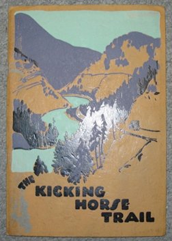
202. WILLIAMS, M.B. The Kicking Horse Trail Scenic Highway from Lake Louise, Alberta to Golden, British Columbia. 8vo. pp. 47. [1]. folding map & numerous text illus. pictorial wrs. [Ottawa: [Canadian National Parks, Ministry of the Interior, 1928]. $45
203. WILLIAMS, M.B. Through the Heart of the Rockies & Selkirks. 8vo. pp. 1 p.l., 105, [1]. 4 folding maps. illus. index. wrs. (wrs. with some spotting & edges with a few tears). [Ottawa]: [Canadian National Parks], Ministry of the Interior, 1921. $75
First Edition. Guide to Rocky Mountains Park, Banff, Lake Louise district, Yoho Park, Glacier Park and Mt. Revelstoke Park, with appendices on vegetation and wild life, trail trips, and place names and altitudes.
204. WILLSON, [Henry] Beckles [1869-1942]. The Great Company Being A History Of The Honourable Company Of Merchants-Adventurers Trading Into Hudson's Bay…With An Introduction By Lord Strathcona And Mount Royal… 8vo. pp. xxii, [17]-541. with half-title. title in red & black. folding map, 14 plates & numerous text illus. (some full-page). original gilt-stamped cloth (spine dull & trifle frayed at foot). Toronto: Copp, Clark Company, Limited, 1899. $150
First Edition.
Peel 637.
205. WILLSON, Beckles. The Life of Lord Strathcona and Mount Royal. 2 Volumes.
8vo. pp. [xv], 543, [1]; 5 p.l., 532 [2]. 2 photogravure frontis portraits, 15 other plates, 1 folding facsimile letter. index. original gilt-stamped cloth, t.e.g., others untrimmed. New York: Houghton Mifflin Company, [1915]. $150
Second Greatly Enlarged Edition.
Peel 2652n.
206. WILSON, Charles. Mapping the Frontier Charles Wilson's Diary Of The Survey Of The 49 th Parallel, 1858-1862, While Secretary Of The British Boundary Commission Edited and with an introduction by George F.G.Stanley. 8vo. pp. 5 p.l., 182. frontis. portrait. biblio. index. cloth. dw. (small sticker residue on front wr.). Toronto: Macmillan of Canada, [1970]. $40y
First Edition.
207. WOODCOCK, George & Ivan AVAKUMOVIC. The Doukhobors. 8vo. pp. 382. 4 double-sided plates. index. cloth. dw. London: Faber And Faber, [1968]. $50
First London Edition.
Edwards & Lort 4087n.
208. WRIGHT, Richard T. & Bob HERGER. The Canadian Rockies. 4to. pp. 86, [2]. profusely illus. in colour. bds. dw. Vancouver: Whitcap Books Ltd. & Canmore: High Country Colour, 1982. $40
Second Revised Edition.
209. YOUNG, Charles H[urlburt]. The Ukrainian Canadians A Study in Assimilation…Edited By Helen R. Y. Reid… 12mo. pp. xiv, 327. 1 folding map, 2 full-page text maps & 10 plates. biblio. index. cloth. Toronto: Thomas Nelson & Sons Limited, [1931]. $125
First Edition.
Peel 5594.
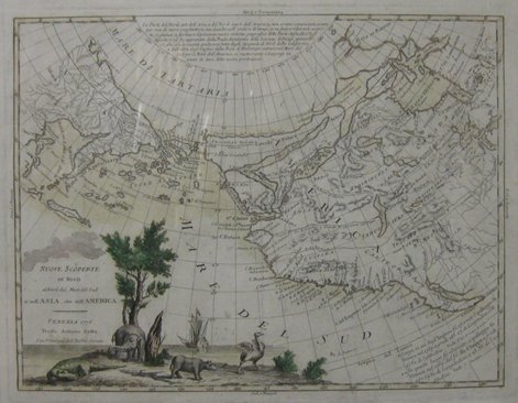
210. ZATTA, Antonio [fl. 1757-97]. Nuove Scoperte De'Russi al Nord del Mare Del Sud si nell'Asia, che nell' America. Venezia 1776 Presso Antonio Zatta… 12 ½” x 16 ¼” (31.7 x 41.6 cm). original colour (margins stained, small areas of paper weakness – backed).
$1,000
Zatta's map of the northwest shows the influence of the 1752 Delisle/Buache Carte Des Nouvelles Decouvertes, including Da Fonte's elaborate system of inland seas and straits and a northwest passage. He shows Quivira and ‘Fou-Sang', a colony the Chinese reputedly established on the norrthwest coast. The map is curiously decorated with illustrations of an elephant, ostrich and rhinoceros.
Wagner 654. Armstrong, From Sea Unto Sea, 32. Falk, Alaskan Maps, 1776-2. Kershaw Vol. IV 1223 & Plate 962.
211. ZUBEK, John P[eter] & Patricia Anne SOLBERG. Doukhobors At War. 8vo. pp. ix, 250. index. cloth. dw. (edges of dw. chipped). Toronto: Ryerson Press, 1952. $35
First Edition.
Edwards & Lort 4125.
ALBERTA
212. ALBERTA ART FOUNDATION. Spaces & Places Eight Decades of Landscape Painting in Alberta. oblong 4to. pp. 1 p.l., 139. numerous illus. (most colour). biblio. wrs. [Edmonton: 1986]. $40
First Edition. Exhib. Cat.
213. ALBERTA TREASURY BRANCHES. Alberta Memories. oblong 4to. pp. 254. profusely illus. (many colour). bds. dw. (both jacket & book spine with some damage at foot). [cEdmonton: c1988]. $40
First Edition.
214. BRANDER, F.W. Victoria Glacier, Canadian Rockies. signed & titled in ink. [c1920-1940]. 10 ½” x 13 ¼” (27 x 33.9 cm). watercolour. $500
215. [BYFIELD, Ted] (Editor). Alberta In The 20 th Century A Journalistic History Of The Province Volume Seven Aberhart And The Alberta Insurrection. folio. pp. vii, 305. profusely illus. (some colour). maps on front endleaves. index. pictorial bds. Edmonton: United Western Communications Ltd., 1998. $50
First Edition.
216. EDMONTON. MACDONALD HOTEL. The Macdonald. 12mo. pp. 16. text illus. wrs. (short tear to 1 edge). np: nd. $35
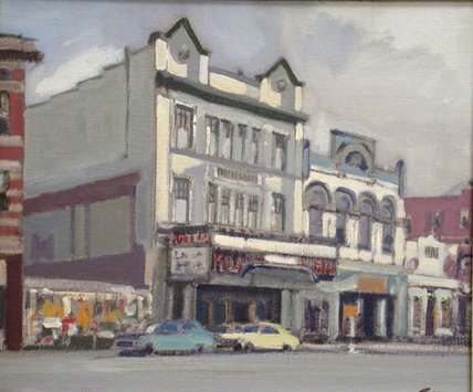
217. EWART , Peter [b. 1918]. Whyte & 82 nd Ave. Edmonton. signed on recto. signed & titled on verso. Downstairs Gallery, Edmonton, stamped on verso. 10” x 12”. acrylic on canvas-board. $1,400
218. FORAN, Max. Calgary An Illustrated History. oblong. 4to. pp. 192. profusely illus. (including maps, some full-page). index. cloth. dw. (library stamp on front flyleaf, few small tears to edges of dw.). Toronto: James Lorimer & Co., National Museum of Man & National Museum of Canada, 1978. $60
First Edition.
219. GOYETTE, Linda & Carolina Jakeway ROEMMICH. Edmonton In Our Own Words. 8vo. pp. xxxviii, [2], 463. numerous text illus. biblio. index. bds. dw. [Edmonton:] University of Alberta Press, [2004]. $50
First Edition.
220. HAGELL, E. F. When the Grass Was Free. 12mo. pp. x, [1 leaf], 128. 8 plates (4 colour) & text illus. after drawings by the author. index. cloth. dw. (edges of dw. chipped). Toronto: The Ryerson Press, 1954. $40
First Edition.
221. HANKS, Lucien M. & Jane Richardson HANKS. Tribe under Trust A Study Of The Blackfoot Reserve Of Alberta. 8vo. pp. xvi, 206. 4 plates (3 double-sided). biblio. index. cloth (Canadian School of Missions Library bookplate, label removed from lower spine, reviews mounted on rear endpapers). Toronto: University of Toronto Press, 1950. $150
First Edition.
Peel 7192.
222. HARDY, W.G. (Editor). The Alberta Golden Jubilee Anthology. 8vo. pp. 471, [1]. numerous plates (many double-sided, some colour). numerous text illus. by H.G.Glyde. maps on endleaves. cloth (some wear to gilt spine). [Toronto:] McClelland & Stewart Limited, [1955]. $50
First Edition.
223. HENDERSON DIRECTORIES LIMITED. Henderson's Greater Edmonton Directory 1938… 8vo. pp. [4]ads, [49]-776. ads on endleaves. cloth (joints cracked & weak, head of spine defective, extremities frayed). Edmonton & Winnipeg: 1938. $250
Peel 2962.
224. HORAN, J[ohn] W[illiam]. "West, Nor'West" A History of Alberta. 8vo. pp. 6 p.l., 184. text illus. index. cloth. Edmonton: Northgate Books, 1945. $60
First Edition.
Peel 6746.
225. HUBERMAN, Irwin. The Place We Call Home A History of Fort McMurray, as its people remember 1778-1980. 8vo. pp. 1 p.l., xi, 281. numerous illus. maps on endleaves. cloth. dw. Fort McMurray: Historical Book Society of Fort McMurray, [2001]. $75
First Edition.
226. IRVING, John A. The Social Credit Movement in Alberta. 8vo. pp. xi, 369. index. cloth. dw. Toronto: University Of Toronto Press, 1959. $60
First Edition.
227. MACDONALD, Jac. Historic Edmonton An Architectural And Pictorial Guide. oblong 4to. pp. 208. profusely illus. (many colour). map. plans on endleaves. bds. dw. Edmonton: The Edmonton Journal, [1987]. $50
First Edition.
228. McDOUGALL, John [1842-1917]. Pathfinding On Plain And Prairie: Stirring Scenes Of Life In The Canadian North-West. 12mo. pp. ix, [10]-277, [3]ads. 12 plates. decorative tailpieces. original black-stamped pictorial cloth (bit rubbed, library number on lower spine, neat bookplate). Toronto: William Briggs…, 1898. $100
First Edition. An account of McDougall's experiences during his posting to the Pigeon Lake mission in Alberta, 1865-68, including his visits to native people in their camps and the HBC posts of Rocky Mountain House and Fort Edmonton.
Peel 461.
229. McDOUGALL, John. Saddle, Sled And Snowshoe: Pioneering On The Saskatchewan In The Sixties. 12mo. pp. ix, 282, [1 leaf]. frontis. 15 plates by J.E.Laughlin. cloth. dw. (extremities tattered, spine darkened). Toronto: The Ryerson Press, [nd]. $50
cfPeel 443.
230. MacGREGOR, J.G. North-West Of 16. 12mo. pp. 224. maps on endleaves. cloth. dw. (dw. little soiled, sticker remnant on spine). Edmonton: M.G.Hurtig Ltd., [1971]. $30
Second Printing of the Hurtig Edition.
231. MacINNES, C[harles] M[alcolm] 1891-1971]. In The Shadow Of The Rockies. 8vo. pp. 1 p.l., [v]-viii, 347. lacking half-title? 2 folding colour maps, 2 plans (1 folding) & 7 plates (incl. 5 portraits). biblio. index. contemporary half calf. London: Rivington's, 1930. $300
First Edition. “An excellent history of the development of ranching in southern Alberta.” (Peel)
Peel 5462.
232. MAIR, Charles [1838-1927]. Through The Mackenzie Basin A Narrative of the Athabaska and Peace River Treaty Expedition of 1899...Also Notes On The Mammals And Birds Of Northern Canada By Roderick MacFarlane... 8vo. pp. 494. folding map (partly in colour). 24 plates (incl. frontis.) & 2 text illus. complete with errata slip. contemporary half roan, t.e.g. (rubbed, front joint & corners repaired, rear joint cracked). Toronto: William Briggs, 1908. $300
First Edition of Mair's narrative of the Treaty expedition of 1899. “This classic account of the natural history and other characteristics of northern Canada contains a good, systematic description of its bird life, more than 400 species being described. A list of Birds and Eggs occupies pp. 287-448...”. (Casey Wood)
Peel 2463. Casey Wood 449.
233. NEWTON, William [1828-1910]. Twenty Years On The Saskatchewan, N.W. Canada. 8vo. pp. 3 p.l., 184. complete with errata slip. 6 illus. (all but one full-page; incl. frontis. portrait). original black & gilt-stamped cloth (extremities frayed, some pencil scoring, shaken). London: Elliot Stock, 1897. $225
First Edition. In 1875 the author left his parish in the Toronto diocese and went to Western Canada as a missionary for the Society for the Propagation of the Gospel. He became the first Anglican missionary at Edmonton in the North West Territories and maintained his headquarters there for over thirty years. His narrative includes reflections on the Riel Rebellion, Indian life, emigration, the progress of missionary work in the West, the character and accomplishments of Wesleyan missionary James Evans, and the future of North-West Canada. Most of the work relates to Edmonton and vicinity.
Peel 2355.
234. NORDEGG, Martin. Pioneering In Canada. 1906-1924. 4to. ff. 4 p.l., 168. mimeographed text on recto's only. cloth (stain on upper cover). Inscribed from the Author's wife. np: [c1940]. $250
Apparently privately produced for limited distribution. A German mining engineer, Nordegg immigrated to Canada in 1906, settling in west central Alberta where he discovered and developed rich coal deposits on the eastern slopes of the Rocky Mountains. In 1911 he built the largest mine in Alberta (Brazeau Collieries) and founded the town of Nordegg.
235. PERSON, Dennis & Carin ROUTLEDGE. Edmonton Portrait of a City. folio. pp. 237, [3]. profusely illus index. cloth. dw. np: Reidmore, [1981]. $50
First Edition.
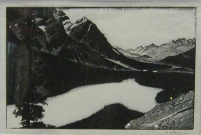
236. PHILLIPS, Walter Joseph [1884-1963] (RCA & CPE). [ Mistaya Valley ]. signed in pencil . [c1954]. 4 ¼” x 6 ½” (10.7 x 16.3 cm). wood engraving. $1,200
Second State. Edition size unknown.
237. RAINE, Herbert [1875-1951] (RCA). Victoria Glacier from Lake Wapta. signed in pencil. Verso: ‘No. 22', titled, signed & priced (in artist's hand?). 7 1/8” x 11 ¼” (18.1 x 28.7 coloured pencil (pinholes to upper & lower right corners & remnants of old mounts to upper corners). $750
See MacDonald VI pp. 1914-1915.
238. RAND McNALLY & CO. Rand, McNally & Co.'s Indexed Pocket Map And Shippers' Guide Of Alberta… Showing in Detail the Entire Railroad System… 12mo. pp, 14. folding map measuring 66 x 47.1 cm. printed wrs. (few short tears to folds of map). Chicago & New York: Rand, McNally & Co., [1911]. $300
239. ROBERTS, Sarah Ellen. of us and the oxen. 8vo. pp. 3 p.l., 260. cloth. dw. (few short tears to edges of dw.). [Saskatoon: Modern Press, 1968]. $40
First Edition. An account of homesteading on the Alberta prairies during the years of 1906 - 1912.
240. SHELTON, Margaret Dorothy [1915-1984]. Ancient Barn. signed, dated [19]78 & titled in pencil. initialled in block. 3 1/8” x 7” (8.3 x 17.9 cm). linocut in one colour – blue (light rippling at upper corner). $500
This 1978 linocut entitled Ancient Barn is probably an alternative title for Krem's Barn (Ainslie, Margaret Shelton Block Prints 1936-1984, 158).
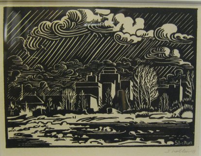
241. SHELTON, Margaret [1915-1984]. [ Calgary From Sunnyside ] . signed & dated [19]41. signed ‘Shelton' in block. 3 ½” x 4 ¾” (9.1 x 12.4 cm). linocut. $500
Ainslie, Margaret Shelton Block Prints 1936-1984, 42.
242. SHELTON, Margaret Dorothy [1915-1984]. Gawdun's Waterwheel, Rosedale. signed, titled & dated [1982] & numbered 8 of an edition of 20 in pencil. 13 ¾” x 18 ¾”. linocut. $1,500
1982 edition, limited to 20 copies; first issued in 1942 in an edition of 30.
cfAinslie, Margaret Shelton Block Prints 1936-1984, 64.
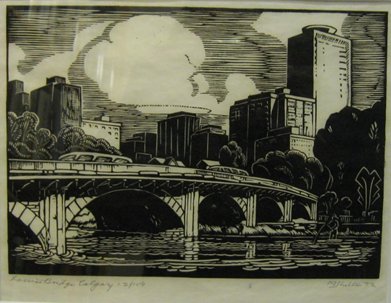
243. SHELTON, Margaret Dorothy [1915-1984]. Louise Bridge, Calgary . signed, titled, dated [19]72 & numbered 12 of an edition of 100 in pencil. 7 ¼” x 10” (17.9 x 25 cm). linocut. $650
Ainslie, Margaret Shelton Block Prints 1936-1984, 146 (illus. p. 28); citing date of 1971 and edition of 200.
244. SHELTON, Margaret Dorothy [1915-1984]. St Andrews Calgary. signed, titled & dated [19]80. 6 ½” x 4 ¼” (16.4 x 10.8 cm). linocut in one colour (red). $500
Ainslie, Margaret Shelton Block Prints 1936-1984, 162.
245. SMITH, Harlan I. Handbook Of The Rocky Mountain Park Museum. 8vo. pp. 126. frontis. biblio. wrs. (head of spine chipped, neat library markings on front wr., light foxing to first few leaves & frontis.). Ottawa: Canada, Department of the Interior, Dominion Parks Branch, Government Printing Bureau, 1914. $75
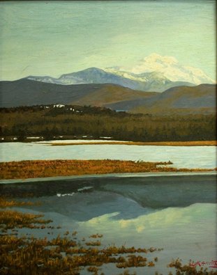
246. SMITH , Lorne Kidd [1880-1966] (CSGA). [ Alberta Landscape ]. signed on recto. [c1950]. 20” x 16”. oil on canvas laid to board. $750
Provenance: The Estate of the Artist, Toronto; Private Collection, Toronto.
247. STEVENS, G.R. A City Goes To War [ History Of The Loyal Edmonton Regiment (3PPCLI) ]. 8vo. pp. 431. b/w frontis., several double-sided b/w plates & 11 folding maps. index. cloth. dw. (dw. bit scuffed with few chips to upper edges). [Edmonton: Edmonton Regiment Association], 1964. $100
First Edition.
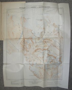
248. THORINGTON, J[ames] Monroe. The Mountains Of The Columbia Icefield, 1923 (Rocky Mountains Of Canada)…Reprinted from ‘The Alpine Journal', No. 227. 8vo. pp. 21, [1]. 5 plates (1 folding, 2 double-sided) & 3 folding colour maps. wrs. (several library rubberstamps, spine glue-stained, lower wr. spine split). [London]: Printed by Spottiswoode, Ballantyne & Co. Ltd., 1923. $250
249. THORINGTON, J[ames] Monroe. The Panorama From Mt. Columbia, 12,294 Feet (Second Elevation: Rocky Mountains Of Canada)… Reprinted from ‘The Alpine Journal', No. 228. 8vo. pp. 6. 1 folding map & 2 folding plates. wrs. (several library rubberstamps, spine glue-stained). [London]: Printed by Spottiswoode, Ballantyne & Co. Ltd., 1924. $150
250. WEBER, George [1907-2002] (CPE). Edmonton, Nocturne #7. signed, titled, dated [19]70 & numbered 25 of an edition of 46 in pencil. 13 ½” x 21 ½” (34.5 x 55.5 cm). colour silkscreen. $700
251. WEBER, George [1907-2002] (CPE). Alberta Harvest. signed, titled & dated [19]71 in pencil. 6” x 9” (15.3 x 22.8 cm). colour silkscreen (small spot to upper left corner). $350
BRITISH COLUMBIA
252. ANONYMOUS. Numero-3. Continuacion de los recocimientos hechos En La Costa No. De America Por Les Burques De S.M. en varias Compañas des de 1774ñ á 1792. Cardano Scul. Morala esc. [Madrid: 1802]. 14 ¼” x 18 ¾”. engraving (side margin closely trimmed as usual & few short tears to margins). $1,500
Issued in Jose Espinosa y Tello's Atlas Para El Viage de las Goletas Sutil y Mexicano (Madrid: 1802), the third section of the Carta Esferica shows the northwest coast from 44 to 62 degrees and Unalaska. The map incorporates geographical information derived from the explorations of the period. Four Spanish voyages to the northwest are tracked: Martinez (1788), Fidalgo (1790), Eliza (1791) and Galiano-Valdés (1792).
Wagner 861 & Falk 1802-3 (3 sheets).
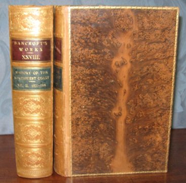
253. BANCROFT, Hubert Howe [1832-1918]. History Of The Northwest Coast. Vol. I. 1543-1800...Vol. II. 1800-1846. (The Works Vols. XXVII-XXVIII). 2 Volumes. 8vo. pp. xxxiii, 703; 1 p.l., [v]-xiv, 768. with half-title in Vol. I. 1 folding map & numerous maps in the text (some full-page). later full tree calf, gilt backs, all edges gilt, inside dentelles (some light wear, Vol. I front free-endpaper tears repaired). San Francisco: A.L.Bancroft & Company, Publishers, 1884. $400
First Edition.
Howes B-91. Smith 517. Strathern 25.
254. BANWELL, Selwyn. A Frontier Judge British Justice In The Earliest Days Of Farthest West. 8vo. pp. 30, [1]. frontis portrait. bds. (surface of spine missing, sunned). Toronto: Rous & Mann Limited, 1938. $60
First Edition.
255. BARRETT, Anthony A. & Rhodri Windsor LISCOMBE. Francis Rattenbury And British Columbia: Architecture And Challenge in the Imperial Age. 8vo. pp. xii, [2], 391. numerous illus. index. biblio. cloth. dw. Vancouver: University of British Columbia Press, 1983. $40
First Edition.
256. BEGG, Alexander [1825-1905]. History Of British Columbia From Its Earliest Discovery To The Present Time. 8vo. pp. xvii, [1], [7]-568. numerous text illus. Uncut & unopened in old buckram. Toronto: William Briggs…, 1894. $175
First Edition.
Lowther 1097. Lande 945.
257. BELCHER, Sir Edward [1799-1877]. Narrative Of A Voyage Round The World, Performed In Her Majesty's Ship Sulphur, During The Years 1836-1842, Including Details Of The Naval Operations In China, From Dec. 1840, To Nov. 1841… 2 Volumes. 8vo. pp. xxii [i.e. xxxviii], [2], 387; vi, [2], 324, [2], [325]-474. 19 engraved plates & 3 folding engraved maps. 20 wood-engraved text illus. contemporary half calf (covers rubbed, edges & corners worn, some plates spotted &/or with browned margins). London: Henry Colburn, 1843. $2,000
First Edition. The purpose of the expedition was to explore and survey the Pacific Coast of North and South America, from Valparaiso, Chile, to Alaska. Captain F.W.Beechey was appointed commander, but was replaced early on because of illness, by Captain Belcher. Among the harbours and ports visited and surveyed along the northwest coast were Port Etches, in King William's Sound, Point Riou and Port Mulgrave, Kodiak Island, Sitka or New Archangel, in Norfolk Sound, Friendly Cove, in Nootka Sound, San Francisco, Monterey, the Columbia River, Bodega (the Russian position near San Francisco), Santa Barbara, San Pedro, San Juan, San Diego, &c. At Sitka, the officers were greeted by the Russian governor, Captain Koupreanoff. At San Francisco, they undertook a month long journey in open boats up the Sacramento River. The Sulphur also stopped at the Hawaiian Islands, the Marquesas, Society and Tonga Islands, New Hebrides, Solomon Islands, and New Guinea. The appendix contains an important description of the botany and zoology of the voyage, including references to the vegetation of Australia and New Zealand, written by Richard Brinsley Hinds, botanist of the expedition.
Cowan 15. Ferguson 3564. Hill p. 20. Howes B-318. Kroepelian 73. Lada-Mocarski 117. Sabin 4390. Strathern & Edwards 34 (17 plates only). Wickersham 6543a.
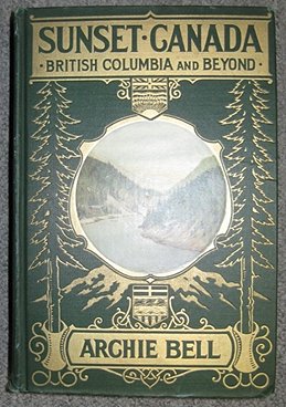
258. BELL, Archie [1877-1943]. Sunset Canada British Columbia And Beyond… 8vo. pp. xii, 320. folding coloured map & 57 plates (7 colour). biblio. index. original gilt-stamped cloth with colour illus. mounted on upper cover (little rubbed). Boston: The Page Company, 1918. $175
First Edition.
Edwards & Lort 214.
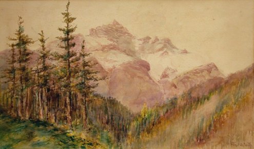
259. BELL-SMITH, Frederic Marlett [1846-1923] (RCA & OSA). [ Rocky Mountain Ridge ]. signed on recto. 12” x 18”. watercolour on paper. $7,000
“In 1887, thanks to the free Canadian Pacific Railway passes given to artists by William Cornelius Van Horne, Bell-Smith had the opportunity to fulfil one of his early dreams and see the Rockies. This was a defining moment: for him, reportedly, the mountains forever after “beckoned the enraptured pilgrim to explore their mysteries and their shrines.” Over the next three decades he would visit the Rockies at least eleven times, and such mountain landscapes as The silent sentinel of the north , Heart of the Selkirks , and An ice-crowned monarch of the Rockies became a staple of his output.” (DCB, Vol. XV)
260. BERELOWITZ, Lance. Dream City Vancouver And The Global Imagination. 8vo. pp. xi, [1], 276. numerous text illus. & maps. biblio. index. bds. dw. Vancouver/Toronto/Berkeley: Douglas & McIntyre, [2005]. $40
First Edition.
261. BERGREN, Myrtle. Tough Timber the loggers of B.C. their story Based on interviews with Arne Johnson, Hjalmar Bergen, John McCuish, George Grafton, Edna Brown and others who helped organize a woodworkers' union in British Columbia. 8vo. pp. 250. illus. wrs. Toronto: Progress Books, 1967. $50
Second Revised Edition. “History of the woodworkers' union in the Lake Cowichan area, mainly in the 1930's and 1940's which culminated in the building of the I.W.A.” (Edwards & Lort)
Edwards & Lort 225.
262. BISHOP, R.P. Mackenzie's Rock With a map showing the course followed by the explorer from Bella Coola, B.C., to the Rock, and illustrated with views along the route. 12mo. pp. 31, [1]. illus. & folding map. pictorial wrs. Ottawa: Department of the Interior [Historic Site Series No. 6], [c1923]. $45
First Edition.
263. [BISSLEY, Paul Lawrence]. A History Of The Union Club Of British Columbia. 8vo. pp. 43, [1]. 4 full-page illus. (incl. portrait). cloth. [Victoria: Colonist Printing, 1956]. $75
First Edition.
Edwards & Lort 240. Lowther 1962.
264. BLANCHET, Father et Al. Notices & Voyages of the Famed Quebec Mission to the Pacific Northwest Being the correspondence, notices, etc. of Fathers Blanchet and Demers, together with those of Fathers Bolduc and Langlois. Containing much remarkable information on the areas and inhabitants of the Columbia, Walamette, Cowlitz and Fraser Rivers, Nesqually Bay, Puget Sound, Whidby and Vancouver Islands while on their arduous mission to the engages of the Hudson's Bay Company and the pagan natives 1838 to 1847. 8vo. pp. 2 p.l., iv, 243, [6 leaves]. large folding map, 4 plates (1 folding). index. uncut & unopened in original cloth. [Portland, Oregon: Champoeg Press, Inc., for the] Oregon Historical Society, 1956. $125
First Edition, Limited to 1000 copies.
265. BOAS, Franz [1858-1942] (Editor). Folk-Tales of Salishan and Sahaptin Tribes. Collected By James A.Teit, Marian K.Gould, Livingston Farrand, Herbert J. Spinden. 8vo. pp. xii, 205. original cloth, t.e.g., others untrimmed. Lancaster, PA. & New York: American Folk-Lore Society, 1917. $300
First Edition.
266. BODDAM-WHETHAM, J[ohn] W[hetham] [b.1843]. Western Wanderings A Record Of Travel In The Evening Land. 8vo. pp. xii, [2], 364. with half-title. title in red & black. 12 wood-engraved plates. untrimmed in original black & gilt-stamped cloth (bit shaken, extremities frayed, spine faded). London: Richard Bentley And Son, 1874. $400
First Edition. Impressions of an overland tour through western America, with remarks on social and economic life, aboriginal tribes and natural history. The author visited New York, Niagara, Chicago, Omaha, Salt Lake City, Virginia City, Stockton, Yosemite Valley, San Francisco, Mount Shasta, Yreka, Fort Lamath, Jacksonville, Oregon City, Kalama, San Juan, Victoria, New Westminster, and Nanaimo. Four of the chapters are devoted to British Columbia.
Lowther 449.
267. BOWSFIELD, Hartwell (Editor). Fort Victoria Letters 1846-1851. 8vo. pp. xcix, 277, xvii. plan frontis. & 2 folding maps. index. gilt-crested cloth. Winnipeg: Hudson's Bay Record Society [Publication No. XXXII], 1979. $90
Limited Edition.
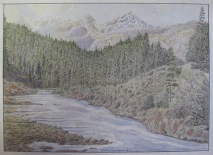
268. BRANDER, F.W. Kicking Horse River B.C. signed & titled. 12” x 16” (30.5 x 40.7 cm). watercolour (verso edges reinforced with paper). $500
269. BRITISH COLUMBIA. DEPARTMENT OF LANDS. Geographical Gazetteer Of British Columbia. 4to. pp. xx, 291. wrs. (lacking front wr., corners of first leaves chipped). Victoria, B.C.: 1930. $75
270. BRYMNER, William [1855-1925] ( P-RCA, OSA, Montreal Watercolour Society. P-PPC, CAC, P-AC). Ross Peak. signed & titled on recto. 14 ½” x 21 ¼”. oil on canvas.
$15,000
Brymner taught at the Ottawa School of Art, and the Art Association of Montreal (1886-1921). He was an outstanding teacher and many of his students became prominent Canadian artists. His own work was influenced by the academic and impressionist schools. Brymner made a number of trips to Western Canada to fulfill a commission of large paintings of the Rockies for the CPR.
Provenance: William Scott & Sons, Montreal, label on verso.
271. [BUDD, Ken & Ric CARELESS]. Tatshenshini River Wild. oblong 4to. pp. 1 p.l., 128. profusely illus. in colour. wrs. [Vancouver: Raincoast Books, 1993]. $35
272. BULHAK, A.G. U.B.C. Panorama Pictorial Studies. oblong 8vo. pp. 87, [1]. 20 double-sided plates (incl. in pagination). double-page birds-eye view. wrs., spiral-bound. [Vancouver: 1945]. $50
First Edition.
273. CANADA. PUBLIC ARCHIVES. NATIONAL MAP COLLECTION. Maps Of Indian Reserves And Settlements In The National Map Collection…Volume I: British Columbia…Compiled by Linda Camponi… 4to. pp. xx, 157. numerous maps in the text (most full-page). pictorial wrs. Ottawa: 1980. $40
First Edition.
274. CANADA. ROYAL COMMISSION ON CHINESE IMMIGRATION. Report Of The Royal Commission On Chinese Immigration. Report And Evidence. 8vo. pp. 1 p.l., cxxxiv, cii, [blank leaf], 487. contemporary half calf (worn, joints cracked, lower spine defective). Ottawa: Printed By Order Of The Commission, 1885. $1,250
Between 1881 and 1884, approximately 17,000 Chinese immigrants came to British Columbia to work as labourers on the Canadian Pacific Railway. They were paid just $1 a day, half the wage of white labourers and had to pay their own expenses, which saved the CPR an estimated $3-5 million in construction costs. They were often given the most dangerous jobs, and many lost their lives to landslides, dynamite blasts, and other accidents. In 1885 the British Columbia section of the railway was completed and the the status of these immigrants became a pressing issue. While Europeans were being offered free land to come to Canada, the Canadian government decided to create a $50 "head tax" to limit the number of Chinese coming to the country. That also meant that those already here would have great difficulty bringing family to Canada.
“British Columbia has repeatedly by her Legislature, as well as by her representatives in Parliament, solicited the Executive and Parliament of Canada to enact a law prohibiting the incoming of Chinese to British Columbia. Nothing was done in that direction until last session of Parliament, when Sir John Macdonald, speaking in answer to a motion asking Parliament to enact a law in the above sense, pledged his Government to issue a Commission to look into the whole subject during the approaching session, and to consider exhaustively its trade relations, its social relations, and all those moral considerations which it is alleged make Chinese immigration undesirable…”. (Preliminary) The report was prepared by commissioners John Hamilton Gray [1814-1889], a British Columbia judge, and Joseph Adolphe Chapleau [1840-1898], Canadian Secretary of State.
275. CANADIAN NATIONAL RAILWAYS. Mount Robson. Canadian National Railways. The Highest Peak in the Canadian Rockies. 23” x 15 ¾” (framed 27 x 20 ½). colour silk-screened print on paper (poster). [Montreal]: Canadian National Railways / The Triangle Tour. [c1930]. $1,500
Provenance: Collection of the Rochester Public Library, Rochester New York, (rubberstamp on verso).
276. CANADIAN NATIONAL RAILWAYS. Map Of Canadian Rockies And The Triangle Tour Of British Columbia. Alaska And The Yukon. 3 colour maps on one sheet: ‘Routes Of The Canadian National Steamships Pacific Coast Service', ‘Alaska And The Yukon' & ‘The Triangle Tour of British Columbia…' (5 inset views on BC map). [1927]. folding map measuring 17” x 30” (43 x 76 cm). printed wrs. with maps of Grand Trunk Railway System on inner front cover (map detached from covers, slanted 2 cm tear to map, covers bit stained with ragged edges & chip to lower corner). $75
277. CITY MAP & WHITE PRINT CO. Map Of Vancouver New Westminster Burnaby And North Shore Municipalities [Cover Title]. Guide Map Vancouver And New Westminster… Published by City Map And White Print Co… Vancouver, B.C. Copyright 19353. 20 ¾” x 30 ½” (entire sheet; 52.5 x 76.4 cm). colour map. folding map in original wrs. (few short tears to folds & curling to outer edge).
278. COAST PUBLISHING CO. Vancouver The Pacific Gateway Of Canada [Cover Title]. [Inside Title: Selected Copyright Camera Studies]. oblong 8vo. 16 plates. wrs. with cutout frame on front wr. (tear to lower wr.). Vancouver: nd. $45
279. COAST PUBLISHING CO. Vancouver The Pacific Gateway Of Canada [Cover Title]. [Rear Title: Selected Copyright Camera Studies]. oblong 8vo. 16 plates. pictorial wrs. [Vancouver:] nd. $45
280. COAST PUBLISHING CO. Victoria The Evergeen City Of Canada [Cover Title]. [Rear Title: Selected Copyright Camera Studies]. oblong 8vo. 16 plates. pictorial wrs. [Vancouver:] nd. $50
281. COLEMAN, A[rthur] P[hilemon] [1852-1939]. The Canadian Rockies New And Old Trails. 8vo. pp. 383, [1]. 3 folding maps (the Canadian Pacific Railway map in colour & not called for in plate list) & 32 plates (incl. frontis.). original pictorial cloth, t.e.g. (a bit worn). Toronto: Henry Frowde, 1912. $300
Second Canadian Edition. An account of climbs made by the author, a professor of geology at the University of Toronto, between 1884 and 1908.
Edwards & Lort 949. Lowther 1589. cfNeate 168.
282. COLLISON, W[illiam] H[enry] [1847-1922]. In The Wake Of The War Canoe A Stirring Record Of Forty Years' Successful Labour, Peril & Adventure Amongst The Savage Indian Tribes Of The Pacific Coast, And The Piratical Headhunting Haidas Of The Queen Charlotte Islands, B.C. 12mo. pp. 351, [1]. 1 map & 16 plates. original gilt-stamped cloth. Toronto: Musson Book Company Limited, [c1915]. $150
First Canadian Edition. “An account by a Church of England missionary of his early work in the Queen Charlotte Islands and along the Skeena River.” (Lowther)
Lowther 1623.
283. COUCILL, Walter Jackson [1915-1982]. Vancouver British Columbia from the Japanese Garden in Vanier Park. signed, titled & dated 1974. 19 ¼” x 27 ¾”. ink & watercolour on board. $750
“[Coucill]…was Art Director of the Robert Simpson display department, art consultant, freelance designer and display designer for General Motors. He was commissioned by National Trust Bank to travel across Canada and paint all the provincial and territorial floral emblems in their natural habitats.” (MacDonald p. 536a)
MacDonald, Dictionary of Canadian Art, pp. 536a-537a.
284. CUTTER, Donald C. Malaspina & Galiano Spanish Voyages to the Northwest Coaast 1791 & 1792. oblong 4to. pp. 4 p.l., 160. numerous text illus. & maps. biblio. index. bds. dw. Vancouver/Toronto: Douglas & McIntyre & Seattle: University of Washington Press, [1991]. $45
First Edition.
285. DALZELL, Kathleen E. The Queen Charlotte Islands. Volume 1 1774-1966 […Volume 2 Places And Names]. 2 Volumes. 8vo. pp. 349; 472. 16 double-sided plates. numerous text illus. & maps. wrs. (some pen scoring in vol.1, tear to upper outer corner of Vol. I front wr.). [Queen Charlotte City: Bill Ellis, 1981]. $50
First Paperback Edition.
cfEdwards & Lort 1155-56.
286. DAVENPORT, Joseph B. Davenport's Commercial Map Of Greater Victoria. Compiled and Published by The Island Blueprint & Map Co. Victoria, B.C. Copyright, Canada, 1921 By Joseph B. Davenport Revised 1931 1944. folding colour map (some creasing & tears, mainly to folds, several small holes affecting, in some cases, letter(s) of place names & imprint). $150
287. DAVID SPENCER LIMITED. A Souvenir of Vancouver, British Columbia. oblong 8vo. [pp. 32]. illus. throughout. pictorial wrs. (ms. notations below some images, spine rubbed). Vancouver: [c1938]. $50
288. DAVIS, Chuck. Where Rails Meet Rivers The Story Of Port Coquitlam. oblong. 4to. pp. 204. many illus. index. cloth. dw. [Madeira Park, BC]: Harbour Publishing, [2000]. $50
First Edition.
289. DELGADO, James P. Racers and Rovers 100 Years of the Royal Vancouver Yacht Club. 4to. pp. xi, 212. frontis. profusely illus. (some colour). biblio. index. cloth. dw. Vancouver & Toronto: Douglas & McIntyre, [2003]. $60
First Edition.
290. DIXON, Captain George [d.1800?] (Editor). [ beresford , William]. A Voyage Round The World; But More Particularly To The North-West Coast Of America: Performed in 1785, 1786, 1787, And 1788, In The King George And Queen Charlotte, Captains Portlock And Dixon… 4to. pp.xxix, [1]blank, [1 leaf]errata & directions to binder, 360, 47. with half-title. 5 folding engraved maps & 17 engraved plates (3 folding). contemporary diced calf, rebacked (corners & edges worn, foxing to plates, few leaves browned). London: Published by Geo. Goulding, 1789. $6,600
First Edition. Portlock and Dixon set out to establish a trade in furs on the northwest coast of America on behalf of the King George's Sound Company, but their major accomplishment was the more detailed exploration and mapping of the coast and improving of Cook's charts of the region. Both had previously sailed with Cook on the third voyage. The two ships separated and sailed independently for a major part of the expedition: Portlock explored north along the Alaskan coast, Dixon proceeded south to Nootka Sound and discovered Queen Charlotte Island, Port Mulgrave, Norfolk Bay, as well as Dixon Entrance and Archipelago.
The account is largely composed of forty-nine letters written by William Beresford, who acted as supercargo on board the Queen Charlotte; Dixon edited the text, provided the maps and added an introduction detailing previous voyages to the north-west coast, and two appendices, on natural history, and navigational details. The work is sometimes confused with Portlock's account of the voyage, published the same year under the same title.
Bell B204. Howes D-365. JCB II 3270. Sabin 64390 [vide PORTLOCK]. JCB II 3270. Smith 779. Strathern & Edwards 37. TPL 593. Hill p. 23. Lada-Mocarski 43. Lande 960. Streeter VI 3484. Story p. 217.
291. DORÉ, Jean (20 th Century French). Canada. Air France. 39”x 24 ½” (framed 43 x 28 ½). colour lithographed print on paper showing a river, mountains and fir trees (poster) (restored chips on bottom). signed in stone. Paris: Air France / Hubert Baille & Cie. [c1950]. $2,000
292. DOWN, Sister Mary Margaret. A Century Of Service 1858 1958 A history of the Sisters of Saint Ann and their contribution to education in British Columbia, the Yukon and Alaska. 8vo. pp. 195. 7 plates (6 double-sided). biblio. index. bds. dw. (tears to edges of dw.). Victoria: The Sisters of Saint Ann, 1966. $30
First Edition.
Edwards & Lort 1236.
293. DUFF, Wilson. The Indian History Of British Columbia Volume 1 The Impact Of The White Man. [Anthropology In British Columbia Memoir No. 5]. 8vo. pp. 117. text illus. & maps. biblio. pictorial wrs. [Victoria: British Columbia Provincial Museum, 1977]. $35
294. DUFF, Wilson. The Upper Stalo Indians of the Fraser Valley, British Columbia. [Anthropology In British Columbia Memoir No. 1]. 8vo. pp. 136. text illus. & maps. biblio. pictorial wrs. [Victoria:] British Columbia Provincial Museum, [1973]. $50
295. DUNCAN CHAMBER OF COMMERCE. Duncan and the Cowichan Valley Including Chemainus and Lake Cowichan, Vancouver Island, British Columbia. “Where Industries Flourish In a Land of Charm” [Cover Title]. oblong 8vo. [pp. 32]. text illus. & map. maps & illus. on wrs. recto & verso. pictorial wrs. [Duncan: c1953]. $40
296. DYE, Eva Emery. McLoughlin And Old Oregon A Chronicle. 8vo. pp. viii, [9]-381, [2] ads. frontis portrait. cloth, t.e.g., others untrimmed. Chicago: A.C. McClurg & Co., 1906. $50
Sixth Edition.
297. EKELÖF, Lieut. Adolph. Ett Ar I Stilla Hafvet. Reseminnen Fran Patagonien, Chili, Peru, Californien, Britiska Columbia Och Oceanien. 4to. pp. 2 p.l., 163, [1]. 12 coloured or tinted lithographed plates (containing 17 views & portraits). original blind & gilt-stamped cloth, rebacked in sheep (bit rubbed, some light foxing & browning). Stockholm: Lith. Art.Anstalt, 1872. $950
First Edition of this account by a Swedish officer of the extensive Pacific voyage undertaken by the British flagship, H.M.S. Zealous in 1867-68. The expedition visited, and lengthy accounts are given, of Patagonia, Chile, Peru, Hawaii, Tahiti, California and British Columbia. The lithograph plates include views of Peruvian Indians, Esquimalt - Vancouver Island, Honolulu, Tahiti and its inhabitants, &c.
Kroepelian 396. Not listed in any relevant Canadiana bibliographies.
298. FRASER, Simon. The Letters and Journals of…1806-1808 Edited with an Introduction by W.Kaye Lamb… 8vo. pp. 4 p.l., 292. frontis. portrait. 3 full-page maps. portrait headpieces. biblio. index. cloth. dw. Toronto: Macmillan Company Of Canada Limited, [1966]. $45
Second Printing.
299. (FRASER RIVER GOLD RUSH). GREAT BRITAIN. COLONIAL OFFICE. Copies Or Extracts Of Correspondence Relative To The Discovery Of Gold In The Fraser River's District In British North America. Presented to both Houses of Parliament by Command of Her Majesty. July 2, 1858. folio. pp. 18. folding coloured lithographed map ‘Reconnaissance of Fraser's River from Fort Hope to the Forks' by John Arrowsmith. new quarter cloth. London: Printed By George Edward Eyre and William Spottiswoode, 1858. $1,350
“This fundamental document on the gold discovery on the Fraser River is the basis for practically all the guides and other pamphlets written on that famous gold rush.” (Streeter) The blue paper includes correspondence between Governor James Douglas, Colonial Secretary Henry Labouchere and his successor Sir Edward Bulwer-Lytton, and W.G.Smith, Secretary of the Hudson's Bay Company.
The massive influx of miners attracted to the Fraser River district by the gold rush of 1858 led to the creation of the crown colony of British Columbia and was a major consideration in the British decision to terminate the Hudson's Bay Company's territorial rights in the West. In 1858 Governor Douglas renamed the former Hudson's Bay Company post Fort Dallas at Camchin, the confluence of the Thompson and Fraser Rivers, Lytton, British Columbia in honour of the Colonial Secretary.
Lowther 67. Streeter VI 3405. TPL 3814.
300. FUTCHER, Winnifred M. (Editor). The Great North Road To The Cariboo. 8vo. pp. 113. folding map. text illus. (some full-page). biblio. cloth (bit rubbed). [Vancouver:] Roy Wrigley Printing & Publishing Co. Ltd., 1938. $100
First Edition.
Edwards & Lort 1443. Lowther 1786.
301. GEDDES, R. The Skeena River Of Destiny. 8vo. pp. ix, 180. frontis. & 7 double-sided plates. maps on endleaves. biblio. index. cloth. dw. (edges of dw. chipped & with tape repairs on verso). Vancouver: Mitchell Press Limited, [1962]. $35
Fourth Edition.
302. GREEN, George. History of Burnaby And Vicinity… 8vo. pp. 6 p.l., 242. frontis. portrait. text illus. & maps. index. bds. (some wear to spine). [Vancouver: The Author, 1947]. $45
First Edition.
Edwards & Lort 1607.
303. HARRIS, Bess Larkin Housser [1890-1969]. B. C. Woods Interior . signed on verso. 12” x 15”. oil on masonite. $3,000
Born in Brandon, Manitoba, Bess Housser Harris was the wife of journalist and author Fred Housser (married 1914) and later of Lawren Harris (married 1934). She wrote and edited for the “Canadian Bookman” and was in charge of their art section from 1924. An early supporter of the Group, she had articles by Harris and some of the other members published in the magazine. While she took some art lessons from F.H. Varley, she was mainly self-taught, and was invited to participate in Group of Seven shows throughout the 1920's.
Provenance: The Estate of the Artist, Vancouver; Heffel Gallery Ltd., Vancouver, label on verso.
304. HARRIS, E. A. Spokeshute Skeena River Memory. 8vo. pp. 237. numerous text illus. (incl. 2 full-page maps). biblio. cloth (light wear to spine ends). dw. [Victoria]: Orca Book Publishers, [1990]. $40
First Edition.
305. HAYES, Derek. Historical Atlas Of British Columbia And The Pacific Northwest Maps of Exploration British Columbia Washington Oregon Alaska Yukon. 4to. pp. 208, [1]. Over 320 illus. (many colour). biblio. Index. cloth (corners bumped). dw. Vancouver: Cavendish Books, [2000]. $75
First published in 1999 and reprinted, with revisions in 2000.
306. HAYES, Derek. Historical Atlas of Vancouver and the Lower Fraser Valley. folio. pp. 192. numerous illus. & maps (many colour). cloth. dw. Vancouver, Toronto & Berkeley: Douglas & McIntyre, [2005]. $100
First Edition.
307. HENRY, John Frazier. Early Maritime Artists of the Pacific Northwest Coast, 1741-1841. 4to. pp. xiii, [19], 240. profusely illus. biblio. index. cloth (crack in rear hinge). dw. Vancouver & Toronto: Douglas & McIntyre, [1984]. $100
First Edition.
308. HILL, A[rnold] V[ictor]. Tides Of Change A Story Of Fishermen's Co-Operatives In British Columbia. 8vo. pp. xii, 279. 8 double-sided plates. maps on endpapers. index. cloth. [Vancouver: Prince Rupert Fishermen's Co-Operative Association, 1967]. $40
First Edition.
Edwards & Lort 1725.
309. HILLS, George [1816-1895] [First Anglican Bishop of British Columbia (1860-92)]. Autograph letter, signed ‘G. Columbia', dated [London, England], February 8, 1864. 8vo. 3 pages. (fold marks, traces of old mount on inner margin of blank). [London]: 1864. $225
“I am to be in Bath next week. Three young men King & one Harding . all worthy – I have seen something of in Columbia. I should like to see the family of the former…& I (…?) to ask whether a meeting could be got together of the neighbourhood to hear particulars of the Columbia Mission…”.
310. HILLS, George [1816-1895] [First Anglican Bishop of British Columbia (1860-92)]. Autograph letter, signed ‘G. Columbia', dated [London, England], November 23, 1869 to Miss Mackenzie. 8vo. 4 pages. stitched in paper wrs. (horizontal folds). [London]: 1869. $300
“I have been much pleased & grateful for the kind mention of the Columbia Mission in your interesting work & for the response which you name. If will do if you send the amount you have received to us at the end of the year. I have just had an interesting letter from Cariboo in which Mr. Reynard details his recent trials, his difficulty in getting his church built which some have opposed – he had however been at last rewarded by being able to make a start. he says “…I am paying two clever builders ten Dollars (2 [pounds] a day each to superintend…on Thursday next I call “a Bee”…I have had many offers of free labour…”.”.
311. HOAGLAND, Edward. Notes from the Century Before A Journal From British Columbia. 8vo. pp. ix, 272, [2]. maps on endpapers. cloth. dw. (price-clipped). New York: Random House, [1969]. $45
First Edition.
Edwards & Lort 1739.
312. HOBSON, Richmond P[earson], Jr. Grass Beyond The Mountains Discovering the Last Great Cattle Frontier on the North American Continent. 8vo. pp. 256. map on endpapers. cloth. dw. (edges of dw. chipped). Philadelphia & New York: J.B.Lippincott Company, [1951]. $75
Second Impression. “Cattle ranching in 1930's in country north east of Bella Coola.” (Edwards & Lort)
cfEdwards & Lort 1741. cfHerd 1043.
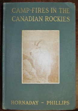
313. HORNADAY, William T[emple] 1854-1937]. Camp-Fires In The Canadian Rockies. 8vo. pp. xvii, 353 + [4]ads. 2 maps & 55 plates (incl. frontis.). original cloth (illus. mounted on upper cover), t.e.g. (some slight wear). New York: Charles Scribner's Sons, 1906. $350
First Edition. The author, Director of the New York Zoological Park, came primarily to study the Rocky Mountain goat in Elk Valley, B.C. The illustrations are by John M. Phillips, Pennsylvania State Game Commissioner. The work includes a description of hunting in the East Kootenays.
Edwards & Lort 1772.
314. HORNYANSKY, Nicholas [1896-1965] (CPE, CSCA, OSA & ARCA). St. James Church, Vancouver B.C. signed & titled in pencil. 8” x 7” (20.5 x 17.5 cm). colour aquatint. framed. $600
The Hungarian born artist studied in Budapest, Munich, Vienna, Amsterdam and Paris. Hornyansky worked in Brussels as a portrait painter before immigrating to Toronto in 1929. He was a painter and prolific printmaker “…who developed a new aquatint method in the 1940's.” (Art Gallery of Hamilton p. 75) He executed fine colour aquatints of Canadian scenery and cities, including a number of the churches and buildings of Toronto.
See Oakville Centennial Gallery, Nicholas Hornyansky Retrospective 1926-1965. MacDonald II pp. 470-472. Art Gallery of Hamilton, The Society of Canadian Painter-Etchers and Engravers in Retrospect , p. 75.
315. HORWOOD, Dennis & Tom PARKIN. Islands for Discovery An Outdoors Guide to B.C.'s Queen Charlotte Islands. 8vo. pp. 200. 4 double-sided colour plates. numerous text illus. & maps (incl. map on inside covers). index. pictorial wrs. [Victoria:] Orca Book Publishers, [1989]. $30
First Edition.
316. HOUSTON, James. Hideaway Life on the Queen Charlotte Islands. 8vo. pp. 3 p.l., 259, [3]ads. full-page map. text illus. illus. on endpapers. bds. (outer edge of a few leaves curled). dw. Signed Presentation Copy. [Toronto: McClelland & Stewart Inc., 1999]. $60
First Edition.
317. [HOWARD, Hilda (Glynn)] 1887-1966]. The Glamour Of British Columbia. By H. Glynn-Ward [Pseud.]. 8vo. pp. xiv, 238. folding map & 31 plates after photos by the author. pictorial cloth (title spotted). New York & London: Century Co., [1926]. $50
First Edition.
Edwards & Lort 1790.
318. HUMPHEYS, Danda. On The Street Where You Live Pioneer Pathways of Early Victoria. 4to. pp. 190. profusely illus. biblio. index. cloth. dw. [Surrey, B.C.]: Heritage House, 1999. $45
First Edition.
319. HUTCHISON, [William] Bruce. The Fraser. Illustrated By Richard Bennett. 12mo. pp. 6 p.l., 368. many text illus., including double-page map. biblio. index. cloth. dw. (slightly tattered, small stain on front cover & front wr.). Toronto: Clarke, Irwin & Co., 1950. $50
First Canadian Edition.
Edwards & Lort 1820n.
320. THE ISLAND BLUE PRINT & MAP CO. Guide Map of Greater Victoria with Street Index [Cover Title]. narrow 12mo. folding coloured map. folding street index. pictorial wrs. (soiled & creased). Victoria: nd. $75
321. ISLANDS PROTECTION SOCIETY. Islands At The Edge Preserving the Queen Charlotte Islands Wilderness. oblong 4to. pp. 160. profusely illus. in colour. bds. dw. Vancouver/Toronto: Douglas & McIntyre, [1986]. $40
Third Printing.
322. [JAMES, Thomas Horton]. Rambles In The United States And Canada During The Year 1845, With A Short Account Of Oregon. By Rubio [Pseud.]. 12mo. pp. viii, 259. A fine copy in original blind-stamped cloth. London: Samuel Clarke, 1846. $700
First Edition. James's review of America and American manners and morals is exceedingly uncomplimentary and highly amusing. The cities he found to be filthy and depressing, and the people vulgar, hypocritical, ignorant, dishonest and constantly grovelling in pursuit of money. Canada West (Toronto, Hamilton, &c.), a visit to which is described in Chapter VI, pp. 87-107, fares much better and the healthy colony is recommended to the prospective English settler. James also gives a brief description of Vancouver and the Queen Charlotte Islands. Apparently some copies of the book were issued with a plate, as Howes, Clark and Strathern call for one; none of the copies we have handled have had one.
Clark III 186. Dionne II 1243. Gagnon I 3097. Howes J-50. Sabin 73850. Strathern & Edwards 277. TPL 272195.
323. JENNINGS, W[illiam] T[yndale] [1846-1906]. Report…On Routes To The Yukon. 8vo. pp. 287. original printed wrs. (badly chipped & detached). Ottawa: Printed By S.E.Dawson [Canada. Sessional papers, 1898, no. 30], 1898. $150
“An interim report to Clifford Sisfton, Minister of the Interior, concerning the possibility of a highway or railway route between the Stikine River and Teslin Lake, and railway routes from Chilkat Pass to the Yukon River, from Dyea via Chilkoot Pass and Tagish Lake to Tootalinqua River, from Skagway via White Pass and Tagish Lake to the Hootalinqua River, and a route via Taku Inlet and the Nakina River to Teslin Lake.” (Lowther)
Lowther 1356. Not in Casey.
324. KALMAN, Harold. Exploring Vancouver Ten Tours of the City and its Buildings…Photographs by John Roaf. The Official Guidebook of the Greater Vancouver Chapter of the Architectural Institute of British Columbia. narrow 4to. pp. 4 p.l., 264. profusely illus. glossary index. pictorial wrs. (short tear to lower spine). [Vancouver:] University of British Columbia Press, [1974]. $30
First Edition.
325. LAI, Chuen-yan David. Arches In British Columbia. 8vo. pp. 122. numerous illus. index. bds. dw. (edges little chipped). Victoria: Sono Nis Press, 1982. $100
First Edition.
326. LA PEROUSE, Jean François De Galoup, Comte de [1741-1788]. Carte Particuliere De La C ô te Du Nord-Ouest De L'Amérique reconnue par les Frégates Francaises La Boussole et L'Astrolabe en 1786. 1e Feuille. Atlas du Voyage de la Pérouse. No. 17. Hérault scrip. [Paris: 1797]. 19 ¼” x 26 ¾”. engraving (paper flaws below upper border & lower margin). $1,500
This map shows La Pérouse's 1786 northwest coast exploration route from Mount St. Elias on the Alaska-Canada border to ‘Baie de Clonard', a cove on the west side of Graham Island. La Pérouse was appointed to lead a French expedition which would further the scientific and geographical exploration of the northwest. He was also charged with continuing the search for the North-West passage from the Pacific side.
Wagner, Cartography Of The Northwest Coast Of America, 841. Phillips, Atlases, 688. Falk, Alaskan Maps, 1797-9.
327. LA PEROUSE, Jean François De Galoup, Comte de [1741-1788]. Chart of the Northwest Coast of America. Explored by the Boussole and Astrolabe in 1786. 1 st Sheet. Published…Nov r . 1 st . 1798 by G.G. and J. Robinson… London. 16 ¼” x 21 ¼” (41.3 x 54.3 cm). engraving (paper weakness at centre fold). $900
cfWagner 841 & Falk, Alaskan Maps, 1797-9 (French edition).
328. LA PEROUSE, Jean François De Galoup, Comte de [1741-1788]. Chart of the Northwest Coast of America. Explored by the Boussole and Astrolabe in 1786. 2nd Sheet. Published…Nov r . 1 st . 1798 by G.G. and J. Robinson… London. 16 ¼” x 20 ¾” (41.3 x 52.1 cm). engraving (paper weakness at centre fold). $1,200
cfWagner 842 & Falk, Alaskan Maps, 1797-9 (French edition).
329. LAPONCE, J.A. People Vs Politics A study of opinions, attitudes, and perceptions in Vancouver-Burrard 1963-1965. 8vo. pp. xii, 219. text illus. index. cloth. dw. (sunned). Toronto: University Of Toronto Press, [1969]. $40
First Edition.
330. LARGE, R[ichard] G[eddes]. Prince Rupert a Gateway to Alaska. 4to. pp. 4 p.l., 210. tipped-in errata. colour frontis. numerous text illus. illus. on endleaves. index. cloth. dw. (dw. creased and tattered along edges & spine, corner of one leaf creased & bit ragged). Vancouver: Mitchell Press Ltd., 1960. $60
First Edition.
Edwards & Lort 2065.
331. LEES, J[ames] A[rthur] [b. 1852] & W[alter] J.CLUTTERBUCK. B.C. 1887 A Ramble In British Columbia... 8vo. pp. viii, 387 + 16(ads). with half-title. folding lithographed map & 75 illus. (incl. 17 plates) from sketches & photographs. original pictorial cloth (rubbed, extremities bit frayed, lacking front free-endpaper, former owner's rubberstamp on front paste-down & several pages). publisher's presentation rubberstamp on title. London & New York: Longmans, Green, And Co., 1888. $250
First Edition. “Primarily relates to the authors' travels in the East Kootenay region.” (Lowther)
Lowther 791. Smith 5809.
332. [LE JEUNE, Jean Marie Raphael] [1855-1930]. Studies On Shuswap [Cover Title]. 12mo. pp. 32. text in Duployan shorthand. original printed wrs. [Kamloops:] 1925. $150
First Edition.
Banks p. 154. Edwards & Lort 2096.
333. LOTTER, Tobias Conrad [1717-1777]. Carte de l'Ocean Pacifique au Nord de l'Equator, et des Côtes qui le bornent des deux côtes: d'aprés les derniéres Découvertes faites par les Espagnols, les Russes et les Anglois, jusqu'en 1780. Publiée par Tobie Conrad Lotter a Augsbourg [1781]. 19 ¼” x 22 ¼” (48.8 x 56.5 cm). original colour. old manuscript notes in two hands (margins little discoloured & ragged). $1,300
Based on Kitchen's A Chart of the discoveries made by the late Captain Cook (1780), Lotter's chart traces Cook's voyage to the northwest coast and Spanish exploration routes.
Kershaw 1137 & Plate 887. Wagner 672.
334. LUMSDEN, Ernest Stephen [1883-1948] (R.S.A., R.E.). Douglas Street, Victoria, B.C. signed & titled in pencil. [1910]. 6” x 8” (15 x 21 cm). etching on laid paper (ink & pencil numbering to lower margin & remnant of old mount to right corner of upper margin & paper weakness to left corner of upper margin). $1,000
Edition of 40. The English etcher and painter, Lumsden, made etchings of the places he visited in Canada, India, Burma, Korea, China, Japan, France and Spain. Lumsden etched eight plates of Victoria, British Columbia, in August 1910. He printed three, including Timber Houses, Victoria, B.C., in 1910 and five in 1911.
Burnaby Art Gallery, Ernest S. Lumsden 1883-1948, p. 24 (illus.).
335. LUMSDEN, Ernest Stephen [1883-1948] (R.S.A., R.E.). Timber Houses, Victoria, B.C. signed and titled, No. ‘37' (left margin), in pencil. [1910]. 6” x 8 ½” (15 x 21.5 cm). etching on laid paper. $1,000
Edition of 18.
Burnaby Art Gallery, Ernest S. Lumsden 1883-1948, p. 24 (illus.).
336. [LUMSDEN, Ernest Stephen] [1883-1948] (R.S.A., R.E.). [ Victoria, B.C. Fort Street ] . [1910]. signed in pencil. 5 ¾” x 7 ¾” (15.3 x 21.3 cm). etching. $1,000
Edition of 30.
This etching of Fort Street shows the shops and buildings, including the Times Building under construction.
Burnaby Art Gallery, Ernest S. Lumsden 1883-1948, p. 23 (illus.).
337. LUMSDEN, Ernest Stephen [1883-1948] (R.S.A., R.E.). Victoria, B.C. Indian Reserve. signed and titled with No. ‘24' (lower right corner) in pencil. [1911]. 6 ½” x 9” (16.5 x 22.8 cm). etching on laid paper. $1,000
Edition of 40.
Burnaby Art Gallery, Ernest S. Lumsden 1883-1948, p. 24 (illus.).
338. LUXTON, Donald. Building The West The Early Architects Of British Columbia. 4to. pp. 560. profusely illus. biblio. index. wrs. Inscribed to Christopher Hume from the Simon Fraser University City program. [Vancouver: Talonbooks, 2007]. $50
Second Revised Edition.
339. MACFIE, Matthew. Vancouver Island And British Columbia. Their History, Resources, And Prospects. 8vo. pp. 3 p.l., [ix]-xxi, [1 leaf]list of illus., 574, [2]ads. with half-title. 2 folding partially coloured lithographed maps. wood-engraved frontis. & 6 wood-engraved text illus. modern quarter calf. London: Longman, Green, Longman, Roberts & Green, 1865. $750
First Edition. "Intended chiefly for the perusal of merchants, statesmen and intending emigrants" ( Preface ), Macfie's book contains much detailed, classified and practical information regarding the commercial, timber-exporting, mining and agricultural capabilities of Vancouver Island and British Columbia. Macfie also discusses the history and topography of the colonies, the impact of the gold rush, political statistics, the proposed interoceanic railway, the need for an emigrant route and telegraphic line across the prairies, social life, and the life and customs of the Northwestern Indians. An English clergyman, the author lived in Victoria from 1859 to 1864.
TPL 4423. Gagnon I 2179. Lande 1312. Lowther 255. Sabin 43253. Smith 6334.
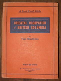
340. MACINNES, T[homas Robert Edward] [1867-1951]. Oriental Occupation of British Columbia. 12mo. pp. 170. original wrs. (spine discoloured). Vancouver: Sun Publishing Company Limited, 1927. $175
First Edition.
Edwards & Lort 2268.
341. MACKAY, Donald. The Lumberjacks. 8vo. pp. 319. profusely illus. (incl. 1 full-page map). index. cloth. dw. (edges of dw. little chipped, one inner corner wanting). Toronto…McGraw-Hill Ryerson Limited, [1978]. $45
First Edition.
342. McKELVIE, B[ruce] A[listair]. Fort Langley Outpost of Empire. 8vo. pp. 2 p.l., vii-ix, [1 leaf], 98. colour frontis. head & tailpieces. map on endleaves. biblio. bds. dw. (spine faded, tears in front fold). [Toronto:] Thomas Nelson And Sons (Canada) Limited, [1957]. $45
Second Printing.
343. McLEAN, Thomas Wesley [1881-1951] (CSGA, CSPWC & MSA). Glacial Lake… signed & dated 33 of 100 in pencil. 4” x 5 ¾” (10.2 x 14.6 cm). colour woodcut (faint mat burn to margins). $250
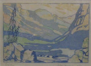
344. McLEAN, Thomas Wesley [1881-1951] (CSGA, CSPWC & MSA). Lake O'Hara. signed, titled & numbered 15(?) of an edition of 100 in pencil. 4” x 5 ¾” (10.2 x 14.6 cm). colour woodcut. $325
345. McLEAN, Thomas Wesley [1881-1951]. [ Western Canada Mountains ]. signed & dated 25 of 100 in pencil. 4” x 5 ¾” (10.2 x 14.6 cm). colour woodcut (faint mat burn to margins & small abrasion & vertical crease to left margin). $250
346. McLOUGHLIN, John [1784-1857]. The Letters Of…From Fort Vancouver To The Governor And Committee Second Series, 1839-44 Edited By E.E.Rich… 8vo. pp. xlix, 427, xi. tipped-in frontis. Unopened in original gilt-crested blue cloth, t.e.g., others uncut [Toronto]: Published by The Champlain Society for The Hudsons' Bay Record Society [Publication No. VI], 1943. $135
Numbered Limited Edition.
Strathern 349. cfTPL 5325.
347. McLOUGHLIN, John [1784-1857]. The Letters Of…From Fort Vancouver To The Governor And Committee Third Series, 1844-46 Edited By E.E.Rich… 8vo. pp. xlii, 341, [1 leaf]errata, xi. Unopened in original gilt-crested blue cloth, t.e.g., others uncut. [Toronto]: Published by The Champlain Society for The Hudsons' Bay Record Society [Publication No. VII], 1944. $135
Numbered Limited Edition.
Strathern 349. cfTPL 5325.
348. MEARES, John. Carte De la Côte N.O. D'Amerique et de la Côte N.E. D'Asie reconnues en 1778 et 79. Par le Captaine Cook, et plus particulierement encoure en 1788 et 89. par le Cat ne . J. Meares. [Paris 1795]. 17 ½” x 25” (44.6 x 63.7 cm). horizontal & vertical folds (tears to folds & few pinholes repaired – backed on archival tissue). $1,500
French edition of Meares Chart of the N.W. Coast of America (1790). Based on the discoveries of Cook, Meares' chart “…gave new credence to the idea of a Northwest Passage through one of the river-and-lake systems…” (Hayes p. 60) The route of the fictious 1789 voyage of the American sloop, ‘Lady Washington', commanded by Gray, is shown from John de Fuca Straits to Port Meares.
cfWagner 758(a) & Hayes, Historical Atlas of British Columbia, p.60, Map 95 (1790 English Edition).
349. MORICE, A[drian] G[abriel] [1859-1938]. The History of the Northern Interior of British Columbia Formerly New Caledonia [1660 To 1880]. 8vo. pp. xi, 349. folding map (frontis.), 20 plates & 6 text illus. original cloth (library markings on endleaves & lower spine, extremities bit frayed, some staining to front cover). Toronto: William Briggs, 1904. $175
First Edition. “Presents details of fur-trading days, life at the Hudson's Bay trading posts, the story of the gold-rushes, the work of missionaries (especially on the Babine and Skeena Rivers), as well as information on Indian life.” (Lowther)
Lowther 1534.
350. NICOLAY, C[harles] G[renfell] [1818-1897]. The Oregon Territory: A Geographical And Physical Account Of That Country And Its Inhabitants With Outlines Of Its History And Discovery. 24mo. pp. 226. with half-title. wood-engraved frontis. 2 maps (1 folding). untrimmed in original printed wrs. (on front wr.: ‘Knight's Weekly Volume For All Readers, Class I. Copyright Miscellanies, LXXXIX…') (soiled, spine & edges chipped, stitching partly broken, marginal tears to upper margin of some leaves). London: Charles Knight & Co., 1846. $600
First Edition. Also issued in cloth with no reference to ‘Knight's Weekly Volume…'. A detailed history of the Oregon Territory with chapters on discovery, exploration, the settlement, the Hudson's Bay Company, Indian tribes, and discussion of the British and American claims.
Cowan 162. Howes N-151. Sabin 55251. Smith 7311. Strathern & Edwards 403. TPL 2793. Wagner-Camp 122c:1.
351. ONLEY, (Toni) Norman Anthony [1929-2004] (RCA & CPE). Black Mountain / Volcano Suite. signed, titled & numbered 36 of an edition of 61 in pencil. [1980]. 10 ¾” x 15” (image; 27.4 x 377 cm). silkscreen. $500
352. ONLEY, (Toni) Norman Anthony [1929-2004] (RCA & CPE). Dormant Volcano / Volcano Suite. signed, titled & numbered 36 of an edition of 57 in pencil. [1980]. 10 ¾” x 15” (image; 27.4 x 377 cm). silkscreen. $500
353. ORMSBY, Margaret A. British Columbia: a History. 8vo. pp. x, 558. 3 colour maps (1 double-page), 20 double-sided plates (4 colour), & numerous text illus. biblio. index. cloth. [Vancouver:] Macmillan, 1958. $40
First Edition.
Edwards & Lort 2671. Lowther 2036. Strathern 431.
354. OSTERHOUT, S.S. Orientals in Canada The Story Of The Work Of The United Church Of Canada With Asiatics In Canada. 12mo. pp. xiv, 222. frontis. portrait & 7 double-sided plates. maps on endpapers. index. original cloth. Toronto: Issued for the Board of Home Missions of the United Church of Canada by the Committee on Literature, General Publicity and Missionary Education of the United Church of Canada, [1929]. $175
First Edition.
Edwards & Lort 2677.
355. PÉRON, [Pierre François] [b. 1769]. Mémoires Du Capitaine Péron, Sur Ses Voyages Aux Côtes D'Afrique, En Arabie, À L‘ î le D'Amsterdam, Aux Îles D'Anjouan Et De Mayotte, Aux Côtes Nord-Ouest De L'Amérique, Aux Îles Sandwich, À La Chine, Etc. 2 Volumes. 8vo. pp. 2 p.l., v, 328; 1 p.l., 359. with half-title in Vol. I only. 2 folding plates & 4 folding maps, all lithographed by G.Engelmann. 19 th century quarter roan (bit worn, plate captions shaved, short tear in title – no loss, 1 map with fold tear & 2 smaller tears repaired – no loss, light foxing to another map). Paris: Brissot-Thivars…Bossange Frères, 1824. $4,000
First Edition of these thrilling sea-faring adventures, edited from the author's voluminous notes and diaries by Louis Saturnin Brissot-Thivars. Included are accounts of shipwrecks and storms, the abandonment and rescue of Péron and four companions on the deserted Amsterdam Island in the Indian Ocean, and Péron's five-month fur-trading voyage to the northwest coast of America as chief officer on the ‘Otter', Captain Ebenezer Door commanding. In May of 1796, the ‘Otter' reached the Strait of Juan de Fuca, and the following month, entered the Bay of Nootka, where the crew had lengthy dealings with the famous chief Macuina, whose treachery and cruelty are described by Péron with great detail. Proceeding farther north, they pushed as far as the Bucareli Bay region, Alaska, which they explored and charted, before turning back, meeting and trading with the coastal natives along the way. Important descriptions are given of parts of British Columbia, Vancouver Island, and the Queen Charlotte Islands, as well as California, where Péron spent a week at Monterey on the return voyage; Streeter notes that the ‘Otter' was possibly the first American ship to visit Monterey of which a record has been handed down, while Howgego states that it was the first American ship to enter San Francisco Bay. Visits to Tasmania, New South Wales, Hawaii, and Sumatra are also related.
The lithographed plates include one of seals and penguins, another of seal-hunting, and plans of Amsterdam Island, the northwest coast of America from the Strait of Juan de Fuca to just south of Nootka, the Strait dividing the Queen Charlotte and Prince of Wales Islands, and Bucareli Bay.
Ferguson 980. Graff 3250. Hill p. 230. Howes P-240. Lada-Mocarski 89. Monaghan 1174. Sabin 61001. Strathern & Edwards 441. Streeter VI 3513. Wickersham 6623a. Howgego P64.
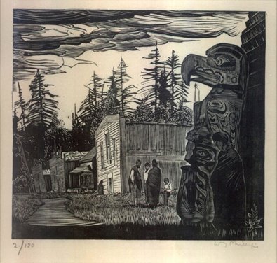
356. PHILLIPS, Walter Joseph [1884-1963] (RCA & CPE). Community Houses At Mamalilicoola [ British Columbia ]. signed & numbered 2 of an edition of 120 in pencil. [1930]. 5 ¼” x 5 ¾” (13.4 x 14.9 cm). wood engraving. $2,800
Boulet, The Tranquility And The Turbulence, MBL146.
357. PHILLIPS, Walter Joseph [1884-1963] (RCA & CPE). [ The Floating Dock. Mamalilicoola]. signed & numbered 42 of an edition of 120 in pencil. [1930]. 6” x 5” (15.1 x 12.7 cm). wood engraving. $2,500
Phillips' The Floating Dock, Mamalilicoola was issued in Phillips' portfolio, An Essay in Woodcuts.
Boulet, The Tranquility And The Turbulence.
358. POIRSON, Jean Baptiste [1760-1831]. Partie Septentrionale De L'Ocean Pacifique Ou L'On A Marqué Les Découvertes Et Les Routes De M rs . De La Pérouse Et Cook. Par J.B. Poirson Ing é nieur Geographe. [Paris: c1824]. 15 ½” x 19 ½” (39.4 x 49.5 cm). original colour (short tears to upper margin). $700
Poirson's map of the Pacific coast of America and Asia traces La Pérouse and Cook's exploration routes.
359. POOLE, Francis [d. 1874]. Queen Charlotte Islands. A Narrative Of Discovery And Adventure In The North Pacific...Edited By John W. Lyndon [Pseud.]... 8vo. pp. xiv, [1 leaf], 347, [1], 16(ads). complete with half-title. 3 wood-engraved plates (incl. frontis.), title vignette & 2 maps. original black & gilt-stamped cloth, all edges gilt (bit rubbed, joints & spinal extremities trifle frayed, inner hinges reinforced, foxing to outer leaves). London: Hurst & Blackett, 1872. $700
First Edition. One of the few books specifically devoted to the Queen Charlotte Islands of British Columbia, based on the diaries of the first resident Englishman, and edited by John Wyse under the pseudonym of John W. Lyndon. Francis Poole, civil and mining engineer, was employed in 1862 by the Queen Charlotte Mining Company to prospect and develop copper mines at Skincuttle Inlet. The work contains an account of the mining enterprise and other details of Poole's eighteen-month stay, his problems with his rebellious white labourers and his relations with the Haida Indians, his 1864 voyage in a war canoe with the Haida chief from Queen Charlotte Island to Victoria, and his impressions of Jamaica, Acapulco, San Francisco, Vancouver Island, Victoria, and other places visited on the outgoing and return trips.
Lowther 401. Sabin 64029. Smith 8216.
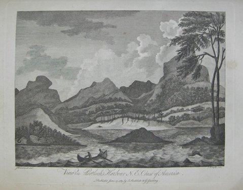
360. PORTLOCK, Nathaniel [1748?-1817]. A Voyage Round The World; But More Particularly To The North-West Coast Of America: Performed In 1785, 1786, 1787, And 1788, In The King George And Queen Charlotte, Captains Portlock And Dixon… 4to. pp. xii, 384, xl. 1 large folding engraved general chart, 5 other folding engraved charts & plans, engraved frontis. portrait & 13 engraved plates. contemporary calf, rebacked (slight staining along folds of 2 maps & to top edge of 2 plates – supplied). London: Printed For John Stockdale & George Goulding, 1789. $7,500
First Edition. Nathaniel Portlock and William Dixon, both veterans of Captain Cook's third voyage to the Pacific in 1776-80, were engaged in 1785 by the King George's Sound Company, to investigate reports of the lucrative fur trade on the northwest American coast and establish a trade on their behalf. Their major accomplishment, however, was the more detailed exploration and mapping of the coast and improving of Cook's charts of the region. On the voyage out, visits were made to the Falkland and Hawaiian Islands. The two ships later separated and sailed independently for a major part of the expedition, Portlock exploring northward up along the Alaskan coast, Dixon proceeding south to Nootka Sound, and discovering Queen Charlotte Island, Port Mulgrave and Norfolk Bay. Both Dixon and Portlock published accounts of the voyage, but Portlock's, as Hill points out, is of particular interest and value for his vivid descriptions of encounters with the Russians and American Indians. Several Indian vocabularies are also included. The maps and plans comprise a chart of the North West Coast of America, and sketches of Graham's Harbour and Coal Bay, McLeod's Harbour, Part of the West Side of Montague Island, Port Etches and Brooks Harbour, and Portlock's and Goulding's Harbours.
Bell P 365. Cowan p. 181. Field 1231. Gagnon I 2786. Hill p. 239. Howes P-497. JCB II 3316. Lada-Mocarski 42. Lande 1393. Sabin 64389. Smith 8304. Strathern & Edwards 450. Streeter VI 3485. TPL 599. Wagner, Cartography , I pp. 207, 213; Maps 738-743.
361. RAINE, Herbert [1875-1951] (RCA). Cathedral Mountain from Lake O'Hara. signed on recto. Verso: ‘No. 17', titled, signed & priced (in artist's hand?). 9 7/8” x 6 3/8” (24.9 x 16 cm). pencil & charcoal (right edge ragged, pinhole to upper left corner & short slanted crease to lower left corner). $725
See MacDonald VI pp. 1914-1915.
362. RAINE, Herbert [1875-1951] (RCA). ( Cathedral ?) Mountain & Mount Stephen . signed & titled in pencil. 11 x 15” (entire sheet; 28 x 37.8 cm). ink & coloured pencil (faint slanted crease, short tear to right edge & pinholes to corners). $900
See MacDonald VI pp. 1914-1915.
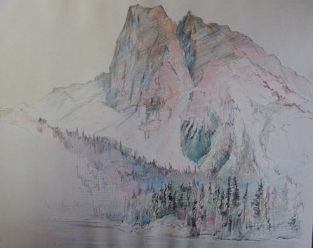
363. RAINE, Herbert [1875-1951] (RCA). Mount Burgess. signed & titled in pencil. 11” x 14” (entire sheet; 28.4 x 35.9 cm). ink & coloured pencil. (pinholes to corners & paper cockled at lower edge). $1,000
See MacDonald VI pp. 1914-1915.
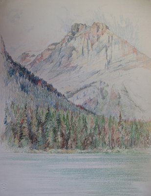
364. [RAINE, Herbert] [1875-1951] (RCA). Vice-president Emerald Lake. titled lower right recto. 14 ½” x 11 ½” (entire sheet; 37 x 29.3 cm). coloured pencil; coloured pencil unfinished drawing on verso. Strathmore thistle embossed stamp at lower right corner (pinholes to corners). $1,000
See MacDonald VI pp. 1914-1915.
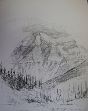
365. [RAINE, Herbert] [1875-1951] (RCA). M [ oun ] t Robson. Titled & dated 1932 on verso. 14 ¾” x 11 ½” (entire sheet; 37.2 x 29 cm). graphite & charcoal. Strathmore thistle embossed stamp at lower right corner (pinholes to corners). $800
See MacDonald VI pp. 1914-1915.
366. RAJALA, Richard A. Up-Coast Forests and Industry on British Columbia's North Coast, 1870-2005. 8vo. pp. 294. numerous text illus. biblio. index. pictorial bds. Victoria: Royal BC Museum, [2006].
First Edition.
367. REKSTEN, Terry. The Illustrated History of British Columbia. folio. pp. viii, 280. numerous illus. (some colour). wrs. (faint creasing to lower corners throughout). Vancouver & Toronto: Douglas & McIntyre, [2005]. $60
368. [ROBERTS, Lieutenant Henry]. Chart of the NW Coast of America and N E Coast of Asia explored in the Years 1778 & 1779 The unshaded parts of the Coast of Asia are taken from a M S Chart received from the Russians. Writing engraved by T. Harmar. [London: 1784]. 17” x 27 ¾” (43.2 x 70.3 cm). (short tear near upper center fold). $1,200
This chart of the northwest coast of America and the northeast coast of Asia was published in the atlas to Cook's third voyage. On this voyage Cook accomplished the monumental charting of the northwest coast of America from Oregon at 44 degrees to Bering Strait at 70 degrees (Icy Cape, Alaska). The chart traces Cook's exploration route from March 7th, 1778 to April 23, 1779.
Wagner 696 (vide HARMAR). Kershaw 1140 & Plate 890 (vide Cook-Harmar). Tooley, The Mapping of America, p. 92.64(a).
369. ROBIN, Martin. The Rush for Spoils The Company Province 1871-1933. 8vo. pp. 318. illus. index. bds. dw. (rubbed & edges bit chipped, a few pencil marks). Toronto: McClelland and Stewart Limited, [1972]. $60
First Edition.
Edwards & Lort 3021.
370. ROBINSON, F[rank] A[lfred] [b. 1874]. Trail-Tales Of Western Canada. 12mo. pp. 255. 6 plates (3 double-sided). original cloth (some dampstaining to cloth & endleaves). Toronto: Social Service And Evangelism, [1914]. $75
First Edition. Fictional tales by a Presbyterian missionary, but the photo-based plates depict actual scenes of lumbering and mining in British Columbia. The introduction is by Charles W.Gordon (‘Ralph Connor').
Edwards & Lort 3022.
371. ST. JOHN, [Frederick Edward] Molyneux [1838-1904]. The Sea Of Mountains An Account Of Lord Dufferin's Tour Through British Columbia In 1876. 2 Volumes. 12mo. pp. xii, 325, [1]; vii, 290. with half-titles. frontis. portrait (mounted photo). contemporary half chagrin, gilt backs (gilt library stamps on upper covers & lower spines, foxing to outer leaves). London: Hurst And Blackett, 1877. $700
First Edition. A special correspondent of the Toronto Globe , St. John accompanied Lord Dufferin on his diplomatic mission to British Columbia to allay the growing discontent with Confederation in that province over the delay in the construction of the Canadian Pacific Railway. Dufferin visited Esquimalt, Vancouver, Victoria, Nanaimo, Fort Simpson, Queen Charlotte Islands, New Westminster, Yale, Fort Hope, Lytton, and Kamloops. St. John's narrative of the tour includes discussion of the railway proposals, the manners, customs, and social conditions of the native Indian tribes (Haida, Tsimshian, Nunpkish), salmon fishing, lumbering, and mining, the Chinese in California, the Mormons in Utah, immigration, &c. The first seven chapters describe the trip west via Chicago, Omaha, Salt Lake City, and San Francisco.
Lowther 513. Smith 8941.
372. SECTIONAL MAP & STREET DIRECTORY COMPANY. Sectional Map And Street Directory Of Vancouver, British Columbia Including: Burnaby, New Westminster, North Vancouver, West Vancouver, Millardville, Lulu & Sea Islands [Cover Title]. 12mo. pp. 1 p.l., x, 44, xi-xx, [1 leaf]. pictorial wrs. (wrs. soiled). [ Vancouver:] nd. $40
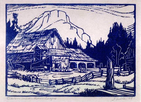
373. SHELTON, Margaret Dorothy [1915-1984]. Barn near Kamloops. signed, titled & dated [19]79 in pencil. 4 ½” x 6” (12.3 x 15.1 cm). linocut in one colour – navy (top edge mounted on Christmas card). $525
374. SHELTON, Margaret Dorothy [1915-1984]. Candelabra Cedar. signed, titled, dated [19]84 & numbered 80 of an edition of 100 in pencil. 9 ¼” x 5 ¾” (23 x 14.6 cm). linocut in one colour (blue). $400
Ainslie, Margaret Shelton Block Prints 1936-1984, 169 (citing edition of 200).
375. SHELTON, Margaret Dorothy [1915-1984]. West Coast Cedar. signed, titled, dated [19]82 & numbered 62 of an edition of 100 in pencil. initialled ‘MS' in block. 6” x 4” (15.3 x 10.4 cm). linocut in one colour (blue). $400
Ainslie, Margaret Shelton Block Prints 1936-1984, 166.
376. SIMPSON, Charles Walter [1878-1942] ( RCA, ACM, PPC. MAA Guild of Artists). [Empress Hotel, Victoria, B.C.]. signed on recto. 13” x 16”. oil on canvas. $2,000
The Empress Hotel, Victoria [Fairmont Empress Hotel] was built in 1908 and was part of a series of Chateaux-Hotels built by Canadian Pacific Railways during the first half of the 20 th century. Simpson studied at the Art Association of Montreal, with Brymner, Dyonnet and Cullen. He also studied at the Art Students' League, New York, with G.B. Bridgman and W.A. Clark. Simpson painted many seascapes, coastal and harbour scenes. As a painter he was known for his bright colours and sensitivity to atmospheric effects.
377. SMET, Pierre Jean De [1801-1873]. Life, Letters And Travels…Edited…by Hiram Martin Chittenden and Alfred Talbot Richardson. 4 Volumes. 8vo. pp. xv, 402; vii, 403-794; vi, 795-1211; vi, 1213-1624. 16 plates & folding map in rear pocket A fine untrimmed set in original cloth. gilt crests on lower spines. New York: Francis P. Harper, 1905. $1,000
First Collected Edition , edited by Hiram Martin Chittenden and Alfred Talbot Richardson from the original unpublished manuscript journals and letter books and from De Smet's printed works, with additional historical, geographical, ethnological and other notes, and a biography. The Belgian-born De Smet served as a Jesuit missionary among the native tribes on the plains, Pacific coast and in the Rocky Mountains in both American and British held territories. Respected and highly influential, he was on numerous occasions engaged by the American government to conduct negotiations with the Indians, and he played a role in the formation of national native American policy. Included are many detailed descriptions of the manners and customs, modes of warfare, legends, and traditions of numerous tribes, including the Sioux, Blackfeet, Flatheads, Assiniboines, Pawnees, Delawares, and Oregon Indians. Some bibliographies erroneously refer to a 1904 edition.
Graff 3824. Howes C-392. Smith 9545. Strathern & Edwards 510.
378. SMITH, Ian. Vancouver Island: Unknown Wilderness. 4to. pp. 174. profusely illus. (some colour). cloth. dw. (top of dw. bit chipped). Seattle: University of Washington Press, [1973]. $50
First American Edition.
379. SPROAT, G[ilbert] M[alcolm] [1832-1913]. Scenes And Studies Of Savage Life. 12mo. pp. xii, 317, [1] + [2]ads. tinted lithographed frontis., after a sketch by F.Whymper. original cloth, rebacked with spine mounted. London: Smith, Elder & Co., 1868. $1,000
First Edition. An interesting account of the Aht or Nootka Indians of the west coast of Vancouver Island, and of the British occupation of their territory. The work is based on the author's personal observations from 1860-65 as a saw mill employee and local manager of Anderson and Co., at Alberni in Barclay Sound, Vancouver Island, and as a justice of the peace for Vancouver Island and government agent for the west coast of the island. Also included is a brief relation of the massacre of the crew of the Boston at Nootka in 1803. Appended is a vocabulary of the Aht language. Sproat would later (1876-80) serve as an Indian reserve commissioner but resigned in the face of government's refusal to recognize Indian land rights.
Field 1477. Graff 3936. Howes S-858. Lowther 313. Sabin 89910. Smith 9792. Strathern & Edwards 521. TPL 4630.
380. SUTTLES, Wayne. Katzie Ethnographic Notes. [BOUND WITH, as issued:] JENNESS, Diamond. The Faith Of A Coast Salish Indian. [Anthropology In British Columbia Memoir No. 2-3]. 2 Volumes in 1. 8vo. pp. 31; 92. 2 text maps; 1 portrait. biblio. pictorial wrs. [Victoria:] British Columbia Provincial Museum, [1973]. $50
381. [SWAN, Joe]. "A Century Of Service" The Vancouver Police 1886-1986. 4to. pp. 131, [11]. frontis? profusely illus. (some colour). bds. (1 corner knocked). dw. (few short tears to edges). [Vancouver: Vancouver Police Historical Society and Centennial Museum, 1986]. $75
First Edition.
382. SWANSON, Robert E. Rhymes Of A Western Logger. A Book Of Verse Concerning the trials and tribulations, lives and ways of the loggers living and working in the Great Northwest of America. 8vo. pp. 1 p.l., 56. folding plate & other illus. pictorial wrs. (some pen scoring). Vancouver: The Author, 1942. $60
Seventh Edition.
383. THOM, Adam [1802-1890]. The Claims To The Oregon Territory Considered. 8vo. pp. iv, 44. later half calf (rubbed, front joint split). London: Smith, Elder And Co., 1844. $450
First Edition. A refutation of the American claim in the dispute over the Oregon Territory (British Columbia, Washington, Oregon), based on the information and materials advanced by the Americans themselves, as presented in Greenhow's Memoir. It includes a summary of exploration and settlement of the region, 1543-1812. The author was at the time first recorder (presiding judge) of Rupert's Land (1839-49).
Casey I 1928. Howes T-161. Lande 1481. Sabin 95370. Smith 10183. Strathern & Edwards 538. TPL 5287.
384. THORNTON, Mildred Valley [1896-1967] ( FRSA). The Dawnless One. signed on recto. titled to label on verso. 19 ½” x 24”. oil on canvas. $4,500
Provenance: Imperial Oil of Canada, Art Collection (inventory cataloguing labels on verso).
385. TOLMIE, W[illiam] Fraser [1812-1866] & George M[ercer] DAWSON [1849-1901]. Comparative Vocabularies Of The Indian Tribes Of British Columbia… [At Head of Title: Geological And Natural History Survey of Canada… ]. 8vo. pp. 131. ‘Appendix II' on folding sheet. large folding coloured lithographed map. original printed wrs. (chipped, back wr. & map loose, several institutional rubberstamps). Montreal: Dawson Brothers, 1884. $175
First Edition. A comparative listing of the principal words of all Indian languages and dialects in the Province of British Columbia. The map illustrates the distribution of the tribes.
Lowther 671. Not in Casey.
386. TURNER-TURNER, J. Three Years' Hunting And Trapping In America and the Great North-West...Illustrated By Constance Hoare. large 8vo. pp. viii, 182, [3]ads. frontis. portrait, 2 lithographed maps & 45 text illus. (7 full-page). original cloth-backed pictorial bds. London: Maclure & Co., 1888. $750
First Edition. Tales and anecdotes of hunting and trapping adventures in the Skeena River area of British Columbia, 1886-88. The author's travels extended along the coast and down through central British Columbia, including visits to Metlahkatla, Fort George, Alexandria, Kamloops, Vancouver, and Victoria. Turner-Turner also comments on Indian life and missionary activity in the region, praising in particular the Indian community at Metlahkatla established by William Duncan.
Lande 1490. Lowther 800. Smith 10352. Soliday IV 902. Story p. 100.
387. TURTON, M. Conway. Cassiar. 8vo. pp. x, 123, [1]. frontis. illus. endleaves. cloth. Toronto: Macmillan Company of Canada, Limited, 1934. $60
First Edition.
Edwards & Lort 3559.
388. TYNEHEAD HISTORICAL SOCIETY. Tynehead Memories. 4to. pp. vi, 162. numerous text illus. & maps. index. cloth. [Surrey: 1982]. $50
First Edition.
389. UNITED STATES. HYDROGRAPHIC OFFICE. The Coast Of British Columbia From Juan De Fuca Strait To Portland Canal, Together With Vancouver And Queen Charlotte Islands. Second Edition. [No. 96. Hydrographic Office]. 8vo. pp. 654. folding map. original gilt-stamped cloth (extremities little scuffed, several institutional markings). Washington: Government Printing Office, 1907. $250
cfLowther 952.
390. VANCOUVER, George [1757-1798]. A Voyage Of Discovery To The North Pacific Ocean, And Round The World… 6 Volumes. 8vo. pp. 410 [i.e. 406, pp. 29-32 omitted in pagination; 1 p.l., 418; 1 p.l., 435; 1 p.l., 417; 1 p.l., 454; ` p.l., 412, [2]ads. 2 folding engraved maps & 17 folding plates engraved by Landseer, Pouncy, & Fittler after W. Alexander, from sketches made "on the spot" by Sykes, Heddington, & others. contemporary tree calf, gilt backs, Vol. 1 rebacked with spine mounted, joints of other vols. cracked & some weak, some chipping to spine ends & wear to corners). London: Printed For John Stockdale, 1801. $10,000
Second (First Octavo) Edition, of the official account of “the most important [voyage] ever made in the interests of geographical knowledge.” (Hill) Vancouver set sail for Nootka Sound on the first of April, 1791, charged by the British government with three tasks: firstly, to take formal possession, according to the terms of the Nootka Sound Convention, of the territory seized there by Spain, secondly, to conduct an accurate survey of the coast northwards from the 30 th degree of north latitude, and thirdly, to search for a possible passage to the Atlantic. The expedition took five years to accomplish.
Vancouver sailed westward by way of Cape of Good Hope, visited and conducted important surveys of the southwest coast of Australia, New Zealand, Tahiti, and the Sandwich (Hawaiian) Islands before he reached his destination. During the next three seasons, he systematically investigated the Pacific coastline from San Francisco to Cook's Inlet, explored the Straits of Juan de Fuca and Puget Sound, discovered the Gulf of Georgia, and circumnavigated the island since known by his name – Vancouver Island. His charts of certain portions of the northwest coast are the earliest and most accurate produced. His researches decisively proved that no passage existed between the Pacific and Hudson's Bay.
Cox II 30-31. Ferguson 339. Hill p. 304. Howes V-23. Sabin 98444. Smith 10470. Strathern 582 (i). cfBell V18. cfCowan II 655. cfGraff 4456. cfLada-Mocarski 55. cfLande 1495. cfStreeter VI 3497. cfTPL 688. cfZamorano Eighty 77.
391. VANCOUVER, George [1758-1798]. Carté De La Partie De La Côte Nord-Ouest De L'Amérique… depuis 29 ? 54', de Latitude Nord et 244 ? . 33'…Cap Douglas par 58 ? . 52'… Redigée par le Lieutenant Edward Roberts… [Paris: c1800]. 30 ½” x 25”. engraving. horizontal & vertical folds (light foxing, several tears to folds, few short creases). $2,400
392. VANCOUVER, George [1758-1798]. A Chart shewing part of the Coast Of N.W. America with the tracks of His Majesty's Sloop Discovery and Armed Tender Chatham Commanded by George Vancouver…from lat. 29 o 54' N. and long. 244 o …58 o , 52'N. and long. 207 o , 20' E… London Published May 1 st 1798…by J. Edwards…and G. Robinson… Plate 14. 23 ¼” x 30 ½” (59.5 x 77.5 cm). (restoration to 1 ½” tear, combined with small circular hole, affecting blank area of map at side border). $2,800
This important chart shows the entire northwest coast of America Vancouver surveyed from 1792-1794. The exploration routes of the ‘Discovery' and ‘Chatham' are tracked. The explorer set sail for Nootka Sound, charged by the British Government with a dual task: firstly, to take formal possession, according to the terms of the Nootka Sound Convention, of the territory seized there by Spain, and secondly, to conduct an accurate survey of the coast northwards from the 30th degree of north latitude and to search for a possible passage to the Atlantic.
Wagner, Cartography of the Northwest Coast of America, 860. Hayes, Historical Atlas of the North Pacific Ocean, p. 122, Map 171. Kershaw 1189 & Plate 934. Hayes, Historical Atlas Of British Columbia And The Pacific Northwest, p. 91, Map 149. Falk, Alaskan Maps, 1798-21.
393. VANCOUVER CITIZENS' DIAMOND JUBILEE COMMITTEE. 1886-1946 Vancouver's Diamond Jubilee June 30-July 14, 1946…Official Souvenir Booklet. [Cover Title: 60 Years! Official Souvenur Vancouver's Diamond Jubilee]. 12mo. pp. 96. text illus. & maps. pictorial wrs. Vancouver: [1946]. $50
394. (VANCOUVER). BEAUTIFUL VANCOUVER British Columbia Canadian Rockies Colorful Canada 18 Full Color Photographs [Cover Title]. 18 colour plates. map on verso of 1 plate. wrs. with cutout frame on front wr. np: nd. $40
395. (Vancouver). [ V ancouver Coliseum ]. signed ‘L. Kr....' (signature indecipherable) & dated [19]92. 13 ½” x 27” (34.3 x 68.7 cm) on Peterboro illustration board measuring 19 ½” x 32” (45.6 x 81.5 cm). gouache. $1,000
396. (VANCOUVER ISLAND). GREAT BRITAIN. COLONIAL OFFICE. Vancouver's Island. Return to an Address of the Honourable The House of Commons, dated 7 August 1848;-for, “Copy of Correspondence between the Chairman of the Hudson's Bay Company and the Secretary of State for the Colonies, relative to the Colonization of Vancouver's Island.” Colonial Office, Downing Street, 8 August 1848. B.Hawes. (Mr. Labouchere.). [Parliamentary Paper, 1847-48, No. 619]. folio. pp. 17, [1]. modern quarter leatherette (library rubberstamp on title & verso of last leaf). [London: 1848]. $700
On January 13, 1849, Vancouver Island was granted by the British Crown to the Hudson's Bay Company, reserving the right to resume the grant should the Company fail to establish a colony within five years.
Included here are copies of the document establishing the colonization rights of the Hudson's Bay Company and of the 1842 report by the new colony's agent, James Douglas, describing the island and the prospects for settlement. Douglas, known as the ‘father of British Columbia', succeeded Richard Blanshard as governor of Vancouver Island in 1851, and in 1858, became the first governor of the mainland colony of British Columbia.
Gagnon I 3640. Lowther 7. Streeter VI 3399. TPL 2908.
397. VANDER MAELEN, Philippe Marie Guillaume [1795-1869]. Amér. Sep. Ile De La Reine Charlotte. No. 30. [‘Atlas Universel'. Bruxelles: 1827]. 18” x 22 ½” (within borders; 45.5 x 57.1 cm). original colour. lithograph (few short tears to lower margin repaired & bit spotted). $500
Vander Maelen “…published one of the most remarkable world atlases ever made: a world atlas with 400 maps on a uniform scale of ca. 1: 1,6 million”. (Koeman p. 141) Vander Maelen's map of Queen Charlotte Island and part of British Columbia from 54 to 52 degrees contains two columns of descriptive text on Mexico.
Koeman, Atlantes Neerlandici III, Vdm 1, p. 144.
398. VENTRESS, Cora, Marguerite DAVIES, Edith KYLLO. The Peacemakers of North Peace. 4to. pp. 416, H1- H96, [2], 14(index). folding map. profusely illus. index. bds. dw. Fort St. John: The Authors, 1973. $75
First Edition.
Edwards & Lort 3820.
399. WARD, N[evill] Lascelles & H.A.HELLABY. Oriental Missions In British Columbia. 12mo. pp. viii, 128. frontis. & 7 double-sided plates. index. original cloth with illus. mounted on upper cover. [London]: Society for the Propagation of the Gospel in Foreign Parts, 1925. $125
First Edition.
Edwards & Lort 3920.
400. WARD, Robin. Vancouver. 4to. pp. 144. profusely illus. bds. dw. (long tear in dw. spine). [Madeira Park:] Harbour Publishing, [1990]. $35
First Edition.
401. WASHBURN, Stanley. Trails, Trappers, and Tender-feet In the New Empire of Western Canada. 8vo. pp. xvi, 350. folding map. frontis. & numerous text illus. (some full-page). original black & gilt-stamped cloth, t.e.g. (one corner discoloured but overall a nice copy). London: Andrew Melrose & Toronto: Musson Book Company Ltd., 1913. $250
First Canadian Edition. “Describes pack horse and canoe trips from the Yellowhead Pass to Fort George in 1909 and 1910 and Fort George to Prince Rupert in 1910. Includes a chapter on the route planning for the G.T.P. railroad and description of the Yellowhead Pass route before and after construction started.
Edwards & Lort 3929.
402. WEBBER, John [1752-1792]. The Inside of a House in Nootka Sound. J. Webber del. W. Sharp sculp. [London: c1784]. 10 ½” x 16" (26.7 x 40.6 cm). engraving. $600
John Webber served as draughtsman and artist on Cook's third voyage in search of a northwest passage. "That Webber performed well and beyond expectation for an expedition artist, is evidenced by the unusually large number of high quality drawings and paintings produced during the four-year voyage. In the words of Bernard Smith in European Vision and the South Pacific, 1768-1850 , 'no voyage undertaken in the days before photography ever returned so well documented with pictorial illustrations, nor had so great an area of the earth's surface come under one artist's observation.'" (Henry, Early Maritime Artists , pp. 74-75)
de Volpi, British Columbia , Plate 3. Joppien & Smith, The Art of Captain Cook's Voyages Vol. III, 3.202A.
403. WEBBER, John [1752-1792]. A Man Of Nootka Sound. J. Webber del. W. Sharp sculp. [London: c1784]. 12" x 9 ½” (30.5 x 24.1 cm).engraving. $500
de Volpi, British Columbia , Plate 4. Joppien & Smith, The Art of Captain Cook's Voyages Vol. III, 3.218A.
404. WEBBER, John [1752-1792]. A Man of Prince William's Sound. J. Webber del. J. Basire sculp t . [London: c1784]. 12" x 9 ½” (30.5 x 24.1 cm). engraving. $500
de Volpi, British Columbia , Plate 7. Joppien & Smith, The Art of Captain Cook's Voyages Vol. III, 3.237A.
405. WEBBER, John [1752-1792]. A View of Snug Corner Cove, in Prince William's Sound. J. Webber del. W. Ellis sculp t . [London: c1784].10" x 16” (25.4 x 40.6 cm). engraving. $600
de Volpi, British Columbia , Plate 6. Joppien & Smith, The Art of Captain Cook's Voyages Vol. III, 3.241A.
406. WEBBER, John [1752-1792]. A View of the Habitations in Nootka Sound. J. Webber del. S. Smith sculp. [London: c1784]. 10" x 16" (25.4 x 40.6 cm). engraving. $600
de Volpi, British Columbia , Plate 2. Joppien & Smith, The Art of Captain Cook's Voyages Vol. III, 3.199A.
407. WEBBER, John [1752-1792]. A Woman Of Nootka Sound. J. Webber del. W. Sharp sculp. [London: c1784]. 12" x 9 ½” (30.5 x 24.1 cm). engraving (bit browned with crease to lower margin). $500
de Volpi, British Columbia , Plate 5. Joppien & Smith, The Art of Captain Cook's Voyages Vol. III, 3.224A.
408. WEBBER, John [1752-1792]. A Woman Of Prince William's Sound. J. Webber del. J. Basire sclp t . [London: c1784]. 12 ¼” x 9 ¾” (31.1 x 24.7 cm). engraving. $500
de Volpi, British Columbia , Plate 8. Joppien & Smith, The Art of Captain Cook's Voyages Vol. III, 3.245A.
409. WEBER, George [1907-2002] (CPE). Inkaneep Reserve, Osoyoos, B.C. signed, titled & numbered 25 of an edition of 75 in pencil. CPE embossed chop mark to lower right margin. 8” x 10” (20.3 x 25.6 cm). colour silkscreen. $300
CPE presentation print for 1957.
Art Gallery of Hamilton, The Society of Canadian Painter-Etchers and Engravers in Retrospect, 87.
410. WHEELER, A[rthur] O[liver] [1860-1945]. The Selkirk Range. 2 Volumes. 8vo. pp. xvii, [1], 459. 95 plates. numerous text illus. (1 full-page). 14 folding maps & profiles in separate volume with inner slipcase (some in colour). original cloth (some wear along slipcase edges). Ottawa: Government Printing Bureau, 1905. $500
First Edition. A topographer and mountaineer, Wheeler conducted various government surveys in the Rockies, the Selkirks, Alaska and the Yukon, served as one of the commissioners on the Alberta-British Columbia boundary from 1913 to 1925, and founded the Alpine Club of Canada in 1906, serving as its first president until 1910. Part I of the present work gives an account of a topographical survey of a portion of the Selkirks adjacent to the Canadian Pacific Railway line, while parts II-IV provide a review of the previous travel and exploration, surveys, and mountaineering in the region (there is a separate chapter on lady mountaineers). Most of the illustrations are after photographs taken by the author.
Lowther 1548. Neate 887 (incorrectly citing 92 plates & 10 maps). Strathern & Edwards 3998.
411. WHERRY, Joseph H. The Totem Pole Indians. 4to. pp. 4 p.l., 152. profusely illus. (incl. map). maps on endpapers. quarter cloth (light stain to outer edge of front free-endpaper). dw. (spotted & rubbed, edges chipped). New York: Funk & Wagnalls, [1964]. $35
Third Printing.
Edwards & Lort 4001.
“Dyked Lands” in British Columbia
412. WHITE, Thomas [1830-1888] [Minister of the Interior for Canada (1830-88)] and Sir Alexander CAMPBELL [1822-1892] [Lawyer and Statesman]. Autograph letter, signed by White, dated Ottawa, December 24, 1887 on Department of the Interior letterhead, to Sir Alexander Campbell, Government House, Toronto, Ontario. 8vo. 4 pages. WITH Response: Autograph Letter, signed by Campbell, dated December 26, 1887 on Government House, Toronto letterhead, to White, marked ‘Private'. 8vo. 4 pages. (vertical folds). Ottawa & Toronto: 1887. $400
Two letters concerning the ownership of 45,000 acres of land (‘Dyked Lands') in British Columbia. White requests information on the settlement negotiated when Campbell was head of the Department of the Interior: “A question has arisen between the British Columbia and this government with reference to the 45,000 acres of land in the Sumas and Chilliwack district, which, at the time of the settlement, was appropriated under an Act of the Local Legislature for the purpose of assisting a dyking Company to reclaim lands in the district. The dyking company failed, and the question which has arisen is whether these 45,000 acres belong to the Province or to the Dominion…”.
Campbell discusses his recollection of the matter and concludes the Dominion of Canada was compensated for ‘alienated' lands: “…the “alienated” lands they perhaps had in mind were isolated grants here and there within the Railway Belt – not including the Dyked land – Mr. Smith of B.C. probably thought of the Dyked Land as well as all other “alienated” land to me it seems clear that it was included in the language of the arrangement and consequently compensated for.”
413. WILLIAMS, David R. “…The Man For A New Country: Sir Matthew Baillie Begbie. 8vo. pp. x, 333. frontis. portrait & 6 double-sided plates. illus. on endleaves. biblio. index. bds. dw. (short tears to edges). Sidney, B.C.: Gray's Publishing Ltd., 1977. $40
First Edition.
414. WOODCOCK, George. A Picture History of British Columbia. 4to. pp. 240. frontis numerous illus. index. cloth. dw. (bit tattered and torn at edges). Edmonton: Hurtig, [1980]. $45
First Edition.
MANITOBA
415. ARTIBISE, Alan F. J. & Edward H. DAHL. Winnipeg In Maps.1816-1972. folio. pp. 80. text in French & English. several full-page b/w illus. wrs. Ottawa: National Map Collection, Public Archives of Canada, 1975. $40
First Edition.
416. BARAGA, [Irenaeus Friedrich], Bishop [1797-1868]. A Dictionary Of The Otchipwe Language, Explained In English. Part I. English-Otchipwe...A New Edition... 8vo. pp. 3 p.l., 301. text in double columns. original printed wrs. from A Grammar And Dictionary Of the Otchipwe Language , 1879 & prelims from the Grammar. later full turquoise morocco (rubbed). complimentary slip from the editor, Father Albert Lacombe. bookplate & ownership entry of Quebec lawyer, politician & author, Pierre Boucher de La Bruère [1837-1917]. Montreal: Beauchemin & Valois, Publishers, 1878 [1879]. $800
Second Edition (first: Cincinnati: 1853). The compiler of the dictionary was for many years a missionary among the Ottawa and Chippeway tribes of the American middle west. This edition, prepared by Oblate missionary, Albert Lacombe, with the financial assistance of the Canadian government, was intended to be of use to Canadian missionaries in Manitoba and Keewatin. The dictionary was usually issued with Baraga's A Theoretical and Practical Grammar of the Otchipwe Language , not present here, but it appears to also have been available on its own. An Otchipwe-English dictionary was published the following year.
TPL 3326-27. Lande S143. Gagnon I 205. Pilling, Algonquian , pp. 27-28. cfSabin 3247. cfField 75. Not in Peel.
417. BEGG, Alexander [1839-1897]. Alexander Begg's Red River Journal And Other Papers Relative To The Red River Resistance Of 1869-1870. Edited With An Introduction By W.L.Morton. 8vo. pp. xxii, [1 leaf], 636, xvi. frontis. portrait, folding map & 4 plates. original gilt-crested cloth, t.e.g., others uncut. Toronto: Champlain Society [Publication No. XXXIV], 1956. $250
Limited to 600 numbered copies.
Peel 290.
418. BEGG, Alexander [1839-1897]. The Creation Of Manitoba: Or, A History Of The Red River Troubles. 12mo. pp. v, 408, [1 leaf]ad. frontis. later half calf. Toronto: A.H.Hovey…, 1871. $200
First Edition. “A valuable history of the rebellion because it is based on a diary in which the author recorded the occurrences and the movement of local opinion from day to day.” (Peel) Under the pseudonym ‘Justicia', Begg wrote letters to the Toronto Globe , in which he sympathized with the rebels and explained the grievances which led to the insurrection. The frontispiece incorporates portraits of W. McDougall, Bishop Taché, Dr. Shultz, and Louis Riel, and a view of Fort Garry.
Gagnon I 241. Peel 533. Story p. 59. Watters p. 652.
419. BEGG, Alexander [1839-1897]. “Dot It Down;” A Story Of Life in the North-West. small 8vo. viii, 9-381, [2]ads. frontis. view of Fort Garry. original black & gilt-stamped cloth (spine dull & little frayed at head, few spots on covers, lacking rear flyleaf). Toronto: Hunter, Rose & Company, 1871. $150
First Edition of Begg's novel about a family's emigration to the Red River Settlement from Ontario. Appended is an ‘ Emigrant's Guide to Manitoba ' (pp. 369-381).
Peel 614. Smith 310. Watters p. 246. Story p. 59.
420. BEGG, Alexander [1839-1897] & NURSEY, Walter R. [1847-1927]. Ten Years In Winnipeg. A narrative of the principal events in the History Of The City Of Winnipeg From A.D., 1870, To The Year A.D., 1879, Inclusive. 8vo. pp. 3 p.l., 226. full-page text plan. Uncut, unstitched, & unbound (outer pages & edges soiled. some light marginal dampstaining). Winnipeg, Manitoba: Printed at the “Times Printing and Publishing House:, 1879. $275
First Edition.
Peel 860. Watters p. 652. Story p. 59.
421. BERNIER, T[homas] Alfred [1844-1908]. Le Manitoba Champ D'Immigration. 8vo. pp. 144. folding frontis., Railway & Guide Map of Manitoba.by J.H.Brownlee. original printed wrs. (chipped & detached, map foxed). Ottawa: 1887. $250
First Edition. Giving detailed information on Manitoba and enthusiastically recommending that French-Canadians consider emigrating to the province.
Peel 1657. Not in Casey.
422. BRYCE, Dr. George. The Romantic Settlement of Lord Selkirk's Colonists.
8vo. pp. 328. frontis. numerous text illus. Uncu in pictorial cloth. dw. (dw. spine darkened & extremities bit chipped). Toronto: Musson Book Company, [1909]. $125
First Toronto Edition.
Peel 182n.
423. CANADA. DEPARTMENT OF AGRICULTURE. Census Of Manitoba 1885-6… 8vo. pp. xxi, 217. bilingual text. original blind-stamped cloth (several institutional markings). Ottawa: Printed by Maclean, Roger & Co., 1887. $150
Peel 1585.
424. CHIEL, Arthur A. The Jews In Manitoba A Social History. 8vo. pp. viii, [2 leaves], 203. frontis. biblio. index. cloth (light dampstain to lower edge of frontis.& first few leaves). Toronto: University of Toronto Press, Issued Under the Auspices of the Historical and Scientific Society Of Manitoba, 1961. $50
First Edition.
425. COATES, Ken & Fred McGUINNESS. Manitoba The Province & The People. 8vo. pp. vii, [1], 203. text illus. & 2 full-page maps. biblio. index. cloth dw. (price-clipped). Edmonton: Hurtig Publishers, [1987]. $35
First Edition.
426. DAVIES, K.G. & A.M.JOHNSON (Editors). Letters From Hudson Bay 1703-40… 8vo. pp. lxviii, 455, xv. index. gilt-crested cloth. dw. London: The Hudson's Bay Record Society [Publication No. XXV], 1965. $100
Limited Edition.
427. FITZGERALD, Lionel LeMoine [1890-1956] (Manitoba Society Of Artists, Group of Seven & CGP). [ Arts Building University of Manitoba ]. inscribed on recto in pencil: “Christmas 1941 LeMoine Fitzgerald”. [1941]. 7” x 4” (17.8 x 10.3 cm). linocut (horizontal fold & piece wanting at lower right margin). $1,500
Fitzgerald's Christmas card for 1941 shows the rooftops of two Broadway Avenue buildings used by the Arts Faculty of the University of Manitoba in Winnipeg.
Coy, FitzGerald As Printmaker, 86.
428. FITZGERALD, Lionel LeMoine [1890-1956] (Manitoba Society Of Artists, Group of Seven & CGP). [ View from Window with Potted Plant ]. inscribed on verso in pencil: “Greetings! Vally & LeMoine FitzGerald”. [c1939]. 6 ½” x 3 ½” (16.7 x 9 cm). linocut. $2,000
Second State; flecks added. FitzGerald's linocut, View from Window with Potted Plant, was designed as the artist's Christmas card, probably, for 1939. “One of the pleasant sights in downtown Winnipeg is the façade of the Manitoba Government Power Station located on Memorial Boulevard, near the site of the former Winnipeg School of Art… Appearing in FitzGerald's print, it has connotations of a church building, which he doubtless thought suitable for the season.”
Coy, FitzGerald As Printmaker, 54. National Gallery of Canada, Catalogue of the National Gallery of Canada Canadian Art , Vol. 1, No. 16275.
429. FITZGERALD, Lionel LeMoine [1890-1956] (Manitoba Society Of Artists, Group of Seven & CGP). [ View From Window with Two Jugs ]. inscribed on recto in pencil: “Greetings for 1942 LeMoine Fitzgerald'. [1942]. 7 ½” x 3 ½” (19.1 x 8.5 cm). linocut (horizontal fold & piece wanting at lower right margin). $1,500
Fitzgerald's Christmas card for 1942 shows the rooftop of the Memorial Blvd. Juvenile Detention Centre in Winnipeg.
Coy, FitzGerald As Printmaker, 87.

430. FONSECA, W.G. (Publisher). Winnipeg 1884. Entered according to Act of Parliament of Canada in the year 1884 by W.G. Fonseca in the Office of the Minister of Agriculture. Mortimer & Co. Lith. Ottawa. 32 1/2” x 42” (entire sheet). chromolithograph.
$3,000
“The dramatic impact of the coming of the railroad to Winnipeg is illustrated here. Winnipeg's population reached 17,000 in 1884 (not the 30,000 indicated on this map) and in four years the extent of the built-up area more than doubled... Practically overnight Winnipeg had become a major railroad centre.”(Artibise & Dahl)
Fonseca's plan shows the streets, homes, buildings, railway yards of the Canadian Pacific Railway &c. The plan is illustrated with twenty-two views of the old and new Hudson Bay Company Store, the Grand Pacific Hotel, Manitoba Free Press Office, Manitoba College, St. Marys Academy, St. Boniface Cathedral, the residence of Hon. A.G.B. Bannatyne, St. Johns College, the Hudson Bay Land Office, the Redwood Brewery &c.
Artibise & Dahl, Winnipeg In Maps 1816-1972 , pp. 22-23. Reps, Views And Viewmakers Of Urban America , 1269. Warkentin & Ruggles, Historical Atlas of Manitoba, 195
431. FRANCIS, E. K. In Search of Utopia The Mennonites In Manitoba. 8vo. pp. xv, 294, [1 leaf]. 8 doubled-sided plates. 12 tables. 10 charts. biblio. index. cloth. Altona: Manitoba: D. W. Friesen & Sons Ltd., 1955. $60
First Edition.
432. GARRIOCH, Rev. A. C. The Correction Line. 8vo. pp. 6 p.l., 414, vi. 12 plates (incl. frontis portrait). text illus. index. cloth. dw. (upper edges of dw. tattered). Winnipeg: Stovel Company Limited, 1933. $150
First Edition, Limited to 400 copies. A history of Portage la Prairie and southern Manitoba, using material from the previously published First Furrows (1923). The author was a Protestant missionary at Fort Vermilion on the Peace River, which he founded in 1976, and at Fort Dunvegan. He later became incumbent at Rapid City and then at Portage la Prairie.
Peel 5682.
433. GRAHAM, Andrew. Observations On Hudson's Bay 1767-91 Edited By Glyndwr Williams… 8vo. pp. lxxii, 423, xvi. 2 folding maps. index. gilt-crested cloth. London: The Hudson's Bay Record Society [Publication No. XXVII], 1969. $85
Limited Edition.
434. GRAY, James H. The Winter Years The Depression on the Prairies. 8vo. pp. 6 p.l., 220. 12 double-sided plates. index. cloth (some pen scoring in notes) dw. (some chipping to edges of dw., upper portion of dw. repaired with cello-tape). Toronto: Macmillan, 1966. $50
First Edition.
435. GRAY, John Morgan. Lord Selkirk of Red River. 8vo. pp. xvii, [1 leaf], 388. facsimiles on endleaves. 6 double-sided plates. 2 text maps (1 double-page). index. cloth. dw. (edges bit chipped). Signed Presentation copy to Classics Bookstores founder Louis Melzack. Toronto: Macmillan of Canada Limited, 1963. $100
First Edition.
436. [HALKETT, John] [1768-1852]. Statement Respecting The Earl of Selkirk's Settlement Upon the Red River, in North America; Its Destruction in 1815 and 1816; And The Massacre Of Governor Semple And His Party… 8vo. pp. 2 p.l., 125, lxxxix. folding engraved map. A nice uncut copy in later buff wrs. (some offsetting on map & facing page). London: [J.Bretell, January, 1817]. $2,100
First Edition. Privately printed. Halkett here defends his brother-in-law Lord Selkirk's settlement on the Red River against the aggressions instigated by the North West Company, which eventually culminated in the destruction of the colony and the massacre at Seven Oaks in 1816. The appendix contains legal evidence in support of Selkirk's case. The work elicited an immediate response in the form of an anonymous publication entitled A Narrative of Occurrences in the Indian Countries , which was avowedly sanctioned by the agents of the North West Company of Montreal. In order to counter the misrepresentations and injurious statements contained therein, a new edition of Halkett's Statement was prepared and published for general distribution in June 1817, with a new preface, fresh documentation, and an added section, Observations Upon a Narrative of Occurrences… (pp. 113-194)
Lande 1209. Peel 91. Sabin 20703. Streeter VI 3672. TPL 1092. cfBell H11.
437. [HALKETT, John] [1768-1852]. Statement Respecting The Earl of Selkirk's Settlement Upon the Red River, in North America; Its Destruction in 1815 and 1816; And The Massacre Of Governor Semple And His Party… 8vo. pp. viii, 194, [2], c + 12(ads). with half-title. folding engraved frontis. map. A nice uncut copy in original bds., appropriately rebacked in paper (covers scraped, several institutional blindstamps, some offsetting on map & title). London: John Murray, 1817. $1,400
First Trade Edition, Revised And Enlarged.
Bell H11. Lande 1206. Peel 91n. Sabin 20704. Streeter VI 3673. TPL 1093. Vlach 365.
438. [HALKETT, John] [1768-1852]. Précis Touchant La Colonie du Lord Selkirk, Sur La Rivière Rouge, Sa Destruction En 1815 Et 1816, Et Le Massacre Du Gouverneur Semple Et De Son Parti… 8vo. pp. viii, 234, [2], lxxxvii. complete with half-title. some light foxing & a few library stamps, otherwise an outstanding uncut copy in original bds. modern quarter morocco clam-shell box. Montreal: James Lane, 1818. $1,650
First Edition of the French Translation by Montreal lawyer Hughues Heney [1789-1844], from the first trade (enlarged) edition, and the first edition to be published in Canada. The map was omitted in the French version.
Bell H13. Dionne I 126. Gagnon I 2796. Lande 1207. Peel 90. Sabin 20700. Streeter VI 3677. TPL 1095 (defective). Vlach 363. Vlach, Impressions Québécoises , 646.
439. HAMILTON, J[ames] C[leland] [1836-1907]. The Prairie Province; Sketches Of Travel From Lake Ontario To Lake Winnipeg, And An Account Of the Geographical Position, Climate, Civil Institutions, Inhabitants, Productions And Resources Of The Red River Valley... 8vo. pp. vii, 259. large folding lithographed map of Manitoba, Keewatin District & North-West Territory, folding lithographed plan of Winnipeg, folding lithographed map of the Northern Ontario route to Manitoba, 5 plates (incl. 2 views of Fort Garry & a view of Saint Boniface), & several text illus. original black & gilt-stamped cloth (extremities rubbed, several pages with a few blue pencil markings). Toronto: Belford Brothers, 1876. $350
First Edition. Including information on natives, government and civil institutions, trade and manufactures, the grasshopper plague, Hudson's Bay Company, Selkirk Settlement, fur trade, Dawson route, Fort Garry, &c.
Peel 780.
440. HARGRAVE, Joseph James [d. 1894]. Red River. 8vo. pp. xvi, [17]-506. modern cloth (2 tears in title – 1 repaired with cellotape & library stamp excised & covered over, remains of library pocket, inner margin of 2 leaves stained & strengthened). Montreal: Printed For The Author By John Lovell, 1871. $200
First Edition. Hargrave entered the service of the Hudson's Bay Company in 1841 and was sent to the Red River where he acted as secretary to his uncle, William MacTavish, governor of Assiniboia. From 1869 to 1884 he was engaged in the fur trade at Red River, and from 1884 to his retirement in 1889, he was stationed at Fort Edmonton. This is a valuable history of the Red River Settlement, based on Hargrave's personal experiences and on papers belonging to his father, who was also a Company employee. The work gives a good account of events leading up to the Red River Rebellion, and includes a relation of the author's difficult trip from England to the western Canadian settlements via Chicago and St. Paul.
Peel 505. Lande 1215.
441. HEALY, W[illiam] J[oseph]. Women of Red River Being A Book Written From The Recollections Of Women Surviving From The Red River Era…A Tribute To The Women Of An Earlier Day By The Women's Canadian Club. 8vo. pp. 5 p.l., 261, [1]. colour frontis. from a woodcut by Walter J.Phillips & numerous text illus. by Charles Comfort. map on endpapers. cloth (extremities trifle frayed). Winnipeg: Russell, Lang & Co. Ltd., 1923. $100
Second Printing, following the limited edition.
Peel 4835.
442. HUTCHINS, Ernest John [c1880-1935]. Old Fort Douglas “Red River Valley (Now Point Douglas) 1815” Winnipeg. titled, signed & dated 1910. 10 x 18” (25 x 45 cm). watercolour. $1,500
Hutchins was an English artist who painted historical views of Upper and Lower Fort Garry, Winnipeg and western Canada during his 1909 to 1911 visit. This view shows Old Fort Douglas in the Red River Valley in 1815. The fort burned down in 1816.
443. HUYSHE, G[eorge] L[ightfoot] [d. 1874]. The Red River Expedition. small 8vo. pp. xi, [1], 276. complete with half-title. 1 folding table. 3 folding maps (incl. frontis.), 1 plate (portrait of Riel) & 2 text illus. original cloth (spine faded, extremities frayed & chipped). ownership entry of J. Jones Bell, 1st Ontario Rifles, Red River Expedition. London & New York: Macmillan & Co. & Toronto: Adam, Stevenson And Co., 1871. $450
First Edition. Huyshe was captain of the Rifle Brigade on the military expedition commanded by Col. Garnet Wolseley, sent to restore order at the Red River Settlement in 1870 after the Riel Rebellion. His narrative relates the experiences of the troops en route. Setting out from Port Arthur's Landing on Thunder Bay, the expedition proceeded via Lac des Milles Lacs, Lac La Croix, Rainy Lake, Fort Frances, Fort Louisa, Lake of the Woods, Islington, Fort Alexander, Lake Winnipeg, and down the Winnipeg River to Fort Garry.
Lande 1243. Peel 575.
444. ISHAM, [James]. Observations On Hudsons Bay, 1743 And Notes And Observations On A Book Entitled A Voyage To Hudsons Bay In The Dobbs Galley, 1749 Edited With An Introduction By E.E.Rich… 8vo. pp. cv, 352, x. 1 plate & 18 text illus. index. Unopened in gilt-crested cloth, t.e.g., others uncut. London: Hudson's Bay Record Society [Publication No. XII], 1949. $300
Limited Edition.
445. JACOBS, Peter [1808-1858]. Journal Of The Reverend Peter Jacobs, Indian Wesleyan Missionary, From Rice Lake To The Hudson's Bay Territory, And Returning. Commencing May, 1852. With A Brief Account Of His Life, And A Short History Of The Wesleyan Mission In That Country. 8vo. pp. 96, [6]ads. 2 frontis. portraits, 1 engraved on steel, the other on wood. original cloth wrs. (joints & extremities frayed). bookplate of Samuel Edward Weir. New York: Published For The Author, 1858. $750
Fifth Enlarged Edition (first: 1853). Jacobs spent time in the Lake Superior region and at Fort Alexander and Norway House and Rossville from 1838 to 1842, before being ordained a Wesleyan Methodist minister in 1843, after which he was stationed at Lac la Pluie (1844-49), and at Saugeen and Rama (1853-56). The 1852 tour of the Hudson Bay Territory and Canada West recounted here took him to Fort Garry and York Factory. Fort Alexander and the Rossville mission are described on pp. 65-96.
Peel 291n. TPL 3268. cfSabin 35503.
446. (JÉRÉMIE, Nicolas [1669-1732] ). RECUEIL D'Arrests & Autres pièces pour l'Établissement De La Compagnie D'Occident. Relation de la Baie de Hudson. Les Navigations De Frobisher, au Détroit qui porte son nom. 12mo. pp. 2 p.l., 253, 100. with half-title. folding engraved map & 3 engraved plates. title in red & black. woodcut title vignette. (parts misbound). Amsterdam: Jean Frédéric Bernard, 1720. $11,500
The Recueil d'Arrests (pp. 253) is apparently the first collected edition of official documents and letters patent (1717-19) relating to the famous ‘Compagnie de l'Occident ou de la Louisiane', later the ‘Compagnie des Indes', under the proprietorship of Scottish monetary theorist and financier, John Law [1671-1729]. The Company was granted exclusive privilege to colonize and develop the vast French territories of the Mississippi Valley in North America, which potential resources were used to increase the issue and circulation of paper money by the Banque Générale of France, also controlled by Law. The Mississippi venture attracted growing public enthusiasm and speculation and finally resulted in the first great bankruptcy in American history, the Mississippi Bubble.
Also included here (pp. 39 of Part II) is the first printing (see Vlach and DCB) of the Relation de la Baie de Hudson by Nicolas Jérémie [1669-1732], a valuable, and one of the only, first-hand accounts of French fur-trading activity in the Hudson's Bay region, covering the period 1694-1714. Jérémie, a fur trader in the service of the Compagnie du Nord, was stationed at the French posts in the region for most of that period. In 1694, he was attached to the Sieur d'Iberville's expedition against the English posts there, and for six years, from 1709, Jérémie was governor at Fort Bourbon (York Factory); in 1714, he surrendered to the British in accord with the terms of the Treaty of Utrecht. Accurate and informative observations and descriptions are also provided of Indian and Esquimo manners and customs, topography, ice conditions, flora and fauna (walrus, beaver, caribou). The description of the musk-ox and the mention of the existence of copper in the north-west appear to be the earliest accounts given. Jérémie's Relation was probably written at the request of the King or one of his counsellors or ministers and ends with a report on the future prospects of the Hudson's Bay Territory and the regions further west.
The last section (pp. 40-100) contains a French translation of the accounts of Martin Frobisher's three voyages in search of a north-west passage to Asia, 1576-77-78. On his first voyage, Frobisher entered what he thought was a channel (Frobisher Bay, Baffin Island), which he named Frobisher Strait. Returning to England, he brought back with him a captive Eskimo and some black stone, which he believed to contain gold. He returned twice to mine the ore, but it proved to be worthless and ruined his financier, thus ending Frobisher's further exploration in that direction.
These two works were issued both separately and as Volumes V and VI of Bernard's Recueil de Voyages au Nord (1715-26).
Bell B231. European Americana 720/18 [vide BERNARD]. Howes R107. JCB I 279. Lande 1255 [vide JÉRÉMIE]. Peel 12. Sabin 68419. Vlach 645 (imperfect). cfDionne II 348, & cfTPL 4690 (1912 reprint of Jérémie). DCB II pp. 296-99.
[BOUND AFTER:] RELATIONS De La Louisiane, Et Du Fleuve Mississipi, Où l'on voit l'état de ce grand Païs & les avantages qu'il peut produire &c. 12mo. pp. 1 p.l., 408. lacking half-title. folding engraved map & 14 engraved plates (incl. frontis.). title in red & black. woodcut title vignette. contemporary sprinkled calf, gilt back (short split in upper front joint). Amsterdam: Jean Frédéric Bernard, 1720.
A collection of four relations, three very important ones describing Louisiana and the explorations of La Salle, which Streeter conjectures was brought out to boom the Mississippi Company. Included are Relation de la Louisianne ou Mississipi, Écrite à une Dame, par un Officier de Marine (pp. 1-34); Relation de la Louisianne, et du Mississippi par Le Chevalier de Tonti Gouvernour du Fort Saint Louis, aux Ilinois (pp. 35-198); Voyage En Un Pays Plus Grand Que L'Europe...par Le R. P. Hennepin (pp. 191-381); Relation Des Voyages De Gosnol, Pringe Et Gilbert. à la Virginie en 1602. & 1603 (pp. 382-408). The large folding map, Carte de la Louisiane et du Cours du Mississippi , is re-engraved on a smaller scale after the famous De L'Isle map of the same title of 1718 (Sabin notes a map of Virginia).
Bell B233. European Americana 720/18 [vide BERNARD]. Howes T294 (vide TONTY; lacking 1 plate). JCB I 280 (lacking the plates?). Sabin 69299. Streeter I 117 (lacking the plates). See Gagnon I 2950 & TPL 177 for Bernard's Recueil .
447. KEATING, William H[ypolitus] [1799-1840]. Narrative Of An Expedition To The Source Of St. Peter's River, Lake Winnipeek, Lake Of The Woods, &c.&c. Performed In The Year 1823, By Order Of The Hon. J.C.Calhoun, Secretary Of War, Under The Command Of Stephen H.Long, Major U.S.T.E. Compiled From The Notes Of Major Long, Messrs. Say, Keating and Colhoun... 2 Volumes. 8vo. pp. xiii, [3], 458; vi, 248, 156. complete with half-titles. folding engraved map & 8 engraved plates (1 of Indian music). 3 double-sided folding tables. 19 th century half chagrin (bit rubbed, numbers on spine, institutional bookplates, several rubberstamps, scattered light foxing, plates offset, but a good tight copy). London: Printed for George B.Whittaker, 1825. $1,300
First London Edition. Keating acted as geologist and historiographer on Long's second expedition, sent to explore the headwaters of the Mississippi River in 1823. This work contains a wealth of important information relating to the Indians of the explored territory. "Nothing escaped the attention, or record of the gentlemen who accompanied the expedition; and their statement regarding the customs, character, and numbers of the Sioux and Chippeway tribes, are among the most valuable we have." (Sabin) Included is a comparative vocabularly of the Sawk, Sioux, Chippeway, and Cree languages. The greater portion of the second volume relates to the Red River Settlement and to communications with Fort William on Lake Superior. Most of the plates were engraved by R. Fenner after drawings of Samuel Seymour, and illustrate views and scenes of Indian life on the Upper Mississippi: Wanotan and his son, heads of Metea, Wennebea and Blackman, Maiden's Rock on Lake Pepin, Upper Falls on Winnepeek River, and Kakabikka Falls.
Bell K24. Buck 183. Gagnon I 1856. Howes K-20. Lande 1260. Morgan p. 209. Peel 154n. Pilling, Algonquian, p. 276. Sabin 37137. TPL 1284. Wagner-Camp 26b:2. cfBuck 183. cfField 949 [vide LONG]. cfGraff 2280. cfStreeter III 1785.
448. KEATING, William H. Narrative Of An Expedition To The Source Of St. Peter's River, Lake Winnepeek, Lake Of The Woods, &c. Performed In The Year 1823, By Order Of The Hon. J. C. Calhoun, Secretary Of War, Under The Command Of Stephen H. Long, U. S. T. E. 2 Volumes in 1. 8vo. pp. xxiv, [8 leaves], 458; vi, 248, [14]. frontis portrait. 6 full-page illus. 1 folding map. 1 page of music. cloth (lower spine discoloured). dw. (extremities tattered, price-clipped). Minneapolis: Ross & Haines, Inc., 1959. $75
Reprint Edition Limited To 1500 Copies.
449. KNIGHT, James. The Founding Of Churchill Being the Journal of Captain…, Governor-in-Chief in Hudson Bay, from the 14 th of July to the 13 th of September, 1717 Edited, with a Historical Introduction and Notes, by James F.Kenney… 12 mo. pp. x, [1 leaf], 213, [1]. 1 map & 3 plates (incl. frontis.). 1 full-page text illus. index. cloth. dw. (small hole in rear panel & edges chipped). Toronto, London & Vancouver: J.M.Dent And Sons Ltd., [1932]. $100
First Edition.
Peel 14.
450. KNOX, Olive. John Black of Old Kildonan. 8vo. pp. 4 p.l., 198. cloth. dw. Toronto: The Ryerson Press, [1958]. $40
First Edition.
451. [LACASSE, Pierre Zacharie] [1845-1921]. Une Visite Dans Les Écoles Du Manitoba Par Jean DesPrairies [Pseud.].Quinzième Mille. 16mo. pp. 86, [1]. original printed wrs. Montreal : Librairie Saint-Joseph, 1897. $125
Peel 2357. Not in Casey.
452. LAMOTHE, H[enri Félix] de. Cinq Mois Chez Les Français D'Amérique: Voyage Au Canada Et À La Rivière Rouge Du Nord. 12mo. pp. 2 p.l., iv, 373. 24 plates & 4 maps (3 folding). original gilt-stamped decorative cloth. Paris: Hachette, 1879. $175
First Edition. Lamothe visited Quebec, Montreal, Ottawa, Collingwood, Killarney, Manitoulin, Nipigon, Red Rock, Fort William, Saint-Boniface, and Winnipeg. Chapters XIII-XVIII are concerned with Manitoba, missions in the Northwest, the Riel Rebellions, &c.
Dionne II 1666. Gagnon I 1932. Lande 1274. Peel 673.
453. LÉPINE, Ambroise D[ydime] [1840-1923] (Defendant). Preliminary Investigation And Trial Of… For The Murder Of Thomas Scott, Being a full report of the proceedings in this case before the Magistrates' Court and the several Courts of Queen's Bench in the Province of Manitoba. Specially Reported And Compiled By Messrs. Elliott And Brokovski, Of The Canadian Press. 8vo. pp. 4 p.l. (ads), 127, [5]ads. 3 plates. A fine copy in original printed wrs. [Montreal]: 1874. $850
First Edition. As adjutant-general in the provisional government of Louis Riel, Lépine commanded the Métis during the Red River Rebellion of 1869-70 and presided over the court martial which condemned Thomas Scott to death. Arrested in 1873, he was tried on the charge of complicity in the murder of Scott, found guilty and condemned to death, but his sentence was commuted to two years' imprisonment and the loss of his civil rights.
Casey I 3952. Dionne III 1608. Peel 710.
454. McDOUGALL, John [1842-1917]. Forest, Lake, And Prairie. Twenty Years Of Frontier Life In Western Canada – 1842-62. 8vo. pp. x, [11]-267, [1]ad. 4 plates (incl. frontis.) & numerous text illus. (20 full-page). original black & gilt-stamped pictorial cloth. Toronto: William Briggs…, [1895]. $125
First Edition.
Peel 211.
455. McLEAN, John [1851-1928]. James Evans Inventor Of The Syllabic System Of The Cree Language. 12mo. pp. xii, [13]-208. 21 wood-engraved illus. (some full-page, incl. frontis. portrait). original black & gilt-stamped cloth (slight discoluration to lower spine). Toronto: William Briggs…, [1890]. $150
First Edition, variant issue. Evans [1801-1846] taught in the Methodist missions at Rice Lake in 1828, and served as a missionary to the Ojibway Indians on the St. Clair River, 1834, and among the first nations of Lake Superior, 1838-40. In 1840 he became general superintendent of the northwest missions. At Norway House, he invented the Cree syllabic alphabet, and printed a number of hymn and textbooks, the first examples of printing in the Canadian north-west.
Peel 234n.
456. MACLEOD, Margaret Arnett. Red River's Festive Season. [Cover Title]. 8vo. pp. 18, [1]. pictorial wrs. [Winnipeg: 1962]. $30
First Edition.
457. [McRAYE, Walter Jackson] (Editor). Pioneers And Prominent People Of Manitoba. 8vo. pp. 4 p.l., 353, [14]. original cloth (some light spotting to covers). Winnipeg: Canadian Publicity Co., Publishers, Printed by Bulman Bros. Limited, [1925]. $75
First Edition.
Peel 5011.
458. MACHRAY, Robert [1857-1946]. Life Of Robert Machray D.D., LL.D., D.C.L., Archbishop Of Rupert's Land, Primate Of All Canada, Prelate Of The Order Of St. Michael And St. George. 8vo. pp. xix, 468. 19 plates & 1 coloured map. original gilt-stamped cloth (spine ends frayed). Toronto: Macmillan Company of Canada, Ltd., 1909. $100
First Edition.
Peel 2776.
459. MANITOBA. DEPARTMENT OF INDUSTRY AND COMMERCE. City of the Rivers. 4to. pp. 55, [1]. numerous illus. by Wilhelm Kaufmann. wrs. [Winnipeg: 1959]. $30
460. THE MANITOBA GAZETTE. Vol. VII. Nos. 1-19. [each no. present in its English & French versions]. folio. pp. 94; 76. text in double columns. woodcut coat of arms at head of each issue. old half calf by R.W.Taylor, Book-Binder, Winnipeg, Manitoba, with Taylor's binder's ticket (calf somewhat worn but binding solid, library stamp on lower spine, internally fine). name of former owner, W.D.Ardagh, penned on calf of upper cover. Winnipeg: [Printed by Alexander Begg], January 10, 1878-December 23, 1878. $650
461. THE MANITOBA GAZETTE. Vol. X. Nos. 1-22. [while in correct date order, the issues are actually numbered as follows: Vol. X, Nos. 1-3, Vol. IX, Nos. 18, 5-9, Vol. X, No. 10, Vol. IX, Nos. 11-16, ‘Extra', Vol. X, Nos. 17-22, ‘Extra']. folio. pp. [1]-90, [110]-251. text in English & French in double columns. woodcut coat of arms at head of each issue. old half calf by R.W.Taylor, Book-Binder, Winnipeg, Manitoba, with Taylor's rubberstamp (rubbed, library stamp on lower spine, internally fine). name of former owner, W.D.Ardagh, penned on calf of upper cover. Winnipeg: [Printed by Alexander Begg], January 10, 1881-December 31, 1881. $750
462. MASTERS, D[onald] C[ampbell Charles]. The Winnipeg General Strike. 8vo. pp. xv, 159. 2 double-sided plates. index. cloth (few pencil markings). dw. (torn & tattered). Toronto: University of Toronto Press, 1950. $60
First Edition.
Peel 4508.
463. METCALFE, J[oseph] H[enry] 1870-1938]. The Tread Of The Pioneers Under The Distinguished Patronage Of The Government Of The Province Of Manitoba, The Corporation Of The City Of Portage La Prairie, The Council Of The Rural Municipality Of Portage La Prairie. 8vo. pp. xii, [1 leaf], 305. 13 plates (incl. colour frontis.). cloth (stain on upper cover). Portage La Prairie: Portage La Prairie and District Old Timer' Association & Toronto: Ryerson Press, [1932]. $60
First Edition.
Peel 5630.
464. MOORE, Thomas. A Tour Through Canada, In 1879; With Remarks On The Advantages It Offers For Settlement To The British Farmer. To Which Is Appended A Report on Manitoba, Specially Compiled From The Reports Of The Farmers' Delegates From Great Britain. 8vo. pp. 48. double columns. large folding coloured frontis. map of Canada & part of the U.S. & folding map of Quebec - mainly the Eastern Townships. 11 text illus. (most full-page, incl. 2 views of Main St. in Winnipeg in 1879). original printed wrs. (illus. on rear wr.) (spine damaged). rubberstamp on front wr. & p. 5 of J.Dyke, Canadian Government Agent in Liverpool. tipped-in notice regarding the opening of the Canadian Government Agency in Liverpool. Dublin: The Irish Farmer Office, 1880. $350
First Edition.
Peel 890. Casey II 209. Lande 1352.
465. MORICE, [Adrien Gabriel] 1859-1938]. Vie De Mgr Langevin Oblat de Marie Immaculée Archevêque De Saint-Boniface. 8vo. pp. xvii, 374. 5 plates. cloth (slightly shaken, outer edge of outer leaves bit tatty). Saint-Boniface: The Author, 1916. $45
Second Edition.
Peel 4147n.
466. MORRIS, Alexander [1826-1889] [Lieutenant-Governor of Manitoba and the North West Territories (1872-1877)]. Letter in Secretarial Hand marked ‘Copy', to Sir John A. Macdonald, dated Fort Garry, 12 Dec., 1872. folio. pp. 3. (horizontal & vertical folds, tears along some folds – no loss of text). $3,000
An important letter to the Prime Minister discussing the arrest of Louis Riel and the issue of amnesty for the insurgents in the Red River Rebellion of 1869-70. Morris had just been appointed (Dec. 2) Lieutenant-Governor of Manitoba and the North West Territories.
“I wrote you on the 11 th since which little has transpired. I have however ascertained, that the deputation and the questions put were a plan devised at a meeting at which Riel was the central figure and they came from the meeting upon me, without malice or warning.
“I found that Royal was aware of their coming but did not advise me. On reflection I feel that I could have taken no other course than I did. I gave them the amplest satisfaction as to the lands – but when asked to promise that those who had taken part in the troubles should be “inquieté” troubled, I felt it my duty at once, to explain how the law stood, as a warrant for Riel's arrest may issue at any moment and it was right that they should know that they would resist the law, if they attempted a rescue. I was then asked and this was part of the plan of the meeting, if an amnesty had not been promised and to that I could only give the one reply, that I knew of no such promises. It was an evident trap sprung upon me without malice but it has failed. Schmidt the spokesman admits their blunder, and it may lead Riel to leave the country, so Clarke and Royal think...Clarke asked me to...you, about Blake and the Amnesty.
“I believe that Jetté and H? would from here have been negotiating with Blake and McKenzie for the amnesty, the aid of the French here to be given, to bring over their compatriots in Quebec, I am certain that such negotiations have been going on for some time. The Bishop called on me five days before the deputation on the same subject claiming promises and sent me a copy of a memorial for Mitchell (?)...alleging promises from Lord Lisgar & Sir Clinton Murdoch, addressed to the Queen. It was sent to Lord Lisgar but never acknowledged or replied to, and the same fated attended the address of the House on the same subject last session. They talk now of sending a deputation to England. I don't think the Bishop has decided on his course, but is searching for letters or I understand he considers the course of the deputation and explains my reply by my official oath etc. etc. & that I was not yet Governor & had not as I told them been instructed from Ottawa, so long as Riel is in the country there will be agitation. He has a party of strong adherents and an arrest would probably lead to blood-shed.
“The Imperial Govt. ought to deal with the matter and declare either a special or general amnesty on their own responsibility. If Lord Lisgar & Sir C.Murdock gave pledges they should be fulfilled. Promises are also alleged from Cartier but I cannot reconcile this with a letter to Howe from Bishop Taché on the subject & a reply from the council. This transpired while you were in Washington for Howe wrote the reply, I received it & Cartier gave it the finishing touches. You had better see it and send me a reply. I trust you will approve my action...”.
467. MORTON, W[illiam] L[ewis]. Manitoba A History. 8vo. pp. xii, [1 leaf], 519. 6 plates & 7 full-page text maps. biblio. index. cloth. dw. (edges of dw. chipped with large piece missing from head of spine). Toronto: University of Toronto Press, [1961]. $75
Third Printing, with corrections.
468. [MOUNTAIN, George Jehoshaphat [1789-1863]. The Journal Of The Bishop Of Montreal, During A Visit To The Church Missionary Society's North-West Mission.... Second Edition. small 8vo. pp. 4 p.l., lxxix, 166, [1]ads. folding map & 4 wood-engraved plates (incl. frontis.). original blind-stamped cloth, rebacked preserving endleaves (corners worn, 3 insitutional rubberstamps, occasional spotting). London: Seeleys, 1849. $350
Mountain's 1844 expedition to the Red River was the first such visit undertaken by an Anglican bishop. In addition to describing the 2,000 mile journey by canoe and on foot and the events of his 18-day stay, Mountain also provides an account of the Indian population of the fur country, their moral and general condition, and an historical summary of the formation and progress of the mission of the Church Missionary Society in Prince Rupert's Land. It was largely through the influence and efforts of the Bishop that the diocese of Rupert's Land was created in 1849.
Peel 226n. Sabin 51186. cfTPL 2735. cfLande 1355.
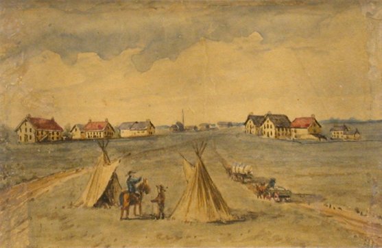
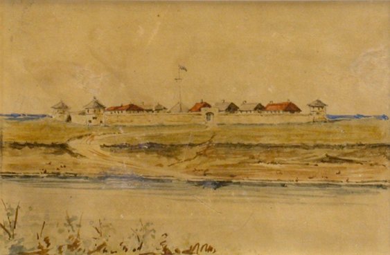
469. [NAPIER, William Henry Edward] [1829-1894] (Attributed To). [ Fort Garry ]. [c1857]. 3 ¼” x 4 ¾” (8 x 12 cm). remnant of old mount with title mounted on verso. watercolour (mounted on archival tissue).
[OFFERED WITH:] [NAPIER, William Henry Edward] [1829-1894] (Attributed To). [ South Gate, Upper Fort Garry, Assiniboine River ]. [c1857]. 3 ¼” x 4 ¾” (8 x 12 cm). watercolour (mounted on archival tissue). The pair. $10,000
Napier executed topographical views of Fort Garry when he served as chief engineer on Hind's Canadian Red River Exploring Expedition. “Napier's most notable contribution to the history of the country was his participation in the 1857 Canadian Government Exploring Expedition…Some water-colours describing this trip are extant and it is known that William Armstrong used Napier's sketches of the period on which to base his water-colours of western subjects, such as Fort Garry.” ( Image of Canada) . He also worked as an engineer on the Grand Trunk Railways and Intercolonial Railways.
Napier was born in Canada (his father was Lord Elgin's personal secretary). He lived in Edinburgh, Scotland from 1870 until his death. The Napier family of Perthshire, Scotland auctioned several sketchbooks and watercolours at Sotheby's Canada in October 1974.
Harper, Early Painters and Engravers in Canada, p. 235. Public Archives of Canada, Image of Canada Documentary Watercolours and Drawings. Bell, Painters In A New Land, p. 183.
470. NELSON VALLEY RAILWAY AND TRANSPORTATION COMPANY. A New Route From Europe To The Interior Of North America With A Description Of Hudson's Bay And Straits. 8vo. pp. 19. large folding lithographed map. original wrs. (edges of wrs. chipped). Montreal: Printed By John Lovell & Son, 1881. $250
First Edition. The Nelson Valley Railway and Transportation Company of Montrea was surveying a railway line from Lake Winnipeg to Churchill on Hudson's Bay. This pamphlet makes a detailed proposal on the feasibility of the international usage of Churchill harbour: “It is in the very heart of the continent, almost entirely midway between the Atlantic and Pacific Oceans, is within 400 miles of the great wheat and cattle raising territories under the British flag,and within fair reach of the northern portions of those in the United States.” (Preface)
Peel 1000. Casey II 294. Gagnon I 2507. Lande 1365. Not in Dionne.
471. NUTE, Grace Lee [1895-1990] (Editor & Translator). Documents Relating to Northwest Missions 1815-1827. 8vo. pp. xix, 469. index. cloth. Saint Paul: Published for the Clarence Walworth Alvord Memorial Commission by the Minnesota Historical Society, 1942. $150
First Edition.
Peel 166.
472. O'DONNELL, John H[arrison]. Manitoba as I Saw it. From 1869 to Date. With Flash-Lights on the First Riel Rebellion. 8vo. pp. 158. 26 portrait plates (frontis portrait). index. untrimmed in original pictorial cloth (light wear to spine ends, lacking front flyleaf). Toronto: The Musson Book Company Limited, [1909]. $100
First Toronto Edition.
Peel 3323n.
473. O'LEARY, Peter. Travels And Experiences In Canada, The Red River Territory, And The United States. small 8vo. pp. vii, 226 + [4]ads. original cloth (bit soiled). London: John B.Day, [c1877]. $225
First Edition. An assessment, from the workingman's standpoint, of the advantages and potential offered by Canada and the United States as fields of emigration for Irish labourers. The Irish-born London mason discusses jobs, wages, living conditions, various ethnic and native groups, transportation, as well as historical events and politics.
Peel 714.
474. PHILLIPS, Walter Joseph [1864-1963]. [ Engineer's House & South Wall ]. Signed in pencil on recto. Ink Christmas card inscription on verso from Josephine & Walter Phillips, 1931. 3 ½” x 5” (8.9 x 12.5 cm). wood engraving (some light staining). $750
Boulet, The Tranquility And The Turbulence, MBL181
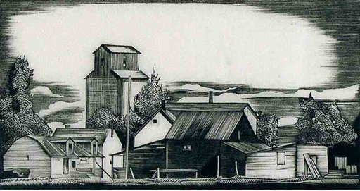
475. PHILLIPS, Walter Joseph [1884-1963] (RCA & CPE). [ Headingley, No. 2 ]. signed in pencil. signed in ink on ‘Christmas Greetings' card. [1939]. 3 ¾” x 7 1/8” (9.5 x 17.9 cm). wood engraving (faint crease to sky area). $1,600
First issued in 1934, reissued as 1939 ‘Christmas Greetings'.
cfBoulet, The Tranquility And The Turbulence, MBL 199 (1934 edition).
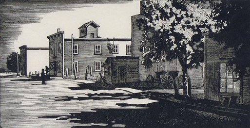
476. PHILLIPS, Walter Joseph [1884-1963] (RCA & CPE). Stockton – Man . signed & titled in pencil. [1956]. 3 ¾” x 7” (9.3 x 17.7 cm). ‘Christmas Greetings' card, signed by Gladys & Walter Phillips on verso. wood engraving. $1,000
Phillips Stockton, Manitoba was first issued in 1932 (edition of 50) and as a Christmas card in 1956 (edition of 300).
Boulet, The Tranquility And The Turbulence, MBL186.
477. PRITCHARD, William A. & WINNIPEG GENERAL STRIKE DEFENSE COMMITTEE. W.A.Pritchard's Address to the Jury In The Crown Vs. Armstrong, Heaps, Bray, Ivens, Johns, Pritchard, And Queen…Indicted for Seditious Conspiracy and Common Nuisance, Fall Assizes, Winnipeg, Manitoba, Canada, 1919-1920. 8vo. pp. 219. portrait on verso of title. original printed wrs. (some dampstaining to lower margins). [Winnipeg]: Wallingford Press, [1920]. $250
First Edition. The defense committee was composed of delegates from the various labour organizations in Winnipeg.
Peel 4627.
478. PRITCHETT, John Perry. The Red River Valley 1811-1849 A Regional Study. 8vo. pp. xvii, [2 leaves], 295. map frontis. colour maps on endpapers. biblio. index. cloth (spine spotted, extremities rubbed). New Haven: Yale University Press…For The Carnegie Endowment For International Peace: Division Of Economics And History, 1942. $75
First Edition.
Peel 265n.
479. ROBSON, Joseph. An Account Of Six Years Residence In Hudson's Bay, From 1733 to 1736, and 1744 to 1747...Containing a Variety of Facts, Observations, and Discoveries, tending to shew, I. The vast Importance of the Countries about Hudson's-Bay to Great-Britain...II. The interested Views of laying open the Trade, and making it the Object of National Encouragement... 8vo. pp. 2 p.l.(incl. advert. leaf), vi, 84, 95. 2 folding engraved maps (incl. frontis. by Thomas Jefferys) & 1 folding engraved plate (containing 3 plans). modern half morocco by Bayntun, top edge gilt (small library rubberstamp on title, folding plate & folding maps, occasional light spotting, title & last 3 leaves washed - the last with small repair in upper margin). London: Printed for J.Payne and J.Bouquet..., 1752. $3,000
First Edition. One of the earliest and most informative works on the Hudson's Bay Territory, Robson's book was also one of the most powerful denunciations of the secretive and selfish methods of the Hudson's Bay Company. Robson possessed an intimate knowledge of the subject, having been employed for some years as surveyor and supervisor to the Company. Condemning their failure to promote fishing and mining enterprise and the exploration and settlement of the interior, Robson urges the importance to Great Britain of breaking the monopoly which was throwing the fur trade into the hands of the French: “The company have for eighty years slept at the edge of a frozen sea; they have shown no curiosity to penetrate farther themselves, and have exerted all their art and power to crush that spirit in others.” Robson supported the petition made in 1749 to revoke the Company's charter and gave testimony before the parliamentary committee appointed to investigate the matter.
The appendix includes a brief account of the discovery of Hudson's Bay and the English activities there after the granting of the Hudson's Bay Charter, based largely on the unpublished journal of Groseiller's expedition of 1668-69 by his ship captain Zachariah Gillam.
Bell R336. Hill p. 257. JCB I 986. Lande 1418. Peel 20. Sabin 72259. TPL 217. Winsor VIII p. 70.
480. ROMAN CATHOLIC CHURCH. DIOCESE OF SAINT-BONIFACE. Fêtes De La Consécration Episcopale De Sa Grandeur Mgr. L.P.A.Langevin, O.M.I. Archevêque de Saint-Boniface. 8vo. pp. 139. frontis. portrait & 2 other plates. original printed wrs. (wrs. detached & edges chipped). Saint-Boniface: “Le Manitoba”, 1895. $85
First Edition.
Peel 2232.
481. ROSS, Alexander [1783-1856]. The Red River Settlement: Its Rise, Progress, And Present State, With Some Account Of The Native Races And Its General History, To The Present Day. 12mo. pp. xvi, 416. lithographed frontis. of Fort Garry. contemporary half calf (somewhat rubbed, several library rubberstamps, light foxing to outer leaves). London: Smith, Elder And Co., 1856. $650
First Edition. The Scottish-born Ross retired to the Red River Settlement in 1825 after fifteen years' service in the employ of the Pacific Fur Company, the North West Company, and the Hudson's Bay Company. There he acquired a prominent and respected position in the community as a member of the council from 1835-1850 and sheriff of Assiniboia from 1839-1852. His is a lively and impartial history and account of activities in the settlement from its troubled beginnings until the relatively prosperous 1850's, with interesting observations on agricultural and social life, the fur trade, native races, emigration and future prospects, as well as a detailed description of the buffalo hunt.
Field 1327. Gagnon I 3062. Graff 3580. Lande 1422. Morgan p. 326. Peel 330. Sabin 73328. TPL 3304. Wagner-Camp 379d. Story p. 725. Winsor VIII p. 75.
482. RYERSON, John [1800-1878]. Hudson's Bay; Or, A Missionary Tour In The Territory Of The Hon. Hudson's Bay Company, By..., Co-Delegate, And Deputation To The Wesleyan Missions In Hudson's Bay: With Brief Introductory Missionary Memorials, And Illustrations. 18mo. pp. xxiv, 190. lithographed frontis. portrait & 9 wood-engraved plates. 1 text illus. original blind-stamped cloth (bit frayed & stained, some foxing to plates, missionary library bookplate). Toronto: Published By G.R.Sanderson, 1855. $300
First Edition. This is Ryerson's epistolary account of his missionary tour to Hudson's Bay conducted in June-October 1854. He describes his journey from Kingston, via Lake Winnipeg and Oxford House, to York Factory, and thence by boat through Hudson Bay and Strait to England, and back. The appendix contains chapters on the Selkirk settlement, mission work among the Indians, the role of the Hudson's Bay Company in improving the social and economic conditions of the native peoples, and the probable fate of Sir John Franklin.
Arctic Bib. 15076. Gagnon I 3112. Graff 3627. Lande 1432. Morgan p. 334. Peel 306 (imperfect). Sabin 74586. Smith 8901. TPL 3608. Wagner-Camp 270.
483. SELKIRK, [Thomas Douglas, Fifth] Earl of [1771-1820]. Observations On The Present State Of The Highlands Of Scotland, With A View Of The Causes And Probable Consequences Of Emigration. 8vo. pp. vii, [1]blank, 223, [1]blank, lvi. with half-title. later quarter morocco (spine rubbed, a few leaves browned). London: Printed For Longman, Hurst, Rees, And Orme..., 1805. $900
First Edition. The Earl of Selkirk developed a particular concern for the economic plight of the Scottish Highlanders, which was heightened during an extensive tour undertaken in 1792. Convinced that emigration was the only possible solution, he developed colonization schemes centred on Prince Edward Island, Upper Canada, and the Red River (what is now Winnipeg). This work was written partially to defend himself against the numerous slanderous reports as to his motives in promoting colonization. It presents an accurate and clearly written assessment of the political and economic conditions in Scotland at the time, the possibilities offered by Canada, and a fairly lengthy discussion of the successful Scottish settlement at Prince Edward Island.
Goldsmiths' 18992. Kress B.4969. Lande 1440. Peel 67. Sabin 20704n. Streeter VI 3655. TPL 766. cfGagnon I 3248 (2nd Edn.). Story p. 755. Winsor VIII p. 177.
484. SHANTZ, J[acob] Y[ost] [1822-1909]. Relation D'Un Voyage À Manitoba. 8vo. pp. 30, [1 leaf]. original printed wrs. (lacking rear wr., several library stamps, spine stained). Ottawa: Department of Agriculture, 1873. $150
First Edition of the French Translation. Shantz, a citizen of Berlin, Ontario, visited southern Manitoba in 1872 to inspect and report on the suitability of the lands for settlement by Russian Mennonites. He was favourably impressed, and this pamphlet, detailing his findings, led to the establishment of the first Mennonite settlements in the West.
Peel 650. Gagnon I 3291, Sabin 79770. Not in Casey.
485. SISLER, W[illiam] J. Peaceful Invasion. 8vo. pp.125, [1]. illus. cloth (stain on lower front cover, library bookplate). Winnipeg: Ketchen Printing Company, [1944]. $40
First Edition. “Deals with education of non-English speaking children in Winnipeg.” (Peel)
Peel 6682.
486. SISSONS, Constance Kerr. John Kerr. 8vo. pp. ix, [3], 282. 4 plates. cloth. dw. (with design by Thoreau MacDonald). Toronto: Oxford University Press, 1946. $45
First Edition.
Peel 6397.
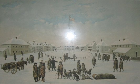
487. STRONG, H.A. Interior of Fort Garry. A Vanished Scene In The Early History Of Our Country. Dedicated To The Pioneer Settlers Of The Canadian Northwest. By H.A. Strong, Winnipeg, Manitoba. Entered according to act of Congress, in the year 1884 by H.A. Strong…at Washington, D.C. Entered according to act of Parliament of Canada, in the year 1884. The Burland Lith. Co., 1884. 18” x 29”. chromolithograph (several tears to margins & short slanted one - repaired with one affecting upper border, one pinhole & light soiling to margins). $2,500
This view of the Hudson's Bay Company post, Old Fort Garry (Winnipeg) in winter shows Red-river carts, fur traders and dog-sleds. Published in 1884, the scene was presumably drawn by the artist, H.A.Strong, sometime during the 1870's. As the title indicates by the words, ‘a vanished scene', the fort was dismantled in 1882.
Jefferys, A Catalogue Of The Sigmund Samuel Collection, 334. Peel 1293.
488. TACHÉ, A[lexandre Antonin] [1823-1894]. Mémoire…Sur La Question Des Écoles En Répose Au Rapport Du Comité De L'Honorable Consil Privé Du Canada. 8vo. pp. 64. original printed wrs., new cloth spine (lacking rear wr.). Montreal: C.O.Beauchemin & Fils, 1894. $100
First Edition.
Peel 2174. Casey II 1935.
489. TACHÉ, A[lexandre Antonin] [1823-1894]. Une Page De L'Histoire Des Écoles De Manitoba. Étude Des Cinq Phases D'Une Période De 75 Années… 8vo. pp. 116. original printed wrs. Montreal: C.O.Beauchemin & Fils, 1894. $100
Second Edition.
Peel 2116n. cfCasey II 1848.
490. TORONTO NEWS COMPANY. Souvenir Of Winnipeg, Manitoba [Cover Title]. 12mo. [ff. 12] containing 28 views on 12 plates. accordion fold-out. black, gilt & blind-stamped cloth (spine ends frayed, tears along folds – some completely separated). Toronto: 1889. $75
491. TROW, James [1825-1892]. Manitoba And North West Territories. Letters By…, M.P., (Chairman of Immigration and Colonization Committee,) Together With Information Relative To Acquiring Dominion Lands; Cost Of Outfit, &c. 8vo. pp. 100. large folding partly coloured lithographed map by J.Johnson (frontis.). disbound (tear in map – no loss). Ottawa: Department of Agriculture, 1878. $300
First Edition, Second Issue, with more current map, dated ‘1878' rather than ‘1874'. These letters were originally published serially in the Stratford Beacon. Trow, who represented South Perth, Ontario, from 1872, travelled as far west as Prince Albert. His letters include advice for prospective settlers, descriptions of Winnipeg, Fort Ellice, and Fort Carlton, Battleford, remarks on native manners and customs, &c.
Casey II 51. Peel 858.
492. TUCKER, S[arah] [d. 1859?]. The Rainbow in the North: A Short Account Of The First Establishment Of Christianity In Rupert's Land By The Church Missionary Society…Fourth Thousand. small 8vo. pp. viii, [3]-222, [8]ads. with half-title. 12 engraved plates (incl. additional title). folding map. A nice copy in original cloth (spine sunned). London: James Nisbet And Co., 1853. $225
An account of the establishment and progress of the Church Missionary Society in the territory north-west of the Great Lakes (Red River, Cumberland Station, Moose Lake, York Fort…), covering the years 1820-50, with letters from the various missionaries.
TPL 3120. Peel 285n. Smith 10336. cfLande 1488. cfMorgan p. 378.
493. UMFREVILLE, Edward. The Present State Of Hudson's Bay Containing A Full Description Of That Settlement, And The Adjacent Country; And Likewise Of The Fur Trade With Hints For Its Improvement, &c. &c…Edited With A Introduction And Notes By W.Stewart Wallace… 8vo. pp. xv, 122. frontis., facsimile & 2 folding tables. index. cloth. dw. (some staining to dw.). Toronto: Ryerson Press, 1954]. $100
Peel 50n.
494. VANDER MAELEN, Philippe Marie Guillaume [1795-1869]. Amér. Sep. Partie De La Nouvelle Bretagne. No. 33. [‘Atlas Universel'. Bruxelles: 1827]. 18 ¾” x 22 ¼” (within borders; 47.6 x 56.7 cm). original colour. lithograph (few soil marks to lower left margin). $600
Vander Maelen “…published one of the most remarkable world atlases ever made: a world atlas with 400 maps on a uniform scale of ca. 1: 1,6 million”. (Koeman p. 141) This detailed map of Manitoba shows the lakes, including Lake Winnipeg, rivers and tribal locations (‘Algonquins', ‘Assinniboines' and ‘Nenaweouheh').
Koeman, Atlantes Neerlandici III, Vdm 1, p. 144.
495. WATSON, Leonard. Fort Garry Gateway . signed & numbered 26 of an edition of 100 in pencil. signed & titled in plate. 6” x 4” (15.8 x 10 cm). etching. $500
496. WATSON, Leonard. Lower Fort Garry. signed, titled & numbered 18 of an edition of 70 in pencil. 3” x 3 ¾” (7.7 x 9.6 cm). etching (margins browned & upper edge mounted on card). $500
497. WELLS, Eric. Winnipeg Where the New West Begins An Illustrated History. With Special Material Contributed by Edith Paterson Editorial Coordination by Margaret Colvin Tropp. 4to. pp. 288. profusely illus. (some colour). biblio. index. cloth. dw. Burlington, Ontario: Windsor Publications (Canada) Ltd., [1982]. $45
First Edition.
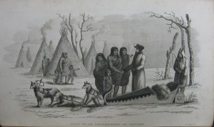
498. WEST, John [1775?-1845]. The Substance Of A Journal During A Residence At The Red River Colony, British North America; And Frequent Excursions Among The North-West American Indians, In The Years 1820, 1822, 1823. Second Edition, Enlarged With A Journal Of A Mission To The Indians Of New Brunswick, and Nova Scotia, And The Mohawks On The Ouse Or Grand River, Upper Canada, 1825, 1826. 8vo. pp. 2 p.l., [vii]-xvi, 210, [1 leaf]errata, [209]-326. lacking half-title. folding engraved map. 3 engraved plates. 1 text illus. modern half calf (some foxing to plates & neighbouring leaves). London: Printed For L.B.Seeley And Son, 1824. $1,100
Second Enlarged Edition (first: 1824). An early account of the Red River Settlement by its first Protestant missionary. West was appointed Chaplain to the Hudson's Bay Company in 1820. His journal relates his journey there via Hudson's Bay and York Factory, his visits to the company stations in the region: Brandon House, Fort Douglas, Qu'Appelle, Pembina, Salt Springs, Fort Daer, Norway House, Fort Churchill, &c., and much detailed and interesting information regarding the manners, customs, and quality of life, of the Chippeway or Saulteaux, Muskeggowuck or Swamp, Stone, and Sioux Indians. The second journal, which was also separately issued, records West's missionary tour of the Maritimes and visit to Upper Canada in 1825-26, under the auspices of the New England Company.
TPL 7178. Peel 156n. Wagner-Camp 27:2. cfBell W88, cfLande 1510, & cfStreeter VI 3696 (1st Edn.). Morgan p. 388. Sabin 102738. Story p. 705. Winsor VIII p. 79.
499. WEST, John [1775?-1845]. The Substance of A Journal During a Residence at the Red River Colony, British North America In the years 1820-1823. 8vo. pp. xx, 186, [2 leaves]. folding coloured map. illus. by Donald Jarvis. cloth. uncut. bd. slipcase (little soiled). Vancouver, Alcuin Society, 1967. $125
Limited to 500 numbered copies.
Peel 156n.
500. [WILCOCKE, Samuel Hull] [1766?-1833]. A Narrative Of Occurrences In The Indian Countries Of North America, Since The Connexion Of The Right Hon. The Earl Of Selkirk With The Hudson's Bay Company, And His Attempt To Establish A Colony On The Red River... 8vo. pp. xiv, 152, [2 leaves], 87. 19 th century half calf (lacking spine label). old ms. notes on a few pages. London: Printed By B.McMillan, Sold By T.Egerton…, 1817. $2,200
First Edition. This anonymous pamphlet was issued under the direction of the London representatives of the North West Company to counter charges of unwarranted aggression and destruction of the Selkirk settlement on the Red River, levelled against them by John Halkett in his Statement Respecting the Earl of Selkirk's Settlement (1817). The Narrative presents a brief outline of the establishment and growth of the Selkirk Colony from 1812, and attempts to defend and justify the North West Company's actions as the natural consequence of the encroachments, hostilities and provocations of Lord Selkirk and the Hudson's Bay Company. Although sometimes attributed to Simon McGillivary and Edward Ellice, the elder, the work was probably prepared by Samuel Hull Wilcocke, "a hack-writer in the employ of the North West Company". (TPL)
Gagnon II 1948. Lande 1313. Peel 106. Sabin 20699. Streeter VI 3675. TPL 1108. Vlach 761.
501. [WILCOCKE, Samuel Hull] [1766?-1833]. A Narrative Of Occurrences In The Indian Countries of North America, Since The Connexion Of The Right Hon. The Earl Of Selkirk With The Hudson's Bay Company, And His Attempt To Establish A Colony On The Red River; With A Detailed Account Of His Lordship's Military Expedition To, And Subsequent Proceedings At Fort William, In Upper Canada. 8vo. pp. xiv, 154, [4], 96. contemporary tree sheep (head & tail of spine defective, institutional bookplates & several rubberstamps, some scattered foxing). from the library of William Henry Allen Davies, fur-trader for the Hudson's Bay Company [d. 1867], with his signature. Montreal: James Brown, 1818. $1,800
First Canadian Edition.
Dionne III 105. Peel 106n. Sabin 20699n. TPL 1110. Vlach 762. Vlach, Impressions Québécoises , 1097. cfGagnon II 1948. cfStreeter VI 3675.
502. [WILCOCKE, Samuel Hull] [1766?-1833]. Récit Des Événemens Qui On Eu Lieu Sur Le Territoire Des Sauvages Dans L'Amérique Septentrionale, Depuis Les Liaisons Du Très Hon. Comte De Selkirk Avec La Compagnie De La Baie D'Hudson, ET La Tentative Faite Par Ce Comte De Fonder Une Colonie Sur La Rivière Rouge… 8vo. pp. xi, [1]blank, 137, [1]blank. 89. old wrs., new cloth spine with remains of printed paper spine label. ownership entry on of J.N.Provencher, possibly Joseph Norbert Provencher [1787-1853], Roman Catholic missionary to the North West (1818), later bishop of St. Boniface (1847-53). modern quarter calf clamshell box. Montreal : James Brown, 1818. $2,200
First Edition of the French Translation by Montreal lawyer Hughes Heney [1789-1844].
Dionne I 127. Gagnon I 2940. Lande 1513. Peel 108. Streeter VI 3679. TPL 1109. Vlach 763. Vlach, Impressions Québécoises , 1098. cfSabin 60367 [vide RÉCIT ].
503. [WILCOCKE, Samuel Hull] [1766?-1833]. (Editor) . Report Of The Proceedings Connected With The Disputes Between The Earl Of Selkirk And The North-West Company, At The Assizes, Held At York, In Upper Canada, October 1818. From Minutes Taken In Court. 8vo. pp. 1 p.l., [v]-xxv, 225, [1]blank, 203, [1]blank, 48. 19th century calf (some wear to spine). Montreal Printed, London: Re-Printed By B.McMillan...Sold by Egerton, Whitehall, Sherwood, Neely, and Jones, and J.Richardson, 1819. $3,500
First London Edition of the controversial Selkirk trials. Following the violent attack on the Red River settlement and massacre at Seven Oaks in 1816 of Governor Semple and twenty of his men, Lord Selkirk instituted legal proceedings against the North West Company. The subsequent trial was little more than a farce. All of the North West Company's influence and power was brought to bear on behalf of its employees and partners; some prisoners were released, others escaped, and the place of trial was shifted from Lower Canada to York, where the Company was linked through family ties with some of the province's leading figures. The delays and setbacks seriously eroded Selkirk's finances and health, and the trial did not finally take place until 1818. Each of the accused was acquitted, and several months later, Lord Selkirk, along with his agent Miles Macdonnell and other Selkirk supporters, were indicted for conspiracy to ruin the trade of the North West Company, and Selkirk himself was fined 2,000 pounds for damages. The Report is divided into three parts: I - The Trial of Paul Brown and François Firmin Boucher; II - The Trial of the Accessories: John Siveright, Alexander Mackenzie, Simon Fraser; III - The Trial of John Cooper and Hugh Bennerman. The postscript relates the indictment of Selkirk and the preface contains a defence of the North West Company against the 'calumnies' of the press.
Lande 1367. Peel 112n. Sabin 79016. TPL 1146. cfDionne III 113, cfGagnon I 2988, cfStreeter VI 3687, cfVlach 563 (Montreal Edn.).
504. WINNIPEG GENERAL STRIKE DEFENSE COMMITTEE. The Winnipeg General Sympathetic Strike May-June 1919…Strike – Arrests – Trials – Penitentiary. [At Head of Title: “Saving The World From Democracy” ]. 8vo. pp. 276. original printed wrs. (head & foot of spine chipped, some dampstaining to lower margins). [Winnipeg]: Wallingford Press, [1919]. $200
First Edition. The defense committee was composed of delegates from the various labour organizations in Winnipeg.
Peel 4548.
505. WINNIPEG. WINNIPEG ART GALLERY. 150 Years Of Art In Manitoba Struggle for a Visual Civilization An Exhibition for the Manitoba Centennial 1970 May 1 To August 31 Legislative Building. oblong 4to. pp. xii, 115, [1]. profusely illus. (some colour). full-page map. pictorial wrs. Winnipeg: [1970]. $35
First Edition. Exhib. Cat.
506. YOUNG, Egerton R[yerson] [1840-1909]. The Apostle Of The North Rev. James Evans. 8vo. pp. 262. with half-title. 21 plates (incl. frontis. portrait) & 2 examples of native script in text. untrimmed in original pictorial cloth. London: Marshall Brothers, 1899. $100
First London Edition.
Peel 240.
SASKATCHEWAN
507. ABRAMS, Gary William David. Prince Albert: The First Century 1866-1966. 8vo. pp. vii, 389. text maps & illus. biblio. index. cloth. dw. (edges of dw. little worn). Saskatoon: [Council of the City of Prince Albert], 1966. $65
First Edition.
508. ARCHER, John H. & Alexander M. DERBY. The Story of a Province A Junior History of Saskatchewan. 8vo. pp. x, 278. numerous text charts, maps & illus. by A. W. Davey. biblio. index. cloth (spine faded). [Toronto]: McClelland & Stewart Limited, 1955.
First Edition. $30
509. BINNIE-CLARK, Georgina [1871-1955]. A Summer On The Canadian Prairie. 8vo. pp. 4 p.l., 311, [1]. 8 plates. A very nice copy in original cloth. Toronto: Musson Book Company Limited & London: Edward Arnold, 1910. $125
First Canadian Edition. “Binnie-Clark spent a summer at Lipton, Saskatchewan, on the edge of the Qu'Appelle Valley. She was favourably impressed with the opportunities the West offered, and vividly describes the people in the homesteading community.” (Peel) Binnie-Clark, who spent a total of four years farming near Fort Qu'Appelle, 1905-08, was also the author of Wheat and Women (1914). Her works are “self-revealing accounts by an upper-class Englishwoman who came to the west to visit her brother, found that he and a friend were failing because they despised labour, conquered her own hauteur sufficiently to learn from pioneers of humbler backgrounds, bought a farm, and managed successfully.” (Story)
Peel 3375. Story p. 586.
510. BLACK, Norman Fergus. History of Saskatchewan and The Old North West. 4to. pp. xxiv, 605. numerous text illus. index. cloth. Regina: North West Historical Company Publishers, [1913]. $250
Second Edition.
Peel 3856n.
511. BLATCHLY, William Daniel [1838-1903] (Lithographer). Battle Of Cut Knife Creek... From Topographical Sketches by Capt. Rutherford… Grip P. P. Co. Toronto. Entered according to Act Of Parliament Of Canada, in the year one thousand eight hundred & eight-five...Toronto Lithographing Co. 18 ½” x 24 ½”. chromolithograph. $800
512. BOCKING D. H. Saskatchewan A Pictorial History. oblong 4to. pp. 6 p.l., 209. numerous text illus. index. wrs. Saskatoon: Western Producer Prairie Books, [1979].
First Paperback Edition. $50
513. BRENNAN, J. William (Editor). Regina before yesterday a visual history 1882 to 1945. oblong 4to. pp. 3 p.l., 228. profusely illus. biblio. wrs. [Regina:] historical Committee, 75 th The City of Regina, [1978]. $45
First Edition.
514. BRITNELL, G[eorge] E[dwin]. The Wheat Economy…Editor's Preface by H.A.Innis. 8vo. pp. xvi, [2], 259, [1]. 3 plates. maps. index. cloth (spine sunned). Toronto: University Of Toronto Press, 1939. $75
First Edition.
Peel 6260.
515. CAMERON, William Bleasdell [1862-1951]. The War Trail Of Big Bear Being the Story of the connection of Big Bear and other Cree Indian Chiefs and their followers with the Canadian North-West Rebellion of 1885, the Frog Lake Massacre… 12mo. pp. 256. 10 illus. on 9 plates (incl. frontis. portrait). original cloth (spine ends frayed, lettering faded). Boston, Mass.: Small Maynard & Company, 1927. $125
First American Edition. The author was a survivor of the Frog Lake Massacre.
Peel 1360n.
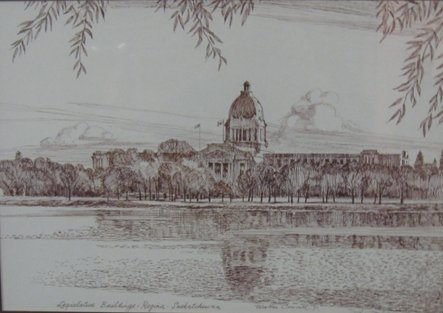
516. COUCILL, Walter Jackson [1915-1982]. Legislative Buildings Regina Saskatchewan. signed & dated [19]71. 14” x 20”. ink on illustration board. $800
“[Coucill] …was Art Director of the Robert Simpson display department, art consultant, freelance designer and display designer for General Motors. He was commissioned by National Trust Bank to travel across Canada and paint all the provincial and territorial floral emblems in their natural habitats.” (MacDonald p. 536a)
MacDonald, Dictionary of Canadian Art, pp. 536a-537a.
517. CURZON, F.W. Battle Of Fish Creek…Sketches by Mr. F.W. Curzon… Published by Grip P.P. Co. Toronto. Entered according to Act Of Parliament Of Canada, in the year one thousand eight hundred & eight-five...Toronto Lithographing Co. 17 ½” x 24 ½” (within borders; 44.7 x 62.3 cm). chromolithograph. $800
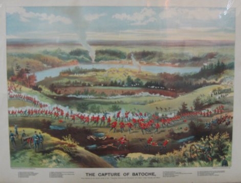
518. CURZON, F.W. The Capture Of Batoche, From sketches by the Special Artist of the “Canadian Pictorial and Illustrated War News,” Sergt. Grundy and others. Published by the Grip Printing and Publishing Co. [1885].Toronto Lithographing Co. 17 ¼” x 24 ½” (within borders; 44 x 62 cm). chromolithograph. $800
519. DOMINION LANDS OFFICE. Map of part of the District of Assiniboia shewing Dominion lands surveyed to 31 st December 1882… Dominion Lands Office Department of the Interior, Ottawa 25 th January 1883. Lindsay Russell, Surveyor General. The Burland Lithographic Co. Montreal. 28” x 36” (71 x 91 cm). lithograph with red grid lines. horizontal & vertical folds (margins chipped & tattered, several tears & small holes, paper cockled at upper right – recent linen backing). $1,000
520. DRAKE, Earl G. Regina The Queen City. 8vo. pp. ix, [1 leaf] 260. 11 plates (some double-sided). text illus. maps on end-leaves. by McGregor Hone. index. cloth (pencil scoring). [Toronto]: McClelland & Stewart Limited, 1955. $40
First Edition.
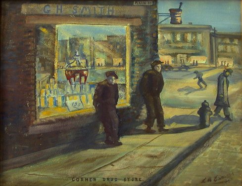
521. EVANS, Lindsay A. [1892-1976] (Founder, Lloydminster Art Club). Corner Drug Store. signed, titled, & dated [19]56 on recto. signed, titled, & inscribed “FCA Regina 1957”. 15 ¾” x 19 5/8”. oil on board. $2,000
Born in Chelsey, Massachusetts, Evans studied at the Pape School of Fine Arts in Boston (1909) and at St. Martins, London. Evans moved with his parents to western Canada where they homesteaded and ranched in Alberta, eventually settling in Lloydminster, Saskatchewan. Evans painted many portraits and depictions of ranch-life, homesteads, oilfields, and the streets of Lloydminster. A founding member of the Lloydminster Art Club, he was a long-time friend of A. Y. Jackson, with whom he studied briefly in his youth.
Exhibited: The Alberta Visual Arts Board, Spring Camp. Exhibition, 1956, label on verso.
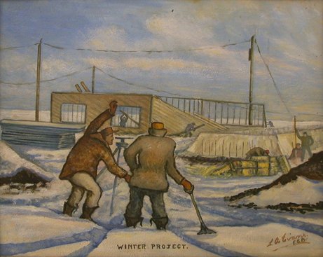
522. EVANS, Lindsay A. [1892-1976] (Founder, Lloydminster Art Club). Winter Project. signed “L.A. Evans, FCA.”, on recto. 18 x 21 ¾ “. oil on board. $2,000
Exhibited: Class A. Saskatchewan, Arts Board. Annual Exhibition of Saskatchewan Art, Feb-10, [19] 64, label on verso; Saskatoon Industrial Exhibition, Ltd., Fine Arts Competition, May 18, [19] 64, label on verso.
523. GOWANLOCK, Theresa & Theresa DELANEY. Two Months in the Camp of Big Bear. The Life and Adventures Of... 2 Parts in 1. 8vo. pp. 141, [3]ads. 14 full-page illus. 2 illus. in ads. decorative tailpieces. original cloth (extremities bit frayed). Parkdale [Toronto]: Times Office, 1885. $350
First Edition , issue with pp. 141, and signature marks appearing in the lower left hand side (considered by Graff to probably be the earlier issue); in this copy pp. [137-38] (copyright) is uncancelled. Mrs. Gowanlock and Mrs. Delaney, together with two men, one of whom escaped before the shooting started, were the sole survivors of the Frog Lake Massacre on the Northern Saskatchewan during the North West Rebellion of 1885, and were held captive for two months by the Crees.
Peel 1457. Ayer Suppt. I, 60. Graff 1605n. Lande 1194.
524. GREENBLAT, Jim. “Those Were The Days” in Swift Current. 8vo. pp. 3 p.l., 136. wrs. [Saskatoon: Modern Press, [c1970]. $30
First Edition.
525. HAMILTON, Zachary MacCaulay & Marie Albina HAMILTON. These Are The Prairies. 8vo. pp. 277. 3 folding maps, 1 colour plate & 12 text illus. cloth. dw. (bit chipped & torn). Regina & Toronto: School Aids And Text Book Publishing Co., Ltd., [1954]. $40
Second Printing.
Peel 7027n.
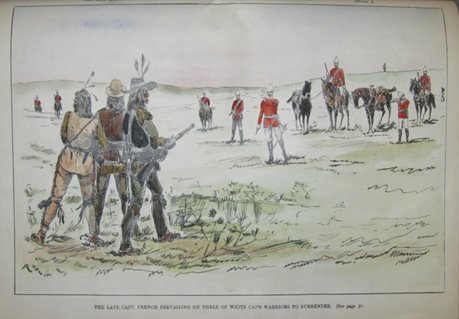
526. HAULTAIN, T[heodore] Arnold [1857-1941]. The Souvenir Number Of The Canadian Pictorial And Illustrated War News. A History Of Riel's Second Rebellion And How It Was Quelled. 2 Parts in 1. folio. pp. 1 p.l., 44 [i.e. 40; pp. 12-15 omitted in pagination]. text in 4 columns. 2 tinted lithographed front wrs. 3 double-page & 23 full & half-page lithographed text illus. on 12pp., all hand-coloured. 1 small text illus. & several illus. in ads on rear wrs. modern cloth, piece of original cloth with title mounted on upper cover (some minor tears & repairs in outer margin). Toronto: Grip Printing and Publishing Company, 1885. $1,700
An interesting pictorial record of the Northwest Rebellion, representing the principal events and battles: the fight at Duck Lake, the defence of Fort Pitt, the attack on the rebels at Fish Creek, the battle of Cut Knife Creek, the capture of Riel, the capture of Batoche, &c. As usual this copy does not have the 2 double-page coloured lithographed plates of Middleton and his commanding officers.
Casey II 787. Lande S1044. Peel 1461.
527. HOFFER, Clara & F.H.KAHAN. Land Of Hope…Illustrated by William Perehudoff. 8vo. pp. 157. numerous text illus. & title vignette. cloth. dw. (edges of dw. bit chipped). Saskatoon: Modern Press, [1960]. $50
First Edition.
528. THE ILLUSTRATED WAR NEWS Nos. 1 To 18, Inclusive. Containing All The Illustrations Referring To The North-West Rebellion of 1885, From Its Outbreak to The Return And Disbanding Of The Troops. folio. pp. 1 p.l., 150. lacking final leaf of text & 4-page supplementary ‘Honour Roll'. 15 double-page unnumbered inserts of tinted illus. numerous other illus. (some tinted). original leather-backed gilt-stamped cloth bds. (very worn, contents loose in binding, stitching broken, few marginal tears, lacking rear flyleaf, front flyleaf loose & torn). Toronto: The Grip Printing And Publishing Co., 1885. $2,500
Peel 1460. Lande 1245.
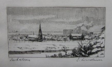
529. LINDNER, Ernest [1897-1988]. Saskatoon. signed & titled in ink. Inscribed on verso in ink: “Merry Christmas and a happy New-Year! Ernst Lindner”. 2 ½” x 4 ¼” (5.6 x 10.7 cm). etching. $225
530. McCONNELL, Gail A. Saskatoon Hub City Of The West. 4to. pp. 127. profusely illus. (incl. maps, some colour). cloth (ms. notes on front free-endpaper). dw. [Burlington]: Windsor Publications in Cooperation with the Saskatoon Board of Trade, [1983]. $35
First Edition.
531. MAUDE, Aylmer. A Peculiar People The Doukhobórs. 8vo. pp. 1 p.l., [v]-xi, 338. 2 maps & 15 plates. index. original cloth, t.e.g., others untrimmed (lacking front free-endpaper, piece torn from rear free-endpaper, corners & edges frayed). London: Archibald Constable & Co. Ltd., 1905. $175
Second London Edition. “A sympathetic account of the sect, by one of those responsible for bringing the Doukhobors to Canada. The first chapter is an amended version of a chapter included in the first edition of Maude's Tolstoy and his problems: Essays (1902).” (Peel) Part of the work relates to the Doukhobor colonies in Saskatchewan.
Peel 2783n.
532. MORTON, Desmond & ROY, Reginald H. (Editors). Telegrams Of The North-West Campaign 1885. 8vo. pp. ciii, 431, xxi. frontis. portrait & 5 full-page maps. largely unopened in gilt-crested cloth, t.e.g., others untrimmed. Toronto: The Champlain Society [Publication No. XLVII], 1972. $200
First Edition, Limited to 1,000 copies.
533. MULVANEY, Charles Pelham [1835-1885]. The History Of The North-West Rebellion… 8vo. pp. viii, [17]-424. frontis portrait, 2 full-page maps & numerous text illus. original black & gilt-stamped cloth. Toronto: A.H. Hovey & Co., 1885. $200
First Edition, 8 th Thousand.
Peel 1508.
534. (NORTH-WEST REBELLION). CANADA. DEPARTMENT OF MILITIA & DEFENCE. Continuation Of Appendix No. 4 To The Report Of 18th May, 1886, On Matters In Connection With The Suppression Of The Rebellion In The North-West Territories, In 1885. Final Report Of War Claims Commission. Presented To Parliament. [Sessional Papers No. 9b.]. 8vo. pp. 2 p.l., 80. modern half-leatherette (front hinge contents loose in binding, title backed). Ottawa: Printed By MacLean, Roger & Co., 1887. $650
Peel 1383.
[BOUND WITH:] CANADA. DEPARTMENT OF MILITIA & DEFENCE. Report Of Lieutenant-Colonel W.H.Jackson, Deputy Adjutant-General, Principal Supply, Pay And Transport Officer To The North-West Forces, And Chairman Of War Claims Commission, On Matters In Connection With The Suppression Of The Rebellion In The North-West Territories, In 1885. [Sessional Papers No. 9c.]. 8vo. pp. 44. Ottawa: Printed By MacLean, Roger & Co., 1887.
Peel 1470.
[BOUND WITH:] CANADA. DEPARTMENT OF MILITIA & DEFENCE. Report Of Major General Laurie, Commanding Base and Lines of Communication upon matters in connection with the suppression of the Rebellion In The North-West Territories In 1885. [Sessional Papers No. 9d.]. 8vo. pp. 39. Ottawa: Printed By MacLean, Roger & Co., 1887.
Peel 1479.
535. RICH, E[dwin] E[rnest] (Editor). Cumberland House Journals And Inland Journal 1775-82... 2 Volumes. 8vo. pp. xcii, [1 leaf],382, xiv; lxii, [1 leaf], 313, [xiv]. Unopened in original gilt-crested blue cloth, t.e.g., others uncut (spines sunned). London: The Hudson's Bay Record Society [Publication Nos. XIV-XV], 1951-52. $225
Numbered Limited Edition.
Peel 46. TPL 4751.
536. RIDDELL, W.A. Regina from Pile O'Bones to Queen City of the Plains An Illustrated History. 4to. pp. 223, [9]. 1 map & numerous text illus. (some colour). index. cloth. dw. Burlington: Windsor Publications (Canada) Ltd. in Association with the Regina Chamber of Commerce, [1981]. $45
First Edition.
537. RUSSELL, R. C. The Carlton Trail The Broad Highway into the Saskatchewan Country From the Red River Settlement 1840-1880. 8vo. pp. 102, [2]. frontis & numerous text illus. (incl. double-page map). biblio. stiff cloth wrs. (slight discolouration on front cover, light foxing to outer leaves). Saskatoon: Modern Press, [1956]. $30
Revised Edition.
538. SASKATCHEWAN. DEPARTMENT OF AGRICULTURE. OFFICE OF THE RECORDER OF BRANDS. Saskatchewan Cattle and Horse Brands Revised and Corrected to December 31, 1917. 8vo. pp. 136, xxx, [blank leaf], [137]-226, xx. limp cloth (rubbed, rear hinge partly split). Regina: J.W.Reid, King's Printer, 1918. $1,000
539. SASKATCHEWAN. DEPARTMENT OF AGRICULTURE. OFFICE OF THE RECORDER OF BRANDS. Saskatchewan Cattle and Horse Brands Consolidated to December 31, 1926. 8vo. pp. 122, xxxiv, [123]-218, xxvi. cloth (covers spotted, short tear in 1 index leaf – no loss). Regina: J.W.Reid, King's Printer, 1927. $1,000
540. SCHWARTZ, Charles. the search for Stability. 8vo. pp. xii, 252. 3 full page maps. biblio. index. cloth. dw. (edges bit chipped). [Toronto]: McClelland & Stewart Limited, [1959]. $35
First Edition.
541. SHEPHERD, George. West Of Yesterday Edited With A Commentary By John H.Archer. 8vo. pp. x, 157. 4 double-sided plates. maps on endpapers. bds. dw. (edges of dw. little chipped, sticker removed from front panel). [Toronto:] McClelland & Stewart Limited, [1966]. $50
Second Printing.
542. WOODCOCK, George. Gabriel Dumont The Metis Chief and his Lost World. 8vo. pp. 256. 4 double-sided plates. maps on endpapers. cloth. dw. (dw. rubbed). Edmonton: Hurtig Publishers, [1975]. $35
First Edition.
543. WRIGHT, J. F. C. Saskatchewan The History of a Province. 8vo. pp. xi, 292. text illus. by A. W. Davey. several text maps. biblio. index. cloth (minor stain on bottom of front cover). [Toronto]: McClelland & Stewart Limited, 1955. $50
First Edition.
TERMS: *All prices net in Canadian Funds & subject to change. *Postage & handling charges extra. *Canadian Residents subject to 5% GST (Books) and any other applicable taxes. *Deferred billing to libraries. *All items are complete and in good or better condition unless otherwise stated; major defects noted. *All items returnable within 10 days of receipt if found not to be as described; please give prior notification by phone, fax, mail, or email); safe return shipment is the client's responsibility.
D & E LAKE LTD.
239 KING STREET EAST, TORONTO, CANADA. M5A 1J9
TEL.: (416)863-9930; FAX: (416)863-9443; Toll Free: 1-877-259-LAKE
email: rarebooks@delake.com